Exploring the Beauty of Pangong Lake in Ladakh

This week we start the Ladakh series. With each destination in Ladakh competing with the other in the uniqueness of the experiences they provided; it was a difficult choice to make. Well ; finally I settled for Pangong to start the series with a bang!!

Welcome to Pangong...

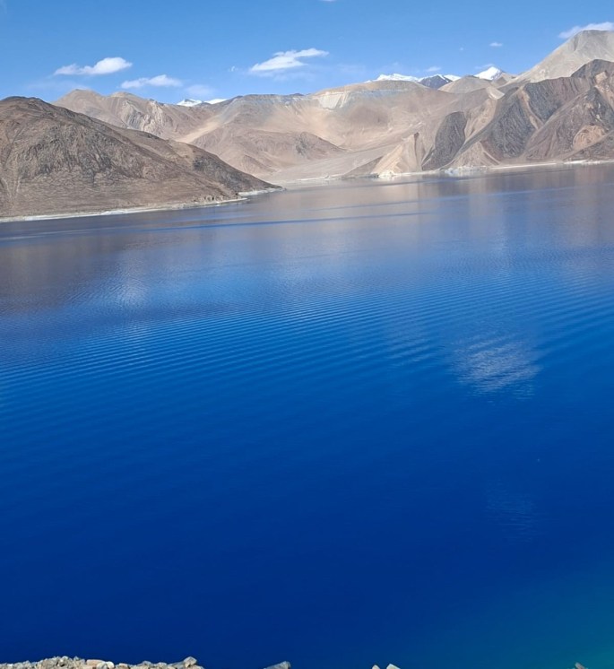
Hidden in the lap of snow clad mountains and high altitude plateaus, Pangong Tso with its deep blue and green colors provides a contrast to the barrenness of the hilly landscape around.

A visit to the Pangong lake located at an altitude of almost 14000 ft. is one of the highlights of a visit to Ladakh. Stretching over a distance of 134 kms, only 30% of the lake lies in India; the rest being located in Tibet. At its broadest point, the lake is 5 kms wide and is separated from the Indus river basin by a small ridge.

It is the largest brackish lake in Asia and is an endorheic lake meaning it is a basin that retains water and does not allow outflow to other external water bodies. Movement of tectonic plates many years ago is believed to have created this lake.

The lake is divided into 5 sub lakes connected through narrow water channels and the western most of these is Pangong Lake which in Tibetan means high grassland lake. The grasslands along the edges of the lake feed the pashmina goats , yaks and other livestock found here. The whole group of lakes is referred to as Tsomo Nganglha Ringpo.

The deep blue and green color of the lake against the backdrop of the barren mountains is indeed a sight to behold!! The lake is open to tourists between May and September.

The lake is a Himalayan wetland reserve and an important breeding ground for a variety of migratory birds. Spangmik is a small village near the lake where pashmina goats are reared.

The best time to visit the lake is of course in summer between May and September. During the winter months the lake is completely frozen and if you are adventurous enough, you can walk on the lake!!

My Trip

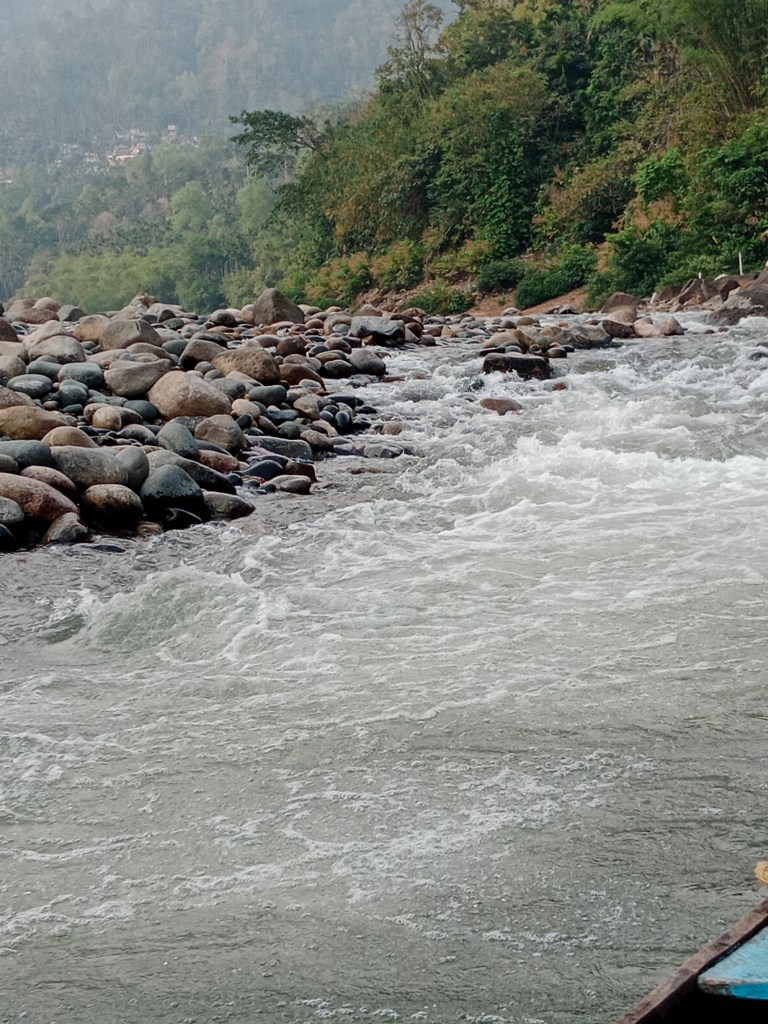
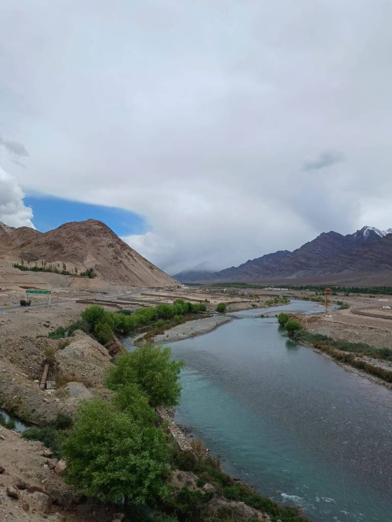
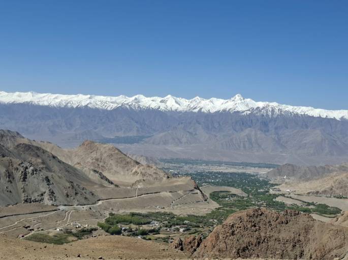
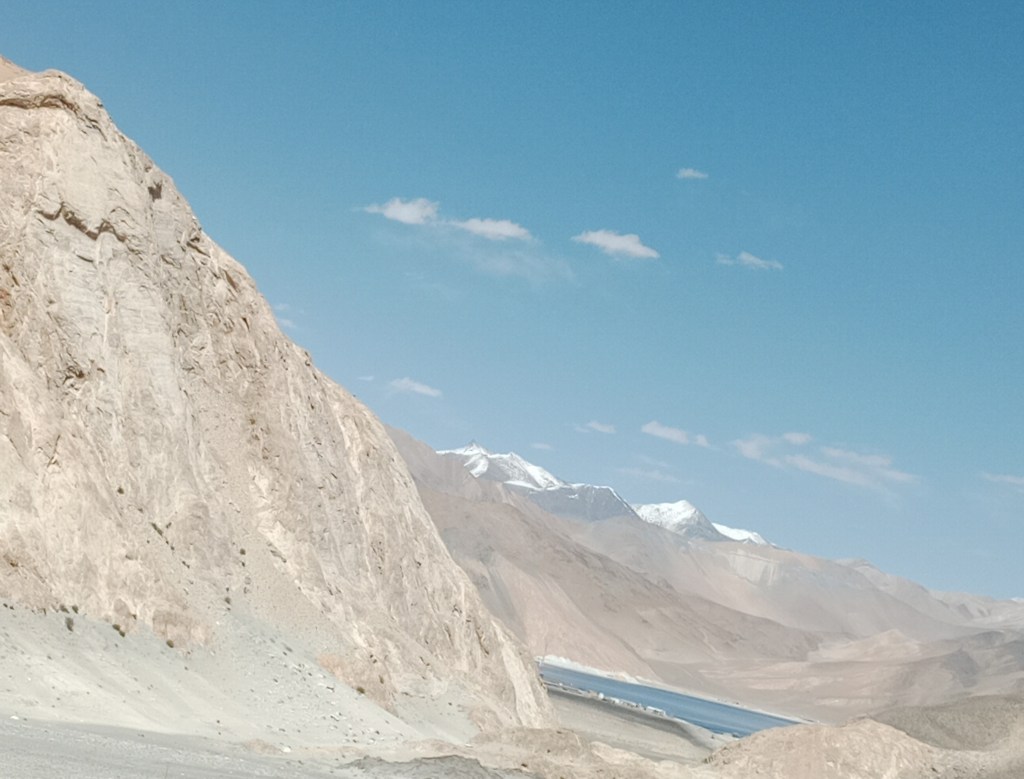
The drive to Pangong Lake itself was very picturesque. The winding snow capped mountain roads with clear glacier water streams gurgling along is beautiful. The varying features of Ladakhi landscape with mountain slopes showing streaks of varying colors resembles a painting.

The rugged mountains with the glacial streams flowing along

The mountain roads with snow capped mountains as a back drop

The mountain slopes showing streaks of various hues like a painting

The Changla pass lies on the route from Leh to Pangong Tso. This high mountain pass at a height of more than 17500 ft, is covered with snow and appears pristine white.

The snow closer to Changla Pass

Driving down those lovely vistas, we were in for a surprise when we encountered a herd of pashmina goats being herded by a mother and daughter across a bridge. It took us some time to cross them but we enjoyed the sight nevertheless. Take a look at the video below..

When the goats decided to slow us down!!!

After the goats decided to give us way, we headed further on awaiting the first views of Pangong Lake and finally Dorje, our driver announced that we were there. Eagerly we turned our eyes to watch the first glimpses and here was what we saw…

The lake slowly comes into view from behind the mountains

The mesmerizing colors of the lake as we drove along…

Driving further down we met up with the others of the group on the banks of the lake.

The ladies pose by the Pangong Tso

A group picture by the lake was followed by some free time for us to explore the area.

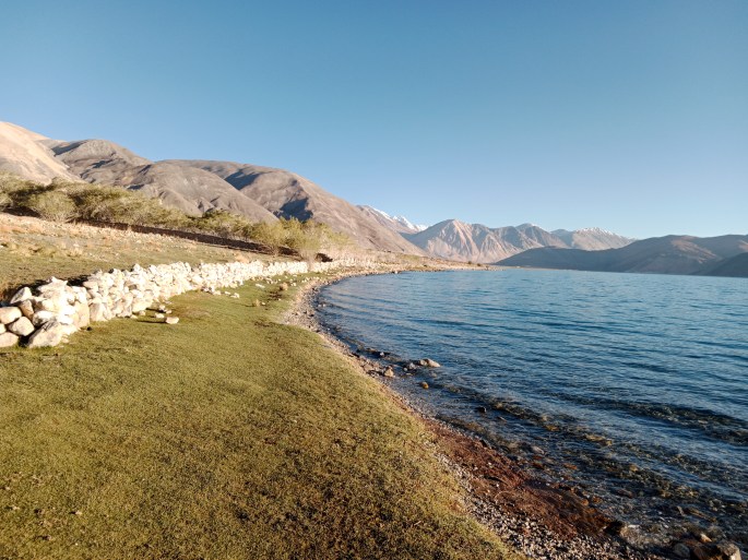
As we walked along the shores of the lake this is what we saw….

Take a look…

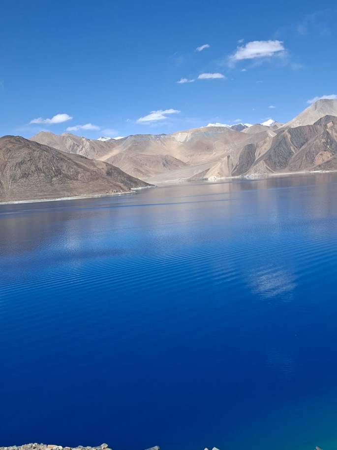
The beautiful colors of the lake

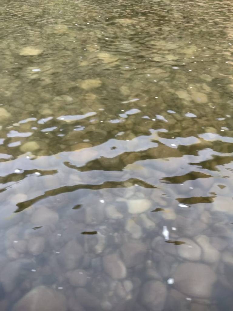
The clarity of the water was simply unbelievable.

Yak rides were available on the banks of the lake …

Yak rides on the banks of the Pangong Tso

We were totally mesmerized by the colors of the lake from different angles. Take a look at this video…

The different hues of Pangong (click on video to enjoy)

We lost track of time as we stood admiring the beauty of the lake and soon had to go to our resort. Our rooms were overlooking the lake and the views from the resort were also awesome.

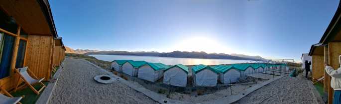
Our Hotel overlooking the lake and views from our room

After tea and some snacks we sat outside our rooms taking in the beauty of the place.

There was a skylight in our room and at night the stars were visible from our beds. That was another unique experience!

The skylight that helped us stargaze from bed….

Hold your breathe for the next surprise…

We saw the milky way in all its glory that night on the banks of the Pangong. In the pitch dark sky, that amazing cloudy mass was a sight to behold!!. Standing there we kept looking at it as it slowly seemed to change its outlines. Unfortunately, we could not capture it for you. But I must tell you, it was a once in a lifetime moment…

A picture from Pexels just to illustrate what we saw…

A host of satellites were also visible crisscrossing the sky.

Next morning, we woke up to see the sunrise…take a look..

Sunrise views…

And the grass that feeds the pashmina goats and gives the lake its name…

As the golden rays illumined the snow capped peaks behind our resort..

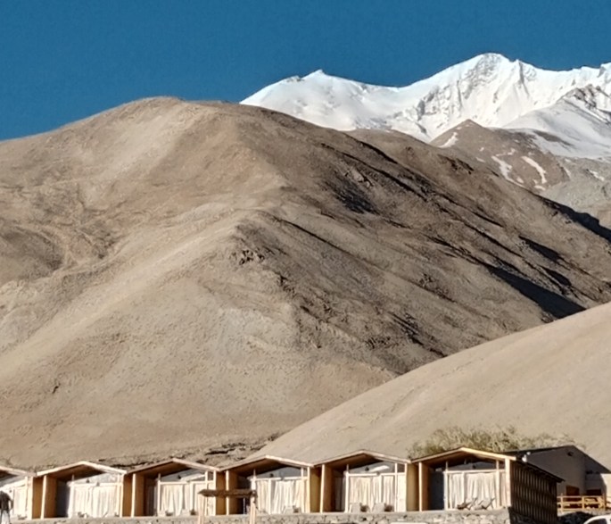
The sunlit snow capped peaks behind our resort

After sumptuous breakfast at the resort, we bid farewell to this highlight of our tour to Ladakh thinking of the truly diverse destinations our country has.

But not before a shot on the banks with our national flag….
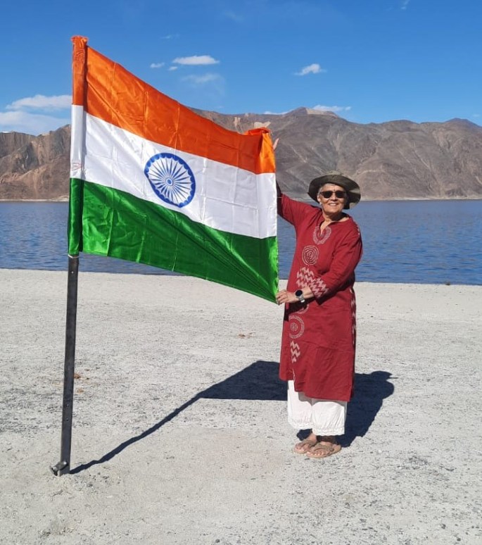
Jai Hind

This trip was undertaken soon after the Pahalgam terror attack giving rise to fears and uncertainty and has to be viewed with that backdrop.

I end this episode with a respectful bow to the armed forces guarding our borders and the allied services like BRO that made this amazing trip possible.

See you next week at another amazing destination. Meanwhile do subscribe, like and comment…

A Journey Through NE India’s Diverse Traditions

North Eastern India has unique culture and traditions. During our trip to Meghalaya, we experienced some of this and this episode covers that.

From Shillong, we visited the Sacred Forest of Mawphlong which is a revered place for the locals

Mawphlong Sacred Forest

A forest revered by the local Khasis, this place resembles the meadow mounds at Munnar in Kerala. But at the other end of these mounds is a thick canopy of trees which comprise these sacred forests.

A wooden board invites us to the sacred forest which has a monolith just outside its main entrance.

Such monoliths are found all over Meghalaya much like the white flags in Bhutan. They are commemorative and put up by families in memory of their dear ones.

The board and the monoliths in front with the sacred forest behind

Just before we entered the sacred grove, our local guide briefed us about the significance of the forest. The locals consider this a very sacred place and hence we are not allowed to carry anything out of the grove. He said he has personally seen people who did not adhere to the rules being cursed and punished.

After the briefing we slowly started walking through the grove.

The entrance to the sacred grove

There is a paved passage in between tall trees on either side and our guide explained the significance of some of the plants and trees.

Inside the sacred forest

One of the first things was a fern with brown tender shoots. These brown shoots are processed and used as earrings by the local women. He also explained how the Rhododendron flowers were used for color and also in tea.

The fern that is used as earrings and the Rhododendron tree

Many of the trees had mushrooms and orchids growing on them

Mushrooms growing on trees

Various kinds of lichen and moss were seen growing on the tree trunks and some of them are believed to change color when wet. A cute blue flower called cat flower that glows in the dark was seen all along the forest floor.

Lichen and moss and the cat flower that glows in the dark

An important tree we saw was the Rudraksh tree. It is sacred for the Hindus who wear the rudraksh on the body for various positive effects. We also saw multi faced rudraksh seeds.

Outside the grove, various kinds of Rudraksh seeds were on sale.

The Rudraksh tree and a three faced rudraksh seed

Rudraksh seeds for sale

The religious importance of this forest for the locals was visible in the form of monoliths at several locations. Some of them were places where rituals were held.

Monoliths where rituals were held

Before we left the sacred grove our group posed for a picture…

Our group in the sacred forest

Another destination that revealed the cultural diversity of NE India was Cherrapunji

Our resort at Cherrapunji was very beautifully located and here are some pictures from there…

Views from our resort with densely forested hill slopes across a deep valley

At most places in Meghalaya, beautiful flowers, particularly orchids had bloomed in plenty; adding colour and beauty to the place…

The flower beds that added to the beauty of the place.

One of the activities at the Cherrapunji resort was a heritage walk from the resort to a small village nearby . The early morning fresh air with the chirping of the birds and the typical smell of burning firewood from the homes was a welcome change for us.

During the heritage walk to the village…

A traditional village home

Evenings at the resort were fun filled with lot of singing and dancing by the hotel staff..

The girls danced to a local song (click on the video to watch)

Another dance with swords…

They also had traditional attire for the guests to try on and some of us ladies tried it too..!!!

Ladies from our group in traditional attire..

The staff also encouraged us to perform their local dances. Here is a video for you to enjoy…

Our group members perform a traditional dance( click on video)

A picture with the performers in the end…

During our visit to Kaziranga National park also, there was a cultural show where traditional dances were performed..

Some pictures from the cultural show…

Traditional instrumental music ( click on video)

Click on the video to enjoy the traditional dance

Traditional dances

Click on video to watch a dance performance

The Tantric Temple at Guwahati where feminity is worshipped was another cultural and religious attraction.

Kamakhya Temple

A tantric temple dedicated to Goddess Kamakhya, this temple also reflects the cultural diversity of the North East.

Built initially in between the 8th and 9th centuries, the temple has seen many modern additions and modifications. Female sexuality is worshipped here and the annual festival symbolises celebration of menstruation of the Goddess.

Offerings to the Goddess are usually flowers but may include animal sacrifices.

Some pictures from this unique temple…

The exterior of the temple with beautiful carvings

When we visited the Goddess…

Well, this is just a sample of the unique culture and artistic forms seen in this part of India. Rich in culture and tradition, this part stands out for its diversity and beauty.

With this, I conclude the series on Meghalaya. We now go on to Ladakh; another amazing part of India that will leave you spell bound.

Till then, do subscribe, like and comment..

Kaziranga National Park: Home of the One Horned Rhino

Kaziranga National Park located in the state of Assam in Northeast India ; covers an area of 430 square kilometers and is home to the unique one horned rhinoceros. Although the name Kaziranga is almost synonymous with the rhino, this park is home to a variety of wildlife including elephants, swamp deer, sambar , wild boar ,water buffalo and tigers. It is also an important birding location and is congruous to the Eastern Himalayan Biodiversity hotspot. Outside of Africa, it is one of the few wild breeding ground of tigers and leopards. The Indian python, one of the largest snakes in the world inhabits this park.

The park was established as a reserve forest in 1905 and became a national park in 1974. The establishment of this park is attributed to Mary Curzon, wife of Lord Curzon ; the then Viceroy of India. During her visit, she was unable to spot any rhino and this alerted the Viceroy to have a protected zone. This beginning was followed by several changes to the area covered and the status of this park changed over several years from reserve forest to game sanctuary to wildlife sanctuary to national park and became a UNESCO world heritage site in 1985.

It is a vast expanse of tall grass, marshland, several water bodies and moist broad leaf forests. Kaziranga has also faced natural calamities like floods as the Brahmaputra and other rivers crisscross this park. Several animals have drowned in unprecedented floods.

The monsoon season is between May and August and the park is closed to visitors at that time.

Rhino poaching was a big challenge faced during the early years and the strict enforcement of the anti poaching act has led to increase in rhino population over the years.

Safari Zones

Kaziranga is split into four safari zones : Central at Kohora, Western at Bhagori, Eastern a Agaratoli and Burhapahar at Ghorakati

The main attraction here of course are the safaris that take you into the park for wildlife viewing. Jeep safaris and Elephant safaris are available. Jeep safaris are hired per family and not shared. They take you through the regular tracks in the forest for about two hours . Rhinos are easily spotted in addition to elephants and deer. These safaris are available both in the morning and evening. Elephant safaris are more unique and are available only early morning. Four people sit on a seat fitted on the elephant’s back and the mahout will take you up close to wildlife; mainly rhinos. Elephant safaris need to be booked well in advance as the number is limited.

Our Trip

We undertook a trip to Kaziranga from Guwahati on our return from Meghalaya. There was another couple from the Meghalaya tour with whom we did this tour. More as we look at the pictures….

The drive to Kaziranga took about four hours and after the initial part of the drive through the city, we were on winding roads, partly in Assam and partly in Meghalaya. As we reached Kaziranga, there were lush green paddy fields at places and tea gardens elsewhere.

Paddy fields and tea gardens as we neared Kaziranga

There are strict speed restrictions as we near the park and so it takes a long time even though the distance is around 200 kms only.

The welcome board with speed alerts

Soon we were at Kaziranga town and we checked into our hotel for a quick lunch before heading for the safari.

The jeep safari started at 2 pm and we saw plenty of rhinos right from the entrance.

All set for the jeep safari.

The Ecoshop just as you enter the park

The jeeps going along the tracks

The general landscape is of tall grass interspersed with trees and plenty of water bodies.

The general landscape

One rhino grazes while another lazes!!!

Almost posing….

A rhino and cub with some deer in the backdrop

The elephants

It was our safari jeep driver Sameer who pointed out an interesting sight…a python resting inside a hole in the tree…take a look..

A python having his siesta!!!

Deer

Water birds

A chestnut headed Bee eater

And this was probably the cutest of all….a group of turtles on a log…

Turtles on a log….

A very positive sight were these watch towers scattered all over for preventing poaching…

An anti poaching watch tower

Elephant safari

The morning elephant safari takes one close up to wildlife and here are some pictures….

The elephant safari

As close as one can get!!!

I hope you enjoyed this virtual Kaziranga safari. Let me leave you with a video of a rhino as he walks away into the bushes…

The giant slowly retreats ….

Hope you enjoyed the tour of Kaziranga.

See you next week at another interesting destination in Meghalaya. Till then, do subscribe, like and comment.

Unveiling Meghalaya: A colonial past and the cleanest village

Driving down from Guwahati to Shillong, we visited Umiam lake that lies almost midway between Shillong and Guwahati.

Umiam Lake

Situated on the Guwahati Shillong highway, about 20 km from Shillong is this man made lake known also as Bara Pani. The lake is actually a reservoir created by damming the Umiam river.

The reservoir was built in 1960 as part of a hydro electric project and has since seen expansions. The valley where the lake now lies was home to around 200 families who were displaced by this project.

Apart from providing electricity and irrigation facilities, this lake is an important tourist destination in Meghalaya today.

After a long walk along the side of the lake, we reached the main recreational area where there are boating facilities and water sport activities.

Some pictures…

Different views of the lake

A boat ride on Umiam lake

Driving down further, we reached Shillong by noon and proceeded for lunch…

Lunch at Shillong

Shillong was originally the capital of the erstwhile state of Assam and later became the capital of Meghalaya when the new state was formed.

Khasi, Jaintia and Garo are the three main tribes of Meghalaya and Shillong is named after the Khasi God “U Blei Shyllong “.

The salubrious climate of Shillong attracted the British who consolidated their interests here. The remnants of a colonial past are visible all over Shillong. The views of the city lying on the slopes of the Khasi and Jaintia hills looks beautiful . However, with unplanned growth, the old world charm seems to have been replaced with modern buildings and crowded streets.

Remnants of a colonial past

Replaced by modern buildings and traffic choked streets

Post lunch ,we visited the Don Bosco Museum

Don Bosco Museum

Situated in Shillong city, this museum is a storehouse of indigenous culture and tradition of all the Northeastern states of India.

The museum is located within the premises of the Sacred Heart church and has seven floors with a sky walk on top from where a great view of Shillong can be enjoyed.

The collection in the museum is divided into 17 galleries over the seven floors with each gallery representing a different theme. Many of the figures of tribal life are life size and create a feeling of reality. Tribal artifacts like clothing, jewellery, tools, musical instruments, sculptures and paintings adorn the various galleries. Tribal books and manuscripts are also on display.

Some pictures…

The Don Bosco Museum

The commemorative monolith and plaque at the entrance

Life size statues of various tribes

Different kinds of jewellery

Musical instruments

From Shillong we also visited Asia’s cleanest village….Mawlynnong .

Mawlynnong Village

Located in the east Khasi hills 90 kms from Shillong, this village close to the Indo Bangladesh border looked definitely like an ideal village.

It was green all over with cute houses on either side of a well maintained road. Most of the houses were home stays and had atleast a small garden in front of it. The village has around 120 households; most of them belonging to the Khasi tribe.

The Khasis are a matrilineal society taking the mother’s surname and youngest daughter inheriting the property of the parents. Women are thus held in high esteem and they are well educated too.

Betelnut and fruit cultivation is the main occupation here .

Waste is collected in bamboo baskets and put in a pit and converted into manure in a community initiative involving all the villagers. Smoking and use of plastics is prohibited here.

Some pictures..

The Entrance to the village

A short walk on a bamboo bridge

The clean road…our tour manager poses and ecofriendly resting spots

The enterprising Khasi women go about their daily work

A typical house with its own garden

We had lunch at a restaurant within the village run entirely by a family of enterprising women…

The restaurant where we had local food

The village offers an example of how local cooperation can help to keep our environment clean and garbage free and create a self sustaining environment .

Hope you enjoyed this episode. See you next week with more from Meghalaya.

Till then, do subscribe, like and comment…

Some disappointments at Meghalaya

Today is a rather unusual episode as will be evident from the title. Occasional disappointments are an inevitable reality of travel and today’s episode is testimony to that.

Meghalaya , as the name suggests means Abode of the Clouds. True to its name, it gets lot of rainfall and hence is endowed with beautiful waterfalls. So I had this mental picture when I embarked on this trip.

But I must tell you right in the beginning of this episode that my expectations were high and the place did not live up to my expectations. Perhaps the wrong season of travel, perhaps unrealistic expectations, perhaps the hyped marketing …whatever be the reason, it definitely did not hold me in awe as many other places have done.

Be that as it may, let me give you a realistic picture of what I experienced.

Seven Sisters Waterfall

True to its name, it is a seven segmented waterfall close to Mawsmai village in the Khasi hills of Meghalaya. It is one of the tallest waterfalls in India falling from a height of 1033 ft.

The falls plunges abruptly over limestone cliffs from a table top mountain into a pool at the bottom and to enjoy the falls, we have to visit during the immediate post monsoon season.

Unfortunately, we visited in the month of April and it was dry. Of course the cliff itself was a sight but there was just a small thin stream of water we could see…

The seven sisters falls…the red mark shows the single streak of water

Noikhalikai Falls

This is the tallest plunge waterfall in India falling from a height of 1115 ft. Below the falls is a pool with unusual green color of water.

This waterfall is associated with a sad legend of a lady called Likai who jumped off the cliff in sorrow after her daughter was killed by her second husband. The legend is explained in a plaque at the site.

Noikhalikai falls

Elephant falls

A three layered waterfall ; this had more water than the other two ,though the height of the falls was not much. A flight of stairs takes one to the bottom where the water forms a pool.

Elephant Falls

From the pictures above, most of you would agree with my opening remarks. The other disappointment was at Dawki. I have seen several pictures of crystal clear water of the Dawki river with boats floating on it. Read on to see what I encountered…

Umngot River

Umngot river is also known as Dawki river and is a river that flows through Dawki town in the foot of the Jaintia Hills on the Indo Bangladesh border. As we drove to Dawki, the fence at the border was very clear and well maintained at many places but quite the opposite elsewhere.

It is one of the cleanest rivers and an important fishing destination for the locals. A suspension bridge spans the river.This river is famed for its crystal clear water allowing us to get a clear vision of the river bed. Unfortunately, we were unable to get that clarity on the day of our visit as it had rained the previous day as per to our local guide.

After a short walk from the parking lot we reached a boat jetty which was really crowded and just behind that was the board showing Indo Bangla border. At this place, the border seemed absolutely porous….

The place where we boarded our boats seemed more like a crowded bathing ghat to me…

The crowded area from where tourists board the boats

The porous Indo Bangladesh border at Dawki

The boat ride on the Dawki river

The suspension bridge

Steep rock formations along the sides and the water gushing down at one end

While along one side were rounded stones

What we saw vs what was expected!!!

So it was with a bit of disappointment that we left from Dawki.

I am sorry that this post has been a disappointing one…but I have to tell you the truth. Hopefully when you travel, you will be able to see these places in the best of times…

See you next week with more encouraging destinations.

Till then, do subscribe, like and comment…

Cruising the Brahmaputra; some highlights

We started our Meghalaya tour from Guwahati where we undertook a cruise on the Brahmaputra river . We reached the cruise jetty by bus and boarded the cruise. Let me take you straight to the cruise through my pictures…

The booking counter

The Cruise Ship was ready and we boarded it …

Boarding the cruise

Inside the cruise ship

After the boarding was complete, the cruise started leaving the shores and we could see the ship cutting through muddy waters of the Brahmaputra.

Cruising the mighty Brahmaputra

As we were sailing along we saw the cable cars of the Brahmaputra Ropeway crossing us. This is a ropeway across the river connecting Guwahati to North Guwahati.

The Brahmaputra Ropeway

We were served tea and snacks on board…

Tea and snacks

We also crossed a huge bridge being built across the Brahmaputra…

A bridge under construction ( click on video )

We also passed some other cruise boats…

Click on video above..

Soon, the entertainment on board started and we enjoyed the songs and dance. Initially there were Hindi film songs and then it went on to traditional Assamese songs to which most of the guests danced . It was a real enjoyable experience…

Entertainment on board. ( click on video to enjoy the Assamese song)

By now, the ship had reached back the starting point and we disembarked but not before a group picture on board…

Bidding goodbye to an evening of fun on board the Brahmaputra cruise

As we left the jetty

Taking our buses back to the hotel we rested for the night in anticipation of a great tour of Meghalaya.

Hope you have enjoyed the cruise and some of the episodes on Meghalaya that have already been covered.

Do subscribe, like and comment…

Exploring Meghalaya’s Unique Cave Systems

Meghalaya receives the highest rainfall in the world and has lot of water bodies. The rain water causes lot of natural waterfalls to appear and over centuries, erodes the limestone beneath to create unique cave systems. These are very interesting places to visit in Meghalaya (India).

We visited two such cave systems near Cherrapunji. Take a look…

Mawsmai Caves

Mawsmai caves offers us a glimpse of the unique long cave systems that Meghalaya is known for. These caves formed due to erosion of limestone by flowing water forms a complex subterranean network.

This cave system is located at Sohra near Cherapunji and is easy to access. A short walk through a paved passage in a forest, leads one to the entrance of the cave.

The cave system starts with a relatively wide entrance with steps going down. As you go more inside, it gets narrower and at places one has to literally crawl or sit down and slide across. Fortunately, it was not very humid inside and most places there was decent amount of light for us to walk through.

Take a look…

A short walk to the cave entrance

A relatively wide entrance with steps going down

The patterns on limestone created by water

Maneuvering the narrow parts of the caves

Some of us inside the caves

Light at the end of the tunnel?

The Garden of Caves

Another enchanting destination near Cherrapunji that offers a blend of tranquility and adventure is the Garden of Caves. Surrounded by natural forests, and entwining creepers , it offers a series of caves, waterfalls , pools and fossils. A walk along the well guided path takes us to these wonders.

The local Khasi tribes often used these caves as hiding places….so says a legend.

A walking stick was provided to all of us for this visit as it involves moderate amount of trekking and climbing.

The walking track is clearly marked with signboards and arrows leading you to the specific sight. Local workers also guide you to these locations.

The King’s Cave

A flat bed like rock which was used as a resting place for the king or the clan chief, there are stalactites and stalagmites formed by limestone erosion over centuries.

The King’s Cave with a flat rock bed

The Sun Syiem Falls

As we walked along the guided path, we reached a natural rock formation with sunlight trickling in and a small waterfall. It is believed that the chief would often bathe here.

Sun Syiem Falls

Stieh Maw ( War Shields)

The board explaining the site and the stones that resemble war shields

The Root Waterfall

A fairly steep ascent along stone steps, takes one to a beautiful waterfall. Enjoy the video below by clicking on it…

At the root waterfall

The Root Waterfall (click to view video)

Baby in mother’s womb

The next spot is a rock with a natural crevice the resembling a baby in the womb

Baby in the womb

The Bamboo Bridge and Um Dawai

A long winding bamboo bridge takes us to the next location; Um Dawai.

Um Dawai (Natural Spring)

Here we encountered a natural spring used by locals for good health. We all drank off the sweet water from the spring. Unique bamboo bottles were sold here for collecting this water.

Um Dawai

The Bamboo bridge and the bamboo bottles with spring water

The Heart Shaped Rock Impression

The Heart shaped impression on rock

Arsdad Falls

Last but not the least was a beautiful waterfall in layers. One has to climb down a series of steps to reach the waterfall and the clear pool at the bottom.

The falls from above

At the bottom

The beautiful waterfall and the clear pool ( click to watch video)

The Garden of Caves was a very enjoyable destination and we thoroughly enjoyed the visit.

As you can see we saw quite a bit of the natural cave formations in Meghalaya. Time permitting, many more such caves can be explored here.

See you next week at another interesting destination. Till then, do subscribe, like and comment.

Living Root Bridges of Meghalaya: Nature’s Marvels

Starting the Meghalaya series with one of it’s unique attributes….the living root bridges.

Meghalaya’s Living Root Bridges are a natural wonder and have found a name in the tentative list of UNESCO world heritage sites . Meghalaya is a land of dense forests and the local Khasi tribes use living roots of trees to build natural bridges across rivers. It is in fact a kind of tree shaping where the delicate roots of the rubber fig tree (Ficus Elastica) are guided to form a bridge over a framework of bamboo.

One of the less highlighted features of these living root bridges are that they become stronger and more resistant with use unlike concrete bridges and are claimed to have a life of a few hundred years. As long as the tree grows strong and healthy, the roots forming the bridge also grow and thicken and hence the bridge becomes stronger with age.

These bridges are found extensively in the Khasi and Jaintia hills of Meghalaya.Most of these bridges are found on the steep slopes of the subtropical forests that cover these hills. Other Northeastern states like Nagaland are also home to these unique natural bridges.

These bridges typically rise 50 to 100 feet above ground level and the longest one is claimed to be 175 feet long. Most of these bridges have only one level but there are unique double decker ones where they are at two levels .

How these bridges are made:

Some of these are made manually just by guiding the roots without the use of a scaffolding. Such bridges are smaller and continuous manipulation of roots is done making it a continuous process.

Using wood or bamboo scaffolding

A scaffolding of wood or bamboo is prepared and the roots are guided along this framework by wrapping the roots over the scaffolding. In these cases, the scaffolding may require replacement over time as they are made of perishable material. The roots grow along as long as the parent tree is alive.

Using Areca Palm Trunks

Here the delicate aerial roots of the Ficus Elastica tree are placed into the hollowed out branches of a type of palm tree. This provides the essential nutrition and protection and serves as a root guidance system. A bamboo framework supports the entire structure. Over time, as the aerial roots grow and become stronger, the palm support is not required. Stones, mud, timber planks and leaves are added gradually and this plugs the gaps. Over a few years (15 to 30), these bridges do not need the bamboo framework and can support weight by itself.

Using conventional structures

Sometimes these roots are guided along already existing steel wire suspension bridges. Here the time required for the roots to develop is immaterial as the framework is already present.

Care of these bridges

These bridges need to be constantly checked and cared for. The roots are trimmed and manipulated as per the requirement.

Visiting these living wonders

A visit to most of these bridges involves moderate amount of trekking. There are stone steps laid out but ultimately it is in the middle of dense forest and has its own challenges.

Importance of these bridges

The local villagers and farmers use it for transporting materials.

They are crucial for biodiversity as they promote growth of moss which provides habitat for squirrels, birds and pollinating insects.

They provide crossing opportunities for the wildlife in the forest.

Last but not the least, the whole exercise is a collaborative process and everyone is involved in the creation and maintenance adding to the sense of oneness , cooperation and involvement.

Our Visit

We visited two such bridges ; the first one was the Riwai root bridge at Nohwet village and the other was the double decker bridge at Nongriat near Cherapunji. A look at the pictures that follow will give you a better idea .

Riwai Living Root Bridge

Located a few kilometers from Mowlynnong, ( the cleanest village in Asia) ; a visit here required a short trek along a path with stone steps . It lies across the Thyllong river ( river of Gods) in a fairly densely forested area and is about 30 feet long. The trees that form this bridge were planted in 1840.

The stone paved passage leading to the bridge

A memorial plaque near the bridge highlights its features and also the importance attached to these natural bridges.

The memorial plaque

Long shot and closeup of the root bridge

Crossing the root bridge

Once you cross the bridge and proceed a few steps down, one reaches the Thyllong river where the rocks provide an access and a photo opportunity with the bridge in the back ground.

The Thyllong river with the rocky bed

Our group with the bridge in the background

The Double Decker Root Bridge

Located at Nongriat near Cherapunji, a trek to this is moderately challenging. It involves trekking down 3500 steps one way to reach the double decker bridge. The path is also paved but is fairly steep and many places. After reaching down, the trek up the 3500 steps can be really challenging and some of the trekkers had to use a doli towards the end. The whole trek lasted for almost eight hours.

Some pictures…

The Double decker bridge with some of our trekkers on it

A video showing one of the trekkers crossing the bridge

One of the trekkers cools her heels in the river below

I hope you have got a fair idea of the root bridges of Meghalaya. See you next week with more such natural wonders from the land of clouds.

Till then, do subscribe, give your comments and feedback.

A Tour of Cairo’s Egyptian Museum and Historical Sites

Cairo, the capital of Egypt was our last destination on the tour. Though we first flew in to Cairo, we went to Giza and from there on to Aswan. From there we took the Nile cruise and stopped at various temples and archaeological sites before reaching Luxor . From Luxor we flew back to Cairo and this episode covers this part of our incredible journey through Egypt.

One of the main attractions we visited at Cairo was the Museum of Egyptian Antiquities , commonly known as the Egyptian Museum. Located centrally at Tahrir Square, it is the largest repository of Egyptian antiquities and is housed in a building built in 1901. With over 1,20,000 displays, notable among them being the treasures of Tutankhamun, it literally symbolizes ancient Egypt.

The building itself has undergone restoration work as it is more than a century old. The interiors, lighting and other facilities have also been upgraded over the last decade.

The entrance to the museum

Walking through the museum, one can get lost due to the sheer size and number of antiquities displayed. A guide who takes you around is required here so that at least the most important displays are covered. Join me on a walk through this storehouse of Egyptian history…

The large statues are located on the ground floor.

The lower hall and view from upper gallery highlighting the vastness of the place

The colossal statues of pharaohs (note the height from floor to next level)

Pharaohs with Gods

The painted head of Pharaoh Hatshepsut’s statue from her temple in the valley of kings

Undoubtedly, Tutankhamun is the most popular of the pharaohs and there is a separate hall where many of his treasures are preserved. The sarcophagus and mummy are still in the tomb in the Valley of Kings. No photography is allowed inside that hall. Some of his treasures are exhibited outside. Have a look…

Entrance to King Tut’s hall with a gilded statue

A chest and a gold chair ….part of King Tut’s treasures

One of the most popular exhibits of the museum are the mummies and the coffin boxes (sarcophagi). We have all probably seen mummies in pictures but seeing a real mummy was a different experience. During the process of mummification, certain visceral organs were taken out and preserved in what is called Canopic jars .

Egyptians strongly believed in after-life and so materials required for that was interred in the tombs. Actually making food mummies ( preserved meat and poultry) and burying it with the mummy was definitely a surprise!!!

Stone sarcophagi

A mummy

Sarcophagi with mummies inside

Victual or food mummies (meat wrapped and stored for after life in tombs)

Bird mummies and a Canopic jar used for viscera storage during mummification

Many of the mummies are in multiple coffins one inside the other and wearing mummy masks .

Multiple coffins and a gilded mummy mask

If all this was not enough, entire tomb chambers are also seen apart from hieroglyphics

A tomb chamber and hieroglyphics

By this time we were all quite saturated with the wealth of information that we had encountered in this great museum. The richness of their civilization is aptly displayed here. With a very satisfied feeling of having seen most of it, we walked out of the museum and continued our tour of Cairo.

Post lunch, we visited the Cairo Citadel and mosque.

Mohammad Ali Mosque

Located at Cairo citadel, it overlooks the city and is one of its prominent landmarks. What sets it apart from other monuments is the Ottoman style of its building. Muhammad Ali, an Ottoman governor built this mosque within the Cairo citadel after demolishing some of the partially ruined palaces there.

The mosque follows the design of Sultan Ahmed mosque in Istanbul and was initially built with alabaster found in the region but later the alabaster was removed.

In front of the Mosque

The interior of the mosque is ornate with a central dome and four surrounding domes with colored mosaic glass windows on the sides. Huge chandeliers and lights add to the beauty.

The ornate interiors with chandeliers and decorated domes

The central courtyard is surrounded by arched porticoes and has a fountain in the center.

The arched courtyard with clock tower and the central fountain

At one corner of the main hall is the tomb of Muhammad Ali hidden behind bronze metal work. A decorated pulpit for sermons is also present.

Muhammad Ali’s tomb and the pulpit

Khan el-Khalili market

The last stop on our Cairo sojourn was the famous Khan el-Khalili market. A market set between narrow streets lined by shops selling all kinds of articles from food to souvenirs, hard bargaining is the rule. Some pictures from there.

The market and enjoying some tea at a cafe there

With this we come to the end of the journey through Egypt. It had been a very educative trip where I learnt a lot about ancient Egyptians and their rich civilization. I have tried to put it all together and bring it before you. The vast amount of information had to be split in multiple episodes to cover everything. Hope I have been able to convey the feeling of awe that I experienced during this journey.

Next week we start the next series….Meghalaya, abode of the clouds.

Till then, do subscribe, like and comment.

Hatshepsut: The Powerful Female Pharaoh of Egypt

Fancy a female Pharaoh? Well, this episode is about a powerful female pharaoh who ruled ancient Egypt. First let us get to know more about this lady, and then we shall visit the temple she built for herself.

Pharaoh Hatshepsut was the daughter of Thutmose I and during her teenage years was married to her half brother Thutmose II . After his death, the two year old Thutmose III inherited the throne and she ruled as regent for a son who was not her own.

The lady pharaoh went against the traditional patriarchal systems and cleverly established female kingship. In order to establish herself as the pharaoh, she started depicting herself as a male pharaoh. Like most pharaohs, she recorded her accomplishments and assumed all symbols of pharaonic position including the traditional false beard. Her rule was one of the most prosperous times of the Egyptian civilization. She was the second female pharaoh in Egyptian history but more powerful than her female predecessors.

One of the most prolific builders of ancient Egypt, she constructed several temples and the masterpiece was her mortuary temple that we call the temple of Hatshepsut today. Building Osirian statues of themselves was common to most pharaohs and she was no exception.

Towards the end of the reign of Thutmose III, an attempt to remove her from historical records was made and many of her statues were removed or defaced.

Our trip

From the Valley of Kings, located in the Theban hills, we proceeded to this temple located close by. This is a mortuary temple built by Hatshepsut facing the Karnak temple across the Nile. The specialty of this temple are it’s three terraces at different levels with porticoes lined by columns.

Reaching the Temple

The foreground has statues of Hatshepsut as a sphinx. This was part of her attempts to establish her kingship by portraying herself as powerful.

Sphinx of Hatshepsut

The three levels of terraces with porticoes lined by columns and statues at the ends.

The balustrade along the passage to the main temple has the falcon headed God Horus.

The falcon headed God Horus at the balustrade

The lower terrace has 22 columns and features reliefs on the walls. These reliefs depict the part played by her in putting up obelisks at the Karnak temple, offerings to various Gods and Hatshepsut as a sphinx defeating the enemies .

Reliefs showing offerings to Horus by Hatshepsut

The middle terrace also has porticoes lined by columns and decorated with reliefs mainly relating her to God Amun Ra, thus legitimizing herself as a ruler. A shrine dedicated to the cow headed God Hathor is also located here.

Offerings to the jackal headed God Anubis

The cow headed God Hathor

The upper terrace also has porticoes lined by columns but the highlight are the massive statues of Hatshepsut.

Hatshepsut statues on the upper terrace

Moving down from the terraces, we walked on to the foreground where there are still a lot of ruins and extensive restoration work was going on.

Ruins surrounding the temple

Another monument we visited near the Valley of Kings was the Colossi Of Memnon.

These are two massive stone statues of the Pharaoh Amenhotep III, which stand at the front of the ruined Mortuary Temple of Amenhotep III, the largest temple in the Theban Necropolis. Both statues are quite damaged, with the features above the waist virtually unrecognizable. Earthquake and floods have ensured that with the exception of the Colossi, nothing remains today of Amenhotep’s temple.

Colossi of Memnon with the ruins of Amenhotep’s temple in the backdrop

After the exhausting visit to the Valley of Kings and Hatshepsut’s temple, we were all tired and hungry and so we proceeded to an Indian restaurant in Luxor for lunch.

A taste of India at Luxor….

Post lunch we explored Luxor market .

A riot of colors at the Luxor market

Making few quick purchases, we headed to the airport to fly back to Cairo.

Next week, we explore Cairo. Till then, do subscribe, give your comments and feedback.