Wai-O-Tapu

Wai-O-Tapu is an active geothermal area in New Zealand’s Taupo Volcanic zone located just 27 km south of Rotorua. Chemical reactions due to various gases and chemicals create very dynamic and colourful sights for the tourists to enjoy.

Due to dramatic geothermal conditions beneath the earth, the area has many hot springs noted for their colourful appearance, the Lady Knox geyser, the Champagne Pool, Artist’s Pallette and boiling mud pools. It covers an area of 18 square kilometres and is protected as a geothermal scenic reserve. Wai-o-Tapu in Maori means “sacred waters”.

A part of the scenic reserve now operates as Wai-O-Tapu Thermal Wonderland which is where the tourists can see these geothermal wonders. It is a volcanic zone but the eruptions do not spew molten lava but are gaseous expulsions from vents and colourful geothermal pools. The distinct smell of sulphur similar to rotting eggs is all pervading here.

Highlights of Wai-O-Tapu:

The Champagne Pool:

A pool in a 65m diameter crater is one of the most iconic photo spots here. The abundance of carbon dioxide much like in a bubbling champagne glass is what has inspired this name. The high sulphur content combining with ferrous salts in water cause the distinct orange sulphur deposit along the border of this pool.

The water in the pool keeps an average temperature of 73 deg C and is at 260 deg C when it enters the pool. So it can be dangerous to get too close or touch these waters!

The Champagne Pool

The Devil’s Bath :

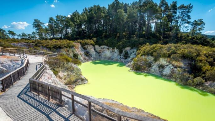
A large ruggedly edged crater created by an eruption deep underground is filled with water of amazing iridescent lime colour. The colour is the result of excess water from the Champagne pool mixing with sulphur and ferrous salts. Changes in colour through yellow to green are associated with the amount of reflected light and cloud cover.

The Devil’s Bath

Lady Knox Geyser :

Wai-0-Tapu has several active geysers but the most famous one is the Lady Knox geyser. It can erupt for over 20 mts high. This geyser is forced to erupt daily at a specific time by a park ranger. If this is not done, it will naturally erupt every 24 to 48 hours at sporadic time intervals. Spectators can view this geyser erupting and is definetly one of the highlights of this park.
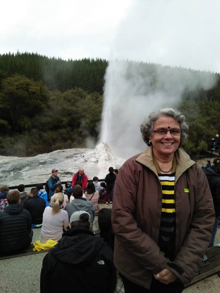
At Lady Knox Geyser

Video of the Geyser eruption….click on video

The Mud Pools :

The word pool should not mislead you….you certainly can’t swim in it. The coughing bubbling spitting mud pools are fun to watch. Here you find thick muddy water spewing out of the earth much like the boiling water splashing up from the pan.

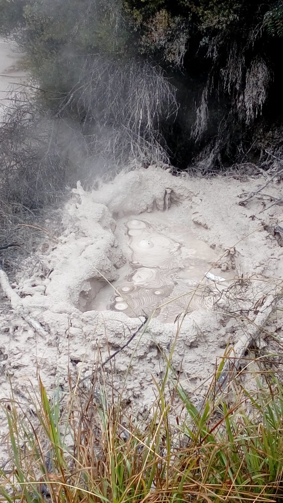
The Boiling Mud Pools

Video of boiling mud pools…click on video

Artist’s Palette :

Overflowing water from the Champagne pool draws minerals from below the surface. As the water cools, the minerals settle down and are exposed to the atmosphere and show up in a variety of colours….much like an artist’s palette!

It looks like a huge palette splashed with various colours…

Artist’s Palette

Opal Pool :

The greenish yellow pool next to Artist’s Palette

The Opal Pool

Sulphur Cave :

Here sulphur has crystallized on the over hanging shelf from the cooling of hot sulphur gases. There are also some chlorine pools here which may have been suitable for cooking.It is believed that the ancient people used these pools for cooking and other purposes. They used to revere these pools highly.
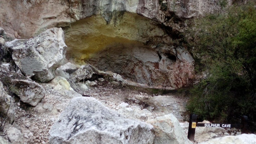
The Sulphur Cave

The chlorine pool useful for cooking.

Inferno Crater :

This crater has a bottom of violently boiling mud.
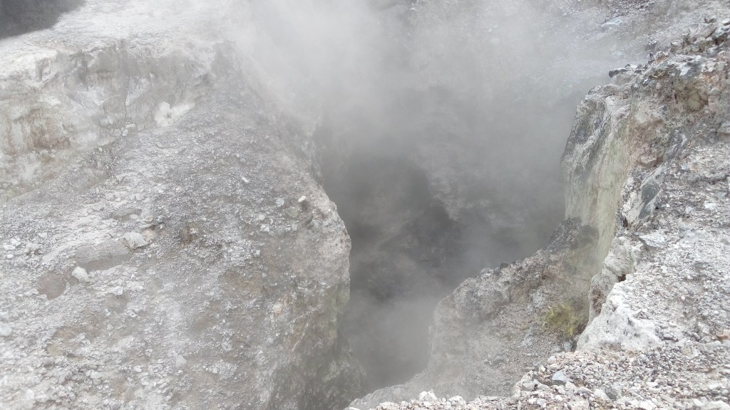
The Inferno Crater

Thunder Crater :

A collapsed crater; it graphically illustrates how unstable the land can be.Due to constant geothermal activity, the bottom of some of the craters give way and result in large gaping holes.

Thunder Crater

Thunder crater…note the steaming hot water at the bottom responsible for the erosion

Bird’s Nest Crater :

As the name suggests, the walls of this crater have holes in which starlings, mynahs and swallows nest. The warmth in the crater helps to incubate their eggs.

Bird’s Nest Crater

Last, but not the least….

A tribute to the original inhabitants of the place….an inscription in the reserve explaining the reverence that the locals had for the river Waikato and the Wai O Tapu region.

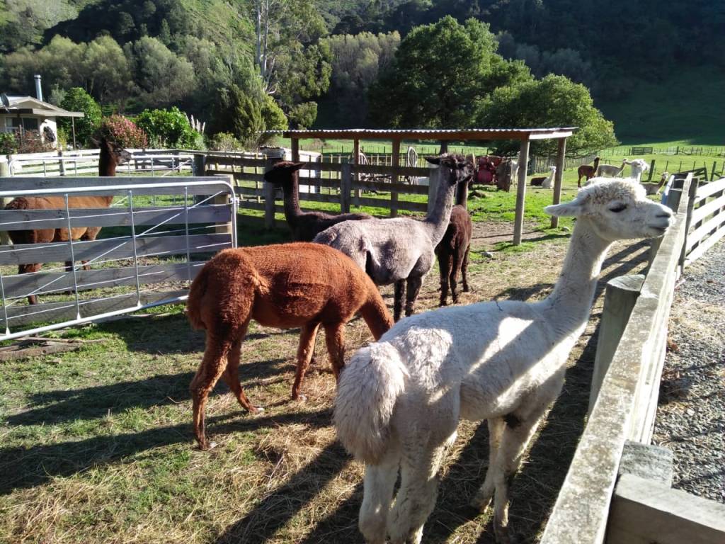
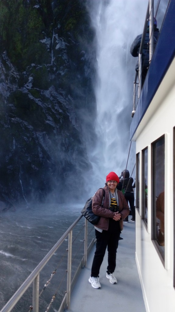
After a very exciting visit to this geothermal area, we returned home to our hotel with great memories..

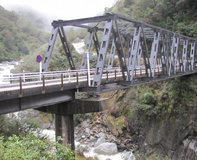
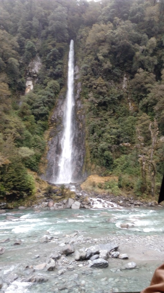
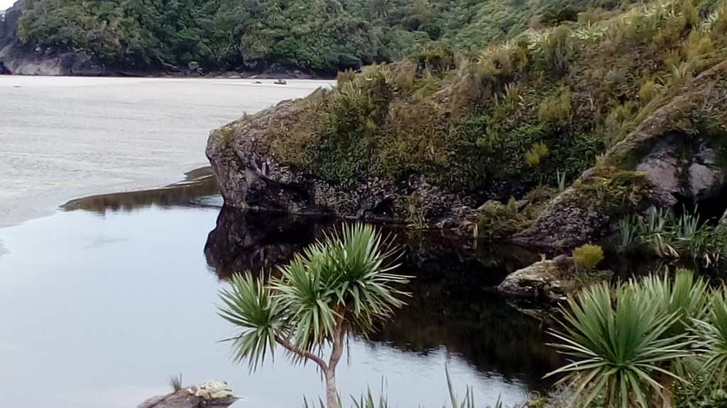
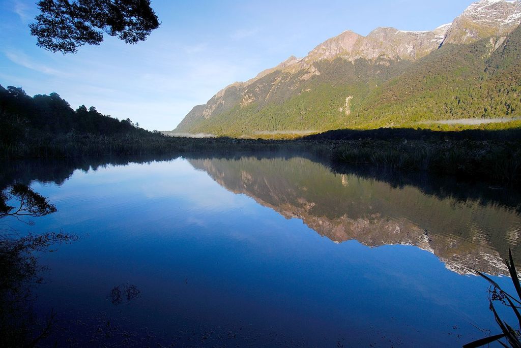
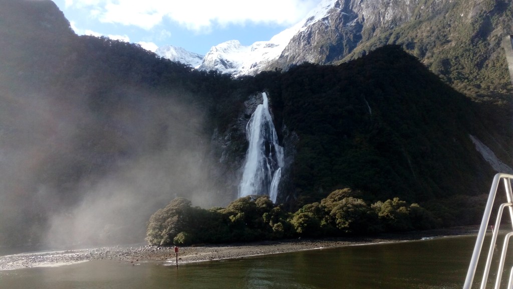
With this episode, we bid farewell to New Zealand.

As we departed New Zealand, there appeared a colourful rainbow in the horizon….as if to say….do not forget the colourful memories from this land….

The rainbow

Starting our Europe tour from next week…memories of a trip undertaken long ago…refreshing my memories as I take you along..

See you next week at London

Till then, do comment and subscribe below:

Rotorua

A city in the North island of New Zealand, Rotorua is located on the banks of Lake Rotorua. Rotorua is famous for geothermal activity and as we reached the city, the smell of Sulphur was overwhelming. Once we reached the city, we got used to it and soon did not realize the smell. Rotorua is also home to a living Maori village and tourists are treated to a Maori Cultural experience. A crafts school teaching traditional Maori woodcarving and weaving is an added attraction.

Enroute Rotorua, we visited an alpaca farm. Alpacas are reared widely in New Zealand and alpaca wool is very popular.

The Alpaca Farm

When we visited Rotorua, it was fall and we enjoyed the visual treat of the fall foliage.

Fall foliage

Lake Rotorua

Geothermal activity

Located in the Volcanic plateau in geothermal belt of North Island, Rotorua has hot springs, boiling mud pools and spouting geysers. Waimangu and Wai-O-Tapu are two areas known for these geothermal activities.

Geothermal activity is visible everywhere in Rotorua. We were surprised to see steam spewing out from the streets and from the compounds of houses.

Steam spewing out from the footpath along the compound wall of a house

There is a park in Rotorua called Kuirou park. Extensive geothermal phenomenon can be visualized there.

Kuirou park

Steam arising from inside Kuirou park

Boiling mud pool

Steaming pool in Kuiro

Steam arising from one of the pools in the park( click on the video)

Boiling Mud pools(click on video)

Maori Culture

Rotorua is one of the principal bases of Maori culture and tradition and Maori constitute a reasonable part of the local population. The Ohinemutu area, on the shore of Lake Rotorua, has several historic buildings, including a traditional Maori meetinghouse.

The Maori Village at Ohenimutu

Meetinghouse at Ohenimutu

Traditional Maori wood carving

Geothermal activity at Ohenimutu

The Maori people and their cultural show

The village of Whakarewarewa, situated in a geothermal area, offers demonstrations to visitors of how the Maori traditionally used the thermal waters in everyday life. 

Rotorua is also home to a sizeable Indian population and many Indian shops and restaurants can be seen.

Indian restaurant in Rotorua

Amphibious duck tours

With so much geothermal activity, tourism is one of the main activities at Rotorua. A special vehicle called the amphibious duck takes tourists to various geothermal centres. This vehicle can move on land and water…as the name suggests. I found this vehicle unique to this place…

The Duck Tour Vehicle

After experiencing all these geothermal wonders in Rotorua, we visited the Geo thermal Park at Wai-O-Tapu. That was another great experience and I shall meet you next week at Wai-O-Tapu and take you to the Lady Knox Geyser…

Till then, good bye…

Do not forget to comment and subscribe below

The Interisland Ferry

After a very gratifying tour of the South island of New Zealand, we were headed to the North island. If fjords, adventure sport and scenic drives are the hallmark of the South island, amazing variety of geothermal activity is what is in store in the North island. This is not to be interpreted as these activities being mutually exclusive of each other. Their preponderance in these locations is what I am trying to convey here.

The fastest way to cross over between the islands is of course to board one of the innumerable flights . But an exhilarating experience of sailing the Cook Strait on an Interisland ferry ,is so much more than getting from one island to the other.

The Interislander is a ferry service between the North and South islands in New Zealand operated by KiwiRail. It runs between Picton in the South island and Wellington in the North island across the Cook Strait covering a distance of around 95 km in 3 hours.

It forms a part of the tourism brand Great Journeys Of New Zealand created by Kiwi Rail to connect their Scenic transports and The Interislander and Tranz Alpine (which we did recently) are part of it.

We traveled from Christchurch to Picton by road. The road embraces the coast for considerable distance and awards great views! One of the main tourist destinations in New Zealand is Kaikoura….a coastal town known for whale watching.

Kaikoura is an important stop on this route. This place is also home to fur seal colonies and travelers get to see them if they are lucky.

Some seals relaxing on the rocks at Kaikoura

Our Trip

We had booked our trip on the Interislander from Picton to Wellington. Arriving Picton the previous evening, we relaxed at a hotel in Picton . Picton is a natural harbour with plenty of cafes, restaurants, and shops. Picton’s marina is home to many of the local’s yachts and boats. Picton is also a base to explore the Marlborough Sounds. There were beautiful views of Picton harbor and Yacht club from our hotel.

Picton Yacht club

Next morning, we headed to the boarding point of the ferry and collected our boarding passes and waited with anticipation for the journey.

The waiting lounge at Picton terminal

As we waited to board the ferry, the cars were being loaded on to the lower deck and we watched the cars being driven on to the ferry. Soon we boarded the ferry .

Some images of the ferry and its interiors:

The passenger deck of the ferry

Vehicles driving onto the lower deck of the ferry

Soon we set sail from Picton and the views of the port and town as we left it, looked beautiful..

Leaving Picton behind

Just after we left Picton, the ferry sailed along some dramatic fjord-like valleys, passing secluded coves and bays. This is the Queen Charlotte Sound, which is part of the Marlborough Sounds. Some pictures….

Queen Charlotte Sound

Soon after that, the hills of Marlborough surrounded us and we were sailing into an extensive labyrinth of waterways with lush greenery of the forest-clad hills soaring into the sky. This is the Marlborough Sounds. Taking up a considerable amount of the New Zealand coastline, the Marlborough sound provides an ideal location for sailing, watersports, fishing and mountain biking. Some pictures as we sailed the Marlborough Sounds….

The hills of Marlborough gradually appear

The Marlborough Sound

After some beautiful views of the Marlborough Sounds, the ship entered the Tory Channel which is the entrance to Cook Strait. At one point it almost looked like a dead end but the ship took a sharp turn and entered the Tory Channel

The sharp turn at Tory Channel

Once we crossed the Tory Channel, we were in the Cook Strait. Dolphins, penguins and seals are very often spotted here and we did see some dolphins!!

Leaving Tory Channel into the Cook Strait.

Dolphins playing around

Once in the Cook Strait, it was water water everywhere….surrounded by water on all sides.

After some more sailing , we were at the entrance to Wellington Harbour.

Two lighthouses mark the entrance to Wellington Harbour. Wellington Harbour is quite big and it takes almost an hour to sail from the entrance to the harbour.

The lighthouses at the entrance to Wellington Harbour

Reaching Wellington

Wellington Harbour

After we left the ferry, we collected our luggage and headed to our hotel in Wellington.

After a rather short stay at Wellington, we went on to explore the town of Rotorua….a hotbed of geothermal activity.

See you next week at Rotorua….till then, do comment and subscribe below

International Antarctic Centre

Have you thought about this? There is a continent which varies in area from time to time. Well…that is Antarctica; its borders change as per the freezing and thawing of its shores!!

Let us visit this unique continent today….first at the International Antarctic Centre in Christchurch and then through some pictures of life in Antarctica!

International Antarctic Centre

Located right next to Christchurch International airport, this center is one of the major tourist attractions in Christchurch. It provides visitors of all ages with an interactive, fun and exciting experience of Antarctica. This center is home to the Antarctic programs of New Zealand, United States and Italy and houses their administrative offices, the Antarctic Passenger Terminal and a Visitor Centre. Christchurch is geographically closest to the Antarctic and hence this connection.

At the entrance of the International Antarctic Centre

The center keeps you captivated from the moment you enter.

As we walked into the center, we got a feel of being in Antarctica. The interiors are inspired by the special landforms of Antarctica such as icebergs and glaciers. On display are the conditions of the Antarctic base and information received on that day from the Base Station in Antarctica.

Exhibits

There is a light and sound show of the Antarctic’s seasons where it snows every few minutes….

The seasons in the Antarctic

Experiencing a snow storm in Antarctica….that’s what the storm dome maintained at -8 deg C here does to you. We entered the dome wearing thick jackets and a simulated snow storm put us through a -18 deg C feel with heavy winds lashing around. Was little frightening….I must admit! There is an igloo here which you can enter .

Inside of the Storm dome

Ready for the snow storm

Polar plunge is where you can challenge yourself to see how long you can hold your hand in the icy cold Antarctic water.

Hagglund Field trip

Polar conditions require special vehicles that can ride on ice and there is a vehicle here called a Hagglund that is actually used in Antarctica.

We buckled up for a ride of our life on a road simulated like the rough Antarctic surface in this unique and all terrain amphibious Hagglund. Needless to say, it was a real bumpy and jerky ride!!

The Hagglund

Penguin Encounter

Here we saw the little blue penguins in their natural environment. There is a penguin feeding live demo also where the little ones are fed regularly. The penguins here are the lucky ones actually because it is a penguin rescue center where abandoned and wounded penguin babies are nursed back to health.

The penguins in their natural environment

Live demo of penguin feeding….click on the video

Ice Voyage is an exciting 4D experience that will take you on a simulated cruise across Antarctica.

“Beyond the frozen Sunset” is a short movie that takes you through a seasonal arc with stunning images.

Apart from the tourist activity, the Antarctic Center is also a full fledged support center for the Antarctic base stations of the US, New Zealand and Italy. All logistical support to their individual base stations is provided from this center. This makes the center a vital link for all scientific work carried out in the centers in Antarctica.

Support Centers for individual base stations

Many countries have their base stations in Antarctica including India. These base stations have scientists who carry out various research activities. The base stations are manned by scientists and essential support staff. There are support centers for these base stations located in different countries which are closest to the respective Antarctic base stations.

The following map will explain this:

Map showing support centers in various countries.

The support center for the US, New Zealand and Italian Antarctic scientific expeditions is located in Christchurch at the Antarctic Centre as their stations in Antarctica are closest to Christchurch. The support center for the Indian Antarctic base station is located in Cape Town . Scientists and other personnel going to the Indian station will go via Cape Town. That is a broad outline on how these logistics are managed.

The Support center for the US Antarctic Program

After all these experiences, one almost feels transformed to Polar territory.

The Gallery offers a host of interactive experiences ranging from tactile to visual , leaving one enriched with information.

Glimpses of life in Antarctica….

As I walked through these experiences, I was reminded of my medical college classmate and close friend who has experienced all this in real time. Introducing you to Polar Woman…Dr Madhubala Chinchalkar. An anesthetist by profession, she was the doctor accompanying the 36th Antarctic Scientific Expedition from India between 2016-2017. An extremely tough and gritty lady, she has spent one winter in Antarctica standing up to all the trials and tribulations that this icy continent offers.

Some pictures she has shared with me…to give you a perspective of actual life in Antarctica!

Dr Madhubala with the Indian base station MAITRI in the background

ALCI…Antarctic Logistic Centre International a 72 seater Russian cargo flight that operates from Cape Town and Novo air base in Antarctica in summer

The inside of the aircraft with the national flags of all countries whose scientists are traveling

An ice shelf in Antarctica

Antarctica has just two seasons, summer and winter. It has 6 months of daylight in summer and 6 months of darkness in winter.

Full moon during polar night in Antarctica

The vertical crescent moon ….unique to the polar regions.

Aurora Australis a natural light show seen in polar regions

The Independence day celebrations at the Indian Antarctic base station Maitri

She has also made a short documentary film on life in Antarctica . This film And Skua Returned Early has received several awards. It dwells on the impact of climate change on this continent. Skua is a bird that comes to Antarctica in summer and thus heralds the onset of summer in Antarctica. The early return of the Skua signifies the early return of summer….an ominous sign of global warming.

For those of you who are interested to know more on this, I will share the link to this film..

I am sure this short diversion from the Christchurch center to the actual life in Antarctica would have kindled some curiosity about this continent in some of you at least. The short film will help answer many of your questions.

With this, I wrap up my visit to the Christchurch centre but not before I bow down with respect to the scientists who work there under very difficult conditions…

We now move from the South island to the North island of New Zealand .See you next week on the Interislander…a ferry that crosses the Cook’s strait and takes you to North Island.

Till then, keep your comments going and do subscribe below:

A Tranz Alpine Journey

Our next destination was Christchurch. What better way to reach Christchurch than by the epic train journey on the Tranz alpine?

Having heard about this train journey we were keen to do it at least one way. That is why we headed to Greymouth from where the Tranz Alpine leaves to Christchurch. The Tranz Alpine effectively takes you from the west coast across the Southern Alps to the east coast of South Island . It ascends and descends the Alps in this journey and thus presents you the beauty of this great mountain range. It is operated by Kiwi Rail and is part of The Great Journeys of New Zealand and is touted to be one of the best train journeys in the world.

We reached Greymouth from Queenstown by a Great Sights bus the previous evening. Greymouth is a small quaint place where the Grey River empties into the sea. Apart from being the starting point of the Tranz Alpine and a well known jade trade centre, Greymouth is a sleepy town. It was pretty cold and windy and we quickly took to the warmth of our hotel room.

Next morning , after a short walk in the town, we headed to the station on time to board the train. The station is also a very small old time kind of station.

Greymouth Station

The Tranz alpine covers a distance of 223 km one way between Christchurch and Greymouth in about 5 hours time.

As we were waiting at the station the Tranz Alpine arrived from Christchurch. Take a look at this video…

The beautiful Tranz Alpine train arriving Greymouth

As this train caters primarily to tourists, it focuses a lot on luxury and portraying the scenic beauty of the place. The train’s carriages have un-tinted, non reflective, panoramic side and roof windows to capture the beauty of the Southern Alps and the alpine forest landscape. Commentary in 5 languages via headphones is available on all seats.

The interior of the train

The train has a cafe carriage offering alcoholic and non alcoholic beverages, snacks and light meals.

The cafe

Apart from this; the train has a viewing platform where there are no seats and one can stand and enjoy uninterrupted views through open windows.

The Viewing Platform

Once the train started off we were treated to some spectacular scenery.

We started with what is called the West Coast where the scenery is greener and vibrant. Initially the train passed the Grey River valley and then headed to Moana on the banks of Lake Brunner…

Lake Brunner

After this we crossed a series of river valleys of which the Taramaku and the Otira are the more famous.

From there was the Otira tunnel…a 8.5 km long tunnel which is the lifeline of this rail track from Greymouth to Christchurch. This tunnel marks the transition from the West Coast .

The Otira Tunnel

After the Otira Tunnel we reached the Arthurs Pass….a pretty alpine village.

Arthurs Pass is the highest point on this track. The part of the track from here on to Springfield is considered an engineering masterpiece and that is what the Tranz Alpine is most famous for. There are 15 tunnels and 4 viaducts of which the staircase viaduct is the highest.

The Arthur’s Pass Station

Soon after the Arthurs pass, the train crossed the Waimakariri river and gorge providing some spectacular scenery.

The Waimakariri River

The Waimakariri gorge

After the train crossed the Waimakariri river a couple of times, it reached an area with plains against the backdrop of the Southern Alps.

The Staircase Viaduct

As we moved along the plains , Mount Binser appeared and was indeed a great view .

Mount Binser

From here on we reached Springfield where the Southern Alps ended and the Plains of Canterbury started. Looking back from Springfield, the Majesty of the Southern Alps seemed unsurmountable.

The view from Springfield

After leaving Springfield the scenery was predominantly of grass covered plains against the backdrop of the mountains. This was the Canterbury Plains.

The Canterbury Plains

After a journey cutting through the grassy plains we arrived Christchurch.

Christchurch Station

From the station we took a cab which had an Indian driver and reached our hotel with wonderful memories of a beautiful train journey.

As most of you know, Christchurch is the closest place to many of the Antarctic stations. Christchurch has a great Antarctic centre where Antarctic life is showcased for the common man.

We had the good fortune to visit this center and experience simulated Antarctic life. So next week. let me take you through an Antarctic experience at the Antarctic Centre, Christchurch.

Till then, do comment on my blog and subscribe below:

Lake Matheson

This beautiful glacial lake is located in the South Island close to Fox Glacier which we talked about last week. The iconic picture of this lake has been featured on chocolate boxes, beer bottles, calendars and souvenirs, and even on a postage stamp! It is the most photographed lake in New Zealand.

It is famous for the reflections of the twin peaks of Mount Cook and Mount Tasman.

Te Ara Kairaumati (the Maori name for the lake) was traditionally a food gathering place for the Maoris as they explored the coast in search of pounamu or jade. Eels which thrive in these brown waters were their traditional food.

Little bit into the past….

The retreat of the Fox Glacier 14000 years ago at the end of the last glacial period left behind a valley and a huge slab of ice which gradually melted and collapsed to form the lake bed. The lake is now about 12 km from the current terminus of the glacier. The gravel from the glacier dammed the valley and the lake grew by being fed by small streams and seepage. This lake is surrounded by dense forest and native bushes. The streams that feed the lake pass through this thick vegetation and carry organic matter and tannins from the forest which gives the water a dark brown colour enhancing its reflecting capacity.

Scientific studies have shown that the water here is acidic , lacks nutrients and tends to get deoxygenated. These are features of a dystrophic brown water lake and it is predicted that the lake will accumulate organic matter and gradually fill in to become a peat bog.

Well, that is going to take a few hundred years atleast…so no worries now…enjoy its beauty.

Little bit into the present….

Since the rise of the tourism industry in New Zealand, this has become an important tourist destination for its reflections of the Southern Alps. The most famous reflections seen on the lake are that of Mount Cook And Mount Tasman, the two highest peaks in New Zealand.

The reflections are best viewed at dawn on a calm clear day before the wind disturbs the water surface or clouds form on the peaks.

Our Trip:

As promised the previous day, Murray our driver arrived on time at our hotel. A short drive from Fox Glacier town, and we were at Lake Matheson…

The area around the lake is part of the Westland Tai Poutini National Park . There are a couple of walking tracks and viewing points along these tracks that offer the best views of the lake and the reflections.

An easy 2.6 km track circles the lake and we followed this track…

Some pictures that had us spell bound…..just come…walk along….

The start of the walk…

The dense bushy native plants around the track

A stream with well rounded stones that we had to cross

The swinging bridge over the Clearwater River

The Clearwater River….note the brownish colour of water

After we crossed the Clearwater river, the track took us in between some tall trees and native vegetation.

The dense vegetation

Further on the track we reached the viewing platform of reflection island.

The viewing platform at reflection island

Here we got some beautiful views of the forest and vegetation reflecting on the water.

View of reflection at reflection island

Finally we reached the most photographed location….the view of views….the reflection of the twin peaks…

The viewing platform at View of views

View of Views….as they call it….the two peaks reflected on the water.

One of our most cherished pictures….

After this we walked back along the track to the car park area where Murray was waiting for us. In the usual kiwi way, he offered to take us around the Lake Matheson area .

Some pictures…

Cattle and sheep graze in the backdrop of the Alps

The beautiful countryside

A helicopter takes off!!

And a couple sky dive…..

After some breathtaking views of Lake Matheson, we headed back to the hotel. Our next destination was Greymouth from where we took the Tranzalpine train to Christchurch. Meet you next week at Greymouth and on the Tranzalpine…an epic train journey indeed!

Till then, do give me your feedback and comments and don’t forget to subscribe

The Fox Glacier

Zig Ziglar……the American author says…Difficult roads lead to beautiful destinations…This saying can be interpreted metaphorically to our life events. But here it’s not metaphorical….it’s physical….

After a difficult but scenic drive from Queenstown along the Haast Pass ( about which was my last blog),we were at the beautiful small town of Fox Glacier….. justifying what Zig Ziglar said!!

The Fox Glacier Town

Called Weheka in Maori, this town is actually a tiny village on the west coast of south island in New Zealand. It was renamed Fox Glacier after a visit by the then Premier of NZ, William Fox . State highway 6 (Haast Pass road) passes through this village as it leads to another glacier; the Franz Josef Glacier.

The village serves two important tourist destinations. The Fox Glacier itself and Lake Matheson. The town is famous for the glacier hikes and helicopter rides.

We stayed at the beautiful Bella Vista Hotel. The views from the hotel were awesome.

Fox Glacier Town

The Bella Vista Hotel

The Fox Glacier

The specialty of this glacier is its close proximity to the Tasman Sea. No where else in the world are there glaciers so close to the coastline and that makes Franz Josef and Fox glaciers truly unique.

The glacier is 13km long and is located in the Tai Poutini National Park. It is one of the most accessible glaciers in the world with its terminal phase as low as 300 meters above sea level about 6 km from fox glacier town.

Fed by four alpine glaciers, Fox Glacier descends from a height of 2600m above sea level in the Southern Alps into the temperate rain forests just 300 m above sea level. The outflow from the glacier forms the Fox River. During the ice age, the ice retreated and left behind many moraines. Lake Matheson( which we visit next) is one such lake.

Fox Glacier

Fox River originating from the glacier

Primarily there are two modes of visiting the glacier…by hiking or by helicopter. Helicopter rides can be booked from the counters in the town and they take you to the top of the glacier. Bad weather is a constant threat to these trips and one must have sufficient time at hand to deal with such delays.

Helicopter rides to the glacier are very popular

There are about 30 different walking tracks around the Franz Josef and Fox glacier areas. Hiking guides are available and one can hike as per one’s capacity from simple walks along the glacier edge to rugged and strenuous hikes up the glacier.

Some of the popular tracks are: Southside Walkway and Fox glacier Valley Walk

Southside walk is a 6 km walking/cycling track that follows the south bank of the Fox River through a rain forest. A 40 minute walk takes one to a view point of the glacier. Cycling is not allowed beyond this point.

Views from South side walk…Fox Glacier

Valley Walk

This is shorter and around 2.6 km

We did this walk and could access the terminal portion of the glacier from around 200mts away . The initial part of the track is not very steep. The slope is gradual and one can follow a stream which we had to jump across several times. Gradually the steepness of the track changed and the final part was a rather steep climb . But we were rewarded with these views at the end….

Terminal portion of the glacier

A close up of the terminal part of the glacier

Another view of the glacier from a distance

Apart from this trek on to the glacier, is an easy wheelchair friendly walk called the Minnehaha Walk from near the town following a stream through the rain forests with the bonus of seeing glowworms at night. This is a loop walk of around 1.2 km and can be easily done in around 30 mins along a rain forest.

Minnehaha walk through rainforest

We did this trip to the Fox Glacier in 2018. I understand that there have been considerable changes here after that. The road to the iconic Fox glacier was closed in 2019 . A severe storm in February 2019 caused a massive landslide . Flooding following heavy rains in March 2019, caused further damage to the road . Tons of rock and gravel came crashing down to the Fox valley and destroyed the causeway and the car park areas. This landslide was New Zealand’s largest active landslide and is called the Alpine Gardens landslide.

After this, the reestablishment of road access was considered impractical and the road was indefinitely closed.

Helicopter rides to the glacier, and scenic flights to Franz Josef are still happening. The economic impact of this closure on the township is huge but the other activities for which it is a hub still continue. One such great place to visit from Fox Glacier township is none other than Lake Matheson…the iconic lake of New Zealand.

Next week we visit this Lake and I promise you some breathtaking views. Till then, its bye from Fox Glacier…

Do give me your valuable comments and subscribe below..

Haast Pass

When it comes to scenic road trips, few can compare with the beauty and diversity of the drive from Queenstown to Fox Glacier. This drive takes you past some beautiful glacial lakes, along the banks of glacial rivers, across some rapids, on the passes of the Southern Alps, along the coast of the Tasman Sea and finally reaches glacier land. Can you ask for more variety?

The Haast Pass is the unofficial name of the road from Wanaka along the Haast river to Haast town. It is also called State Highway 6 . This Pass road is around 140 km long and is located in the Southern Alps in the South Island. A mountain pass at an elevation of more than 1800 ft above sea level, is said to be one of the most scenic alpine routes in New Zealand. Located in Mount Aspiring National Park, it a must do journey; but is also a test for the vehicle and the driver alike. It has many curves and bends and many one-lane bridges and is dotted with slip hazard warning signs! There are no settlements on this road. This is claimed to be the route that the Maori followed in their search of green stone or jade which they called pounamu.

The real Haast Pass is located halfway along this route.

The journey offers a variable landscape of rainforests, wetlands, lakes, rivers and rapids. This road snakes its way to innumerable adventures that lie in wait to be discovered. During winter this road is prone to snowfall and it is best travelled on outside the winter months. Very heavy rainfall also results in road closures here and it is required to keep track of this before travelling.

Our Trip

We were essentially travelling from Queenstown to Fox Glacier. Since we wanted to combine this road trip with some sightseeing on this scenic road we booked on a Great Sights bus.

As we left Queenstown, we had some great views of Lake Wakatipu from another side. Some pictures to enjoy…

Lake Wakatipu

After leaving Queenstown, our first halt was at Wanaka.

Wanaka

A popular ski and summer resort town in South island set on the border of a lake by the same name, is picturesque! It is the gateway to the Mount Aspiring National Park which is a wilderness with glaciers, alpine lakes and forests.

Some pictures…

Some views of Lake Wanaka

The Beautiful town of Wanaka in Fall colours

Further down the road was another beautiful lake…Lake Hawea.

Lake Hawea

Lake Wanaka came into view once again and the road followed the side of Lake Wanaka. Then came the small town of Makarora. Named after the river Makarora, there is a famous cafe where we had a small break.

Makarora Cafe

Driving further on the highway, we crossed the Makarora river.

Makarora River

This river starts at Mount Aspiring National park and flows into Lake Wanaka after passing Makarora town. It meets the Blue river to form the famous Blue Pools which is about 30 minutes walk from the highway. We did not do this trek but it is an awesome place where there are hanging bridges to view the blue pools. The river attracts recreational activities like fishing, kayaking and jetboating.

These rivers have a peculiar blue color as they are fed by glaciers and there is minimal pollution.

The Blue Pools

There is a famous campsite called Cameron Flat further down the road. Many campers use this site to park and explore the Makarora river, Blue pools and surrounding areas.

Cameron Flat Campsite

As the drive continued further we were alongside the Makarora river for a considerable amount of time. Then came another beautiful glacial river….the Haast River.

Haast River

Further on the highway we crossed the actual Haast Pass.

This is a mountain pass in the Southern Alps used by the Maoris in the pre European times.

Haast Pass

We also crossed The Gates Of Haast. These are a series of rapids on the Haast River and can be seen from the bridge as one passes it.

The Gates Of Haast

As we drove along, we came to Thundercreek Falls; one of New Zealand’s highest falls.

Thundercreek falls

As we passed Haast town, the coastline became visible and it was a sudden change from the forests and rivers to the open sea.

Ship Creek

The beach at ship creek has logs of driftwood all over the sand. Besides there is a boardwalk on which one can walk along and see the beautiful reflections on the still waters. There is a small watchtower here from which the reflections look more impressive.

Driftwood at shipcreek

Reflections at ship creek

Ship creek beach

The rainforest and its reflections at ship creek

Knight’s Point is a lookout point that provides spectacular views of the ocean. The rock formations seen in the ocean at this view point are unique.

Knight’s Point lookout

Salmon farm

Salmon farms dot the coastline of South Island . Salmon farms rear different varieties of salmon .Most of them have a cafe and we stopped at one such farm for lunch.

Cafe at the salmon farm

Salmon rearing ponds

From here on the landscape gradually changed and the valleys were replaced by glacier land…..reaching Fox Glacier.

In true Kiwi hospitality style, the bus driver dropped us off at the Hotel and arranged for Murray a local driver for our next day’s programs. After some settling down, we explored Fox Glacier town and had dinner at a local cafe and returned to the warmth of the room.

Next day, we visited Lake Matheson and Fox glacier. Next week I will take you to the glacier. Till then, keep reading, commenting and do not forget to subscribe below

Milford Sound

Described by Rudyard Kipling as one of the Wonders of the World, Milford Sound is home to some of the finest landscapes in New Zealand’s South Island. Known in Maori as Piopiotahi…meaning one piopio…a small bird like a thrush which is now extinct, it is indeed an awesome place! With a magical combination of mountain peaks, dark waters and superb forest clad cliffs,the scenery is intoxicating….to say the least.

Fjords and sounds…an introduction

A fjord ( pronounced as fiord) is a long narrow inlet with steep sides or cliffs created by a glacier. There are many fjords on the coasts of Alaska, Antarctica, British Columbia,Scandinavian countries,UK and of course New Zealand. Norway probably has most of its coastline as fjords. A true fjord is formed when a glacier separation creates a U shaped valley which gets subsequently flooded by the ocean

A sound is a smaller body of water typically connected to larger sea or ocean. Sounds are often formed by seas flooding a river valley….a typical example being the Marlborough sounds of New Zealand.

Fjordland National Park

Milford Sound is located deep within the Fjordland National park which occupies the south west corner of South Island. The largest of the National parks in New Zealand, it is a World Heritage Site. The retreat of the glaciers after the ice age left U shaped valleys with sheer cliffs on either side. There are around 15 fjords here; some of them reaching 40 km inland. Some of the more famous sounds here are Milford Sound, Doubtful Sound and Dusky Sound. Several lakes lie within its boundaries…the more famous among them being Lake Te Anau.

Our Trip

We had heavy rains at Te Anau on the previous night and when we reached the Real journeys office, there was some uncertainty about conducting the tour due to risky conditions at the Homer tunnel. Fortunately for us; we soon embarked on the trip in a beautiful glass topped bus.

The drive took around two hours and had some amazing scenery all along.

Our first halt was at The Mirror Lakes.

About 56 km north of Te Anau and halfway to Milford Sound we had a short photo halt at Mirror Lakes. The calm waters of this group of small lakes, reflect the Earl mountains and provides great photo opportunities. A short walk along a wooden boardwalk leads one to the viewing point.

The Mirror Lake

From there we continued the drive and reached the Eglinton Valley. Here the scenery changed dramatically to steep snow covered cliffs. The Eglinton valley was the shooting location for some parts of the famous movie Lord Of The Rings.

Some pictures from Eglinton Valley..

The Eglinton Valley

Just to get the real feel of driving along to Milford, have a look at the video below

A short video of the drive to Milford Sound

There are many hiking tracks at various locations on this road which can be attempted if time permits. Since we did a day trip from Te Anau, we could not explore these. Many of these locations are beautiful and serene and provide nice short trip opportunities.

Our next destination was the Homer Tunnel. This tunnel is like a life line to Milford Sound as it was only after the completion of this tunnel that road trips to Milford sound was possible. It took 20 years to build due to the difficult terrain and climatic conditions here. The tunnel is 1.2 km long and vehicular traffic is very carefully and strictly monitored here. It is a high avalanche prone area in winter and hence poses severe challenges to the drivers.

Approaching Homer tunnel

Homer Tunnel

The Hundred Falls

True to its name, this place has hundreds of small waterfalls gushing down the rocks. We had rain the previous night and perhaps that added to the number and size of these falls.

The Hundred Falls

After we reached Milford Sound, we waited at the wharf to board the Cruise that was to take us on the Sound. The Milford Mariner was our cruise boat.

The Milford Mariner

Once the cruise started, we were treated to some amazing scenery. I would have loved to remain outside on the deck but it was too cold for comfort and had to rush into the cabin for warmth.

The Beauty of Milford ….from the top deck of the boat

View from lower deck

As we cruised the Sound ,we came across innumerable waterfalls, adding to the charm. Some pictures…

Some of the waterfalls that dot the cliffs of Milford

Very often seals are found basking in the sun on the rocks….we saw some of them….here they are…

Seals basking on the rocks

According to our guide, seeing Dolphins is not such a common thing….but we did see them…adding to the feel good factor…

Dolphins at Milford sound

Enjoying the scenic beauty of Milford Sound, we returned to the wharf and to the bus to be driven back to Te Anau.

Leaving Te Anau was never going to be easy. This was one place that has given me some really cherished memories. Next day we returned to Queenstown to embark on another journey along the Haast Pass to Fox Glacier. So next week, we will be enjoying the drive along the Haast Pass in the Southern Alps.

Hope you enjoyed the tour of Milford Sound. Do give me your feedback and do subscribe below.

The Glowworm Caves

New Zealand is home to this natural wonder. The glowworms are widespread in New Zealand generally in cave systems. The most popular of the cave systems to view glowworms are at Waitomo, Te Anau and Waipu.

A short introduction on the glowworms

The New Zealand variety of glow worm is actually the larva of an insect which looks like a mosquito. The scientific name is Arachnocampa luminosa. The larva produces a blue green bioluminescence. The Maori name is “Titiwai “meaning projected over water. They live in dark, cool , damp and humid environments like caves, sheltered banks and native bushes.

This is not to be confused with fireflies which also are bioluminescent but belong to the beetle species.

The insect eggs are deposited on cave walls. On hatching, the larvae immediately begin to glow. They grow from the initial size around 4 mm upto 40 mm. over several months. They move around the cave wall and finally attach themselves to a site and start producing a silk nest. The larva produces long silk threads which have sticky droplets on them to capture prey.

The bioluminescence is a result of an enzyme luciferase acting on a molecule called luciferin. Though the enzyme has similarities with that found in fireflies and other bio luminescent systems, the composition of luciferin is totally different in this species. The purpose of this glow has been attributed to attracting prey and also potential mates.

The adult stage

The larva and the silk threads

Bioluminescence

Our Trip

We decided to do the glow worm tour at Te Anau. Real Jouneys is the tour company which organizes these tours from Te Anau.

The glow worm caves lie in the mountains across the Lake Te Anau .The caves are around 12000 years old and are still being carved out by the force of the water that flows through them. The result is a twisted network of limestone passages, whirlpools and an underground waterfall.

Tourists have to take a catamaran to the other side of the lake. These caves are situated close to the water level and the trips are called off if there is flooding in the caves. The trip was cancelled on the previous day due to heavy rain and flooding of the caves.

We were lucky to get a rain free day to do the trip. The catamaran ride lasted about 40 minutes.

Once we reached the other side, we were guided by helpers to get across the slippery rocks on the edge of the lake. The whole area has a very marshy , damp , slippery appearance with dense vegetation .Then we were guided to the Cavern House. The Cavern house has tourist facilities like a small cafe , toilets etc and has a small hall where the guides explained about the bioluminescence and the larvae . There are educational exhibits here too…

The mountains where the caves are situated

The catamaran luminosa that takes you across Lake Te Anau

The Cavern House

Photography is strictly prohibited in these caves.

After the educational session, we were divided into small groups with a guide for each group. We followed the guide along some narrow passages among caves. At many places, limestone formations are seen inside the caves. One has to bend and turn and manouvre oneself to prevent injuries from jutting rock formations. As we went further inside, it got darker. The guide had a headlight on her forehead. At places, there are steps made manually too. At places there are small lights too.

As we walked along the caves, there were silk threads visible at places. But the larvae could not be seen. Finally we reached a small area with flowing water and we boarded a very shallow boat. The boat is so shallow that you cannot sit upright. This is also to prevent injuries to the head as the boat goes through the narrow channels.

Once the boat was on its way, we started seeing the beautiful blue green light all along the walls of the caves. At places, it was very bright and at places it was dull. I assume it depends on the density of larvae at that site. It was indeed a great experience. It looks like a sky lit up with stars!!

Some pictures…

Walking to Cavern House with the guide

The underground waterfall

Walking tracks inside the caves

At places one has to bend to avoid injury

The shallow boat ride and the glow worms on the walls

The star like glow of the larvae

After this wonderful experience we were treated to some hot coffee and took the cruise back to downtown Te Anau.

Our trip to Milford Sound was scheduled for the next day . See you next week at Milford Sound….another beautiful location.

Till then, good bye

Do comment and subscribe below