Paradise and Mt Rainier

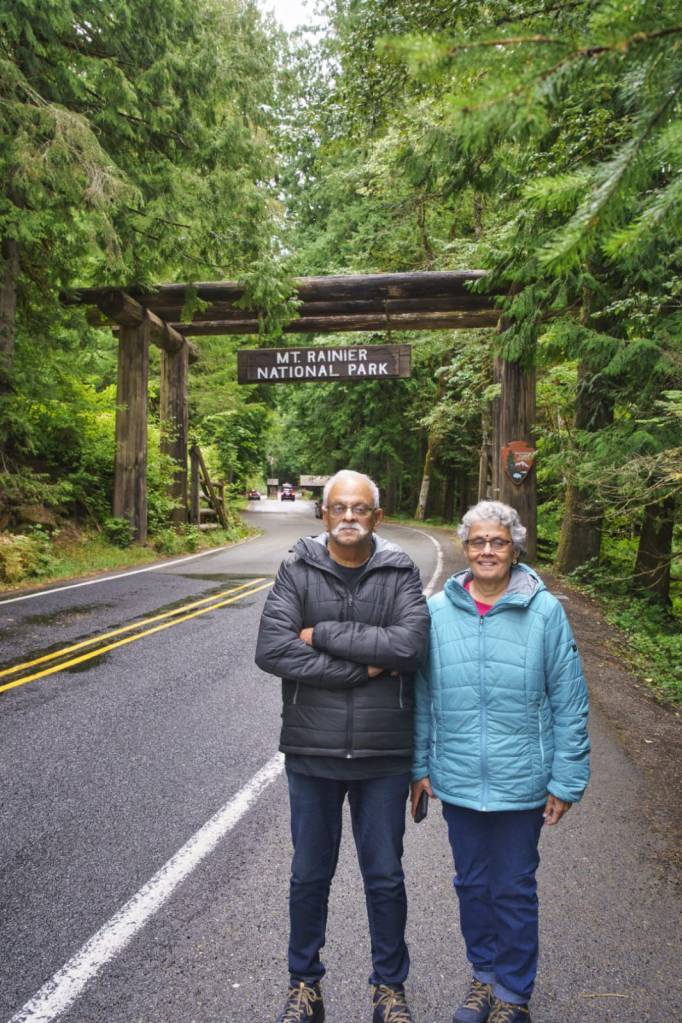
In the last episode, I had promised to take you to a special place called Paradise. That’s where we are today. We reached Paradise around noon during our drive through Mt Rainier National Park.

Paradise

This is an area on the south slope of Mt Rainier at a height of approximately 5400 ft. It is the most popular destination for visitors to the Mt. Rainier National park. It lies in the Paradise river valley.

Paradise features subalpine meadows, the Jackson Visitor Centre, the historic Paradise Inn and offers epic views of Mt Rainier.

Paradise is also the primary winter-use area in the park receiving 643 inches of snow on an average every year making it ideal for winter activities like snowshoeing, cross country skiing and sledding . It is often called the snowiest place on earth where snowfall is measured.

Why is it called Paradise?

For those of you who have not seen the previous episode, James Longmire was an American explorer who ran a homestead in the Rainier area .The mineral springs near the homestead were claimed to have medicinal powers. Subsequently the homestead was convereted into a museum at the place called Longmire inside the Rainier National park.

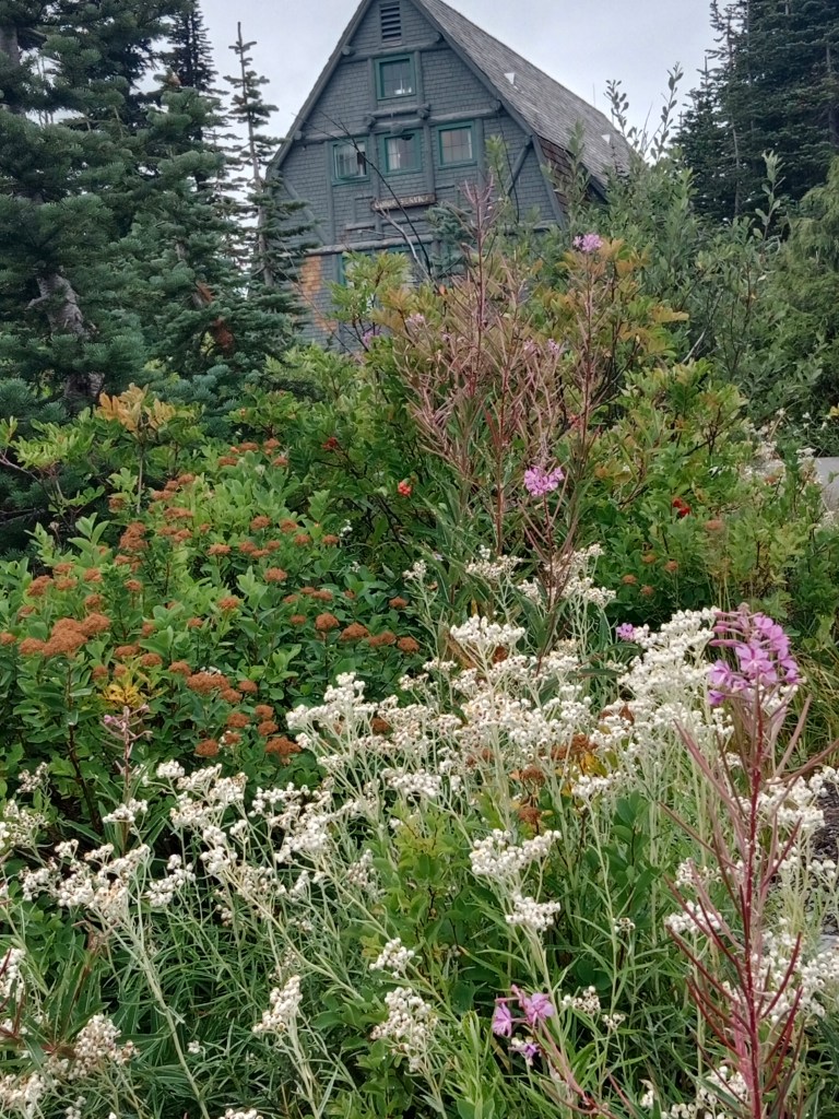
The sub-alpine wild flower meadows and the breathtaking views from here made James Longmire’s daughter in law to exclaim “Oh,! What a Paradise”. The word Paradise stuck to the place and hence the name.

Some pictures….

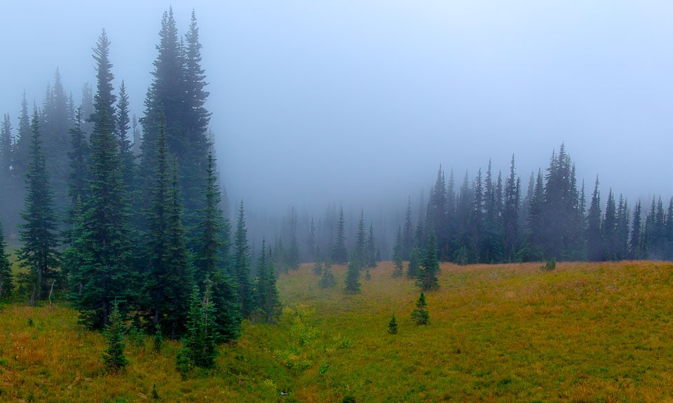
Now you know why it’s called PARADISE…..

Visitor Center

The Visitor center at Paradise offers general information on the park and its features. A documentary film on the park keeps running and one can join in and get a glimpse of the changing faces of the park as the seasons come and go. There are exhibits here of the unique flora and fauna of the place and also the indigenous people.
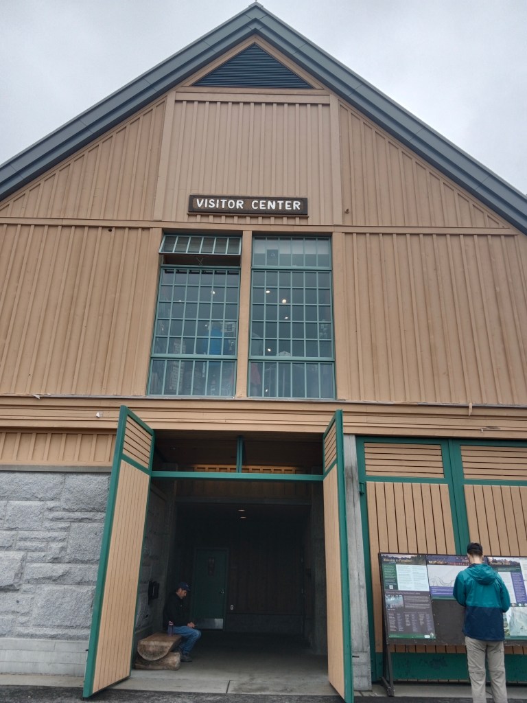
The visitor center

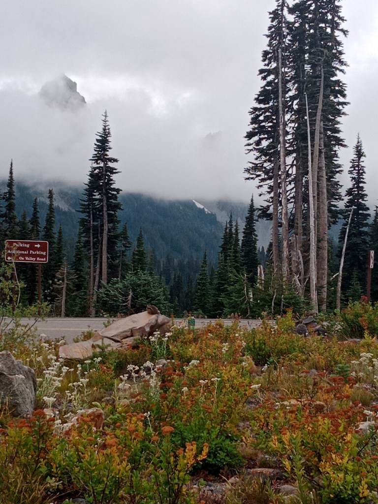
There are various trails that start from near the Visitor Center which takes one through the alpine meadows of Paradise with great views. Some of the trails are…Nisqually vista trail, Skyline trail to myrtle falls, Alta Vista trail etc.

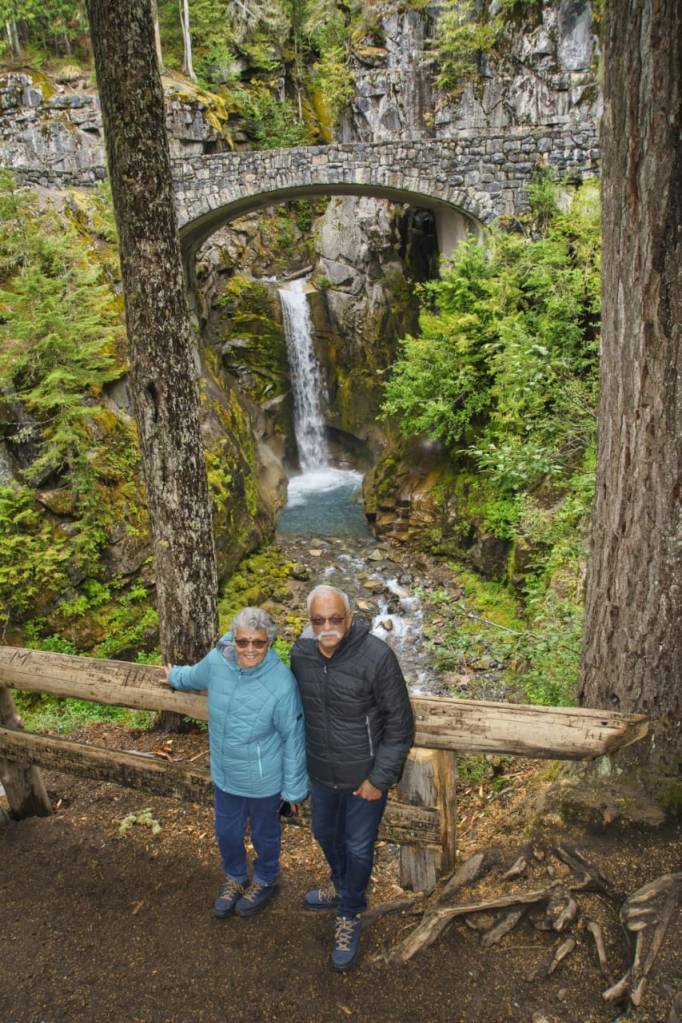
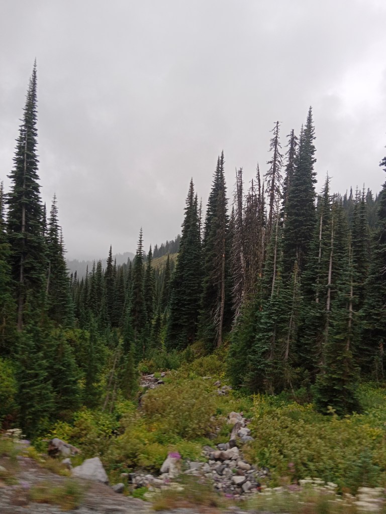
As per Mark’s (our guide) advice, the trail to Myrtle falls seemed more doable and we followed that trail. Some views from this trail.

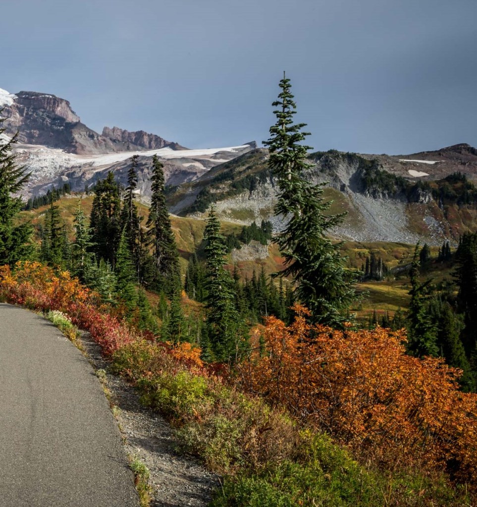
Some pictures from the Myrtle falls trail with the sun playing hide and seek

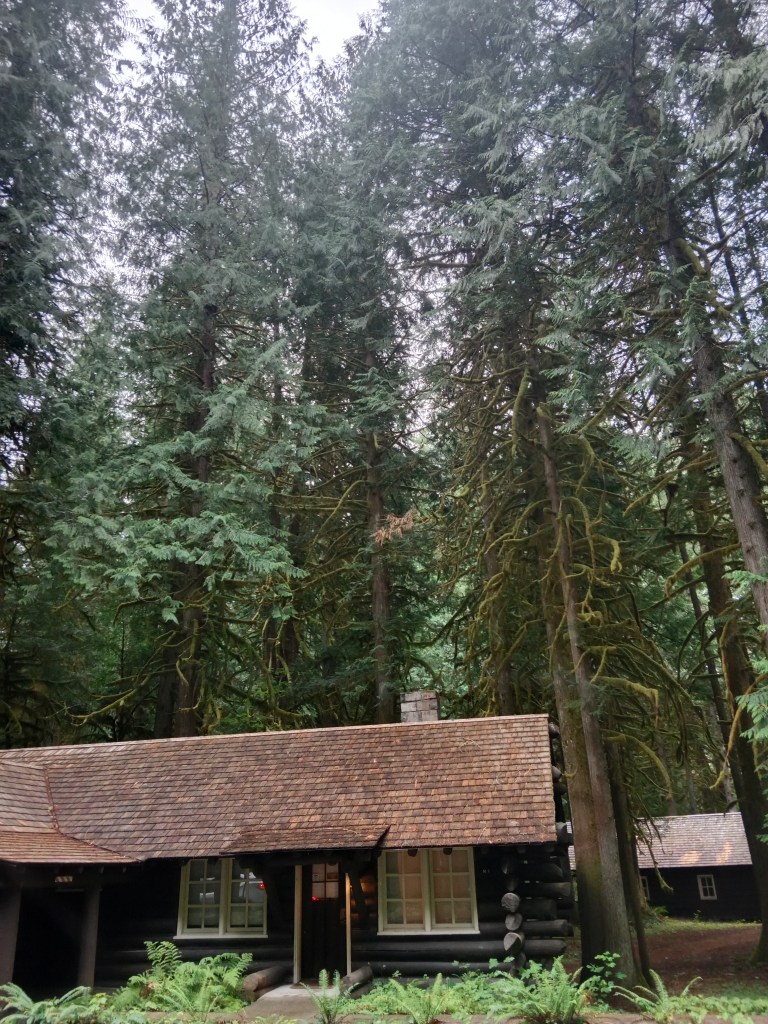
The other architectural beauty at Paradise is the Paradise Inn.

Built in 1916, this is a National Historic Landmark in the Paradise area. It is basically an inn and provides accommodation with great views of Mt Rainier. It also has a restaurant for visitors from outside. The interiors are done up with an old age charm that adds to the beauty. Some pictures…

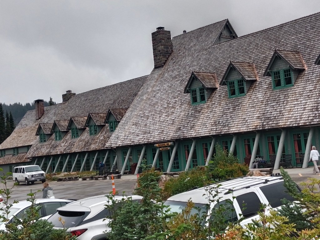
The exterior of Paradise Inn and the outdoor restaurant

The interiors with old world charm

The day had been cloudy and drizzly and Mark had prepared us to have no views of Mt Rainier. He said, you can be on the mountain and still not see it. But there is much more to be seen and done along the route and we should make the most of the situation.

But the sun did not disappoint us. He did come out for a few minutes to give us fleeting views of Mt. Rainier.

A fleeting view of Mt. Rainier from in between the clouds….

What it would look like on a more favourable day…(courtesy pexels)

The clouds soon overwhelmed the sun and we were thankful that we got that fleeting glance!!!

I must tell you here that I had been lucky to see Mt Rainier earlier on from a flight in 2019 heading to Portland.

That brings us to Mt Rainier and its specialties

Mt. Rainier

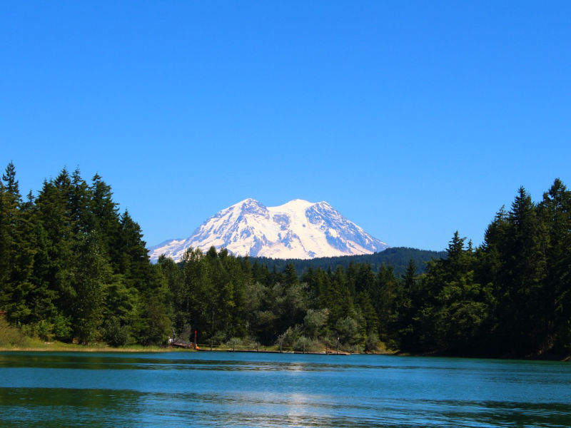
This mountain range is located just southeast of Tacoma – Seattle area and can be seen from there on clear days. Locals call it Mt Tahoma or some even refer to it as “The Mountain”

Mt Rainier from Seattle on a clear day

This tallest volcano in the Cascade Mountain ranges in the state of Washington in the United States is a paradox in itself.

What is this paradox?

Well, what we see from down below is a snow covered peak which makes its appearance from behind the clouds every now and then as if playing hide and seek with us. But far above, at 14,410 ft. , at the summit, steam escapes from deep inside the mountain’s core reminding us that it is still an active volcano. The mountain rises abruptly from the surrounding land which comprises of valleys, waterfalls, meadows and vast expanses of old growth forest.

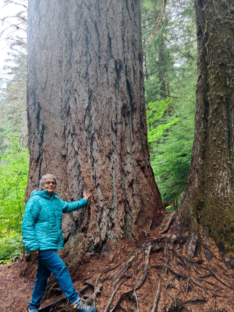
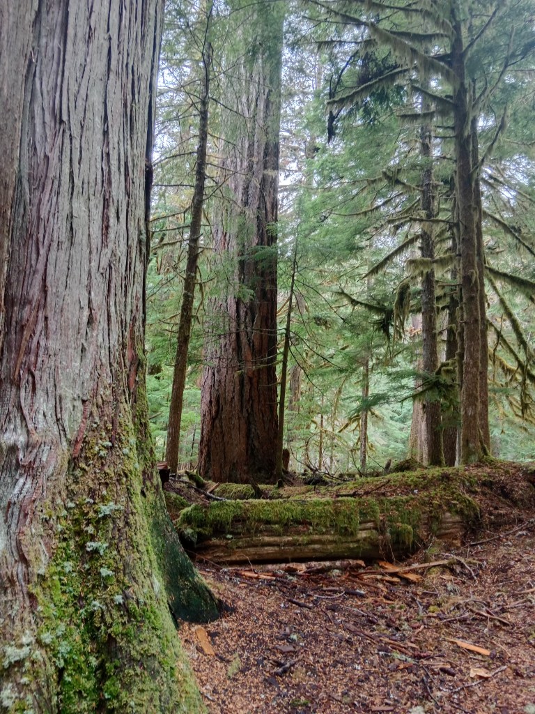
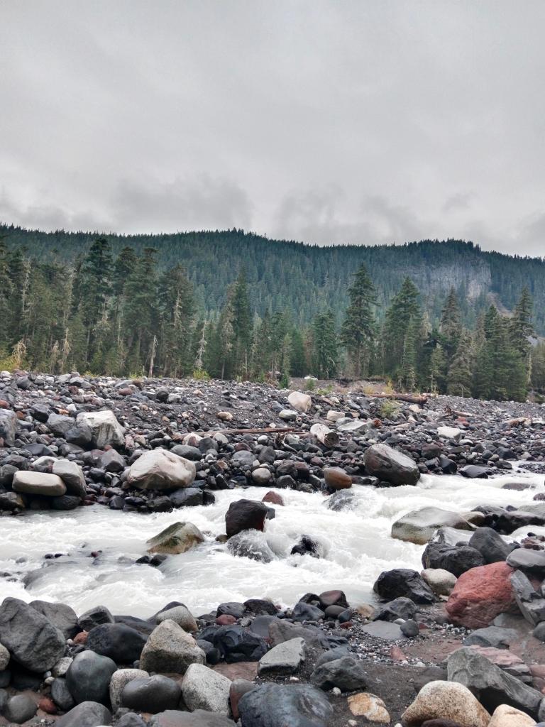
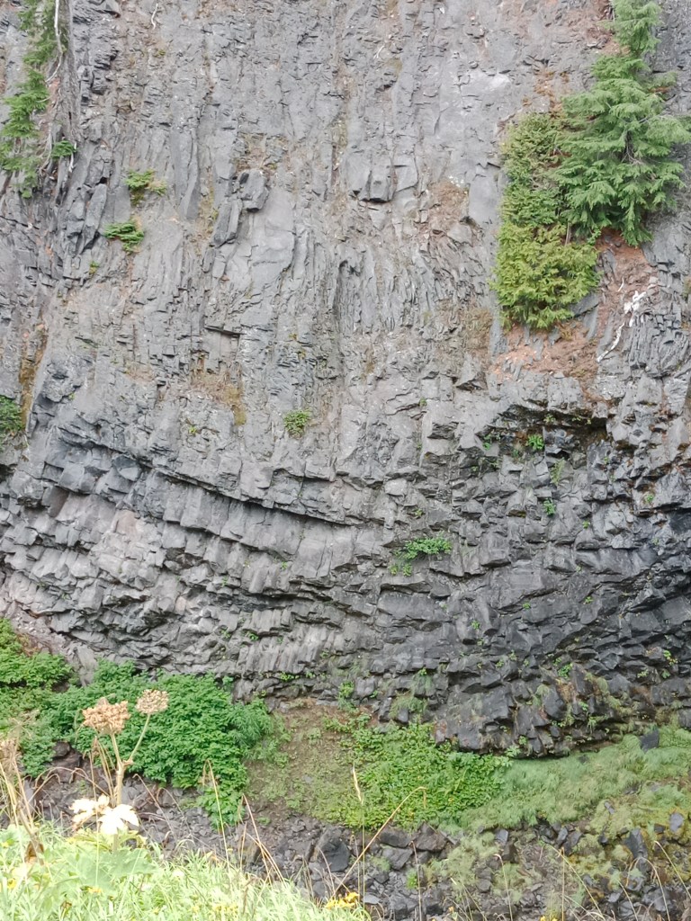
Though the mountain may convey a sense of permanence; it is anything but that! More than 25 glaciers descend the mountain flanks . These are constantly in a state of flux and rivers flow down its rocky slopes transporting water and debris down the mountain and often wreck havoc with roads and facilities in the wilderness area surrounding it.

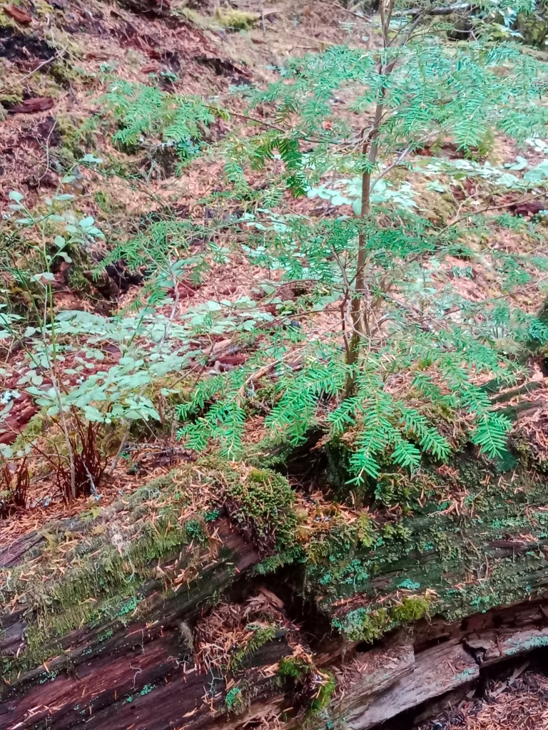
Subalpine meadows remain covered under several feet of snow in winter and yet spring up blooms when spring arrives. Mt Rainier region has been often described as one of the best places to view wild flowers. The long period of snow covered soil, leaves a very short period in summer for these dramatic blooms in and around Paradise. The rivers, lakes, falls and snow can be found elsewhere but not those wild blooms.

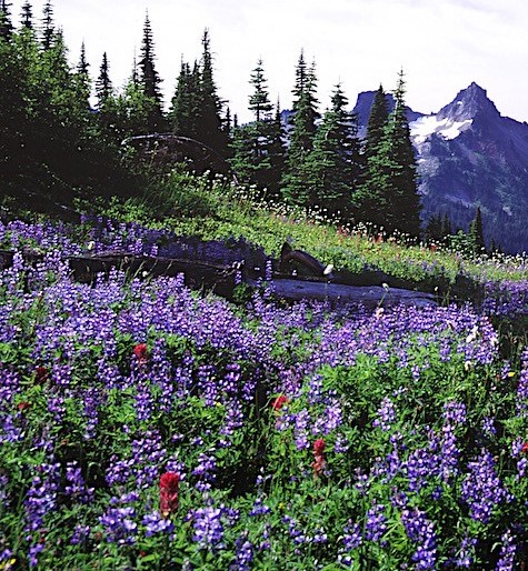
Wild flowers…a riot of color

One of the most dangerous volcanoes

Amidst all this beauty lies a constant threat to the residents of nearby areas. It is listed as a Decade Volcano and is constantly being monitored for safety. Seismic monitors have been set up at the park and on the mountain itself. Typically around 5 earthquakes are recorded near the summit on a monthly basis .Mt Rainier lies on the Pacific Ring of Fire which includes many volcanoes in California, Oregon, Washington and British Columbia.

In addition to that, the glaciers of Mt Rainier can generate mudflows ( lahars) that can cause damage to places lying on its path. These flows can occur anytime independent of a volcanic eruption.

Mt Rainier once stood at about 16000 ft before a major mudflow around 5000 years ago. This massive avalanche of rock and ice shed off 1,600 ft of Mt Rainier bringing its height down to 14,400 ft. This mudflow is said to have reached all the way to Tacoma and south Seattle. In fact Tacoma and some parts of Seattle are now located on the mud flow deposits from that massive lahar.

Summiting Mt Rainier.

An estimated 10,000 climbers attempt this summit every year on an average. It is one of the most difficult climbs as it requires traversing glaciers and weather can often play spoil sport. No wonder then that the success rate stands at 50%.

Well, they say difficult roads lead to beautiful destinations….

This is true of this entire area of Mt Rainier National park which I have covered over two episodes. Reaching there is difficult and the climate can be very fickle with sudden changes that require change of plans. To avoid disappointment , an alternative plan B should always be ready when you plan to visit this area .

With these thoughts, I end for the week. Do give your feedback and comments.

Road to Paradise and beyond

Here we go..

On to the series on Alaskan Adventures…

Today’s episode is geographically not an Alaskan adventure. This is in the state of Washington but I am putting it here simply to give you an idea of the sequence of travel and it was from here that our adventures started. So let’s go…

I am referring to a place called Paradise that lies in the Mt. Rainier National park area and the name truly befits the place. The pictures that come along as you read will convince you about this!! Much of today’s blog is on the sights that we encountered during our drive through the Mt Rainier National Park heading to Paradise to view Mt Rainier.

Paradise is also the place from where the best views of Mt. Rainier are seen and various trails are available to explore the wilderness of the park.

A road trip to Paradise and beyond; that’s what we were headed for, one late summer morning from Seattle. After the city sights and the semi urban vistas of the outskirts, we were on the road to Mt. Rainier National Park.

Mt. Rainier National Park

Established in 1899, this park encompasses Mt. Rainier, the majestic stratovolcano in the Cascade mountains and all of the wilderness that surrounds it. Including valleys, glaciers, moraines, lakes, waterfalls, meadows , old growth forests and of course remnants of old structures, buildings and rustic architecture covering an area of 91,000 acres; it truly is a world in itself.

The park’s vegetation is diverse reflecting the varied climatic and environmental conditions seen across the 12,800 ft elevation gradient that it spans. Home to animals seen and unseen, this wilderness is an evolving forest landscape.

The Vegetation….

As we approached the park area itself, evidence of glacial activity was visible in the form of the glacial flour mixed Nisqually river with its unique blue- grey color and moraines left over by receding glaciers.

Nisqually river and moraine

Entering park from the Nisqually entrance, we were at the entrance arch which is a great location for a picture and we did not miss that opportunity…

At the entrance to Mt. Rainier National Park.

After Mark, our guide finished the formalities at the entrance, we were well and truly in the park. Given the expanse of the park, the only way to explore it is by following designated trails and our first halt was at the Twin firs trail.

Twin Firs Trail.

This is a small half kilometer long loop trail that takes one through the old growth forests so typical of this park. What happened when we entered this trail?

We found ourselves sheltered by giant trees reaching over 200 ft. height into the sky. Douglas fir, red cedar and hemlock trees lined the trail ; most of them being over 800 years old . Walking along we came across large fallen trees that act as nurse logs for saplings growing on it. The forest floor was wet and consisted of forest debris.

Much of the activity seen here is symbiotic. The moss on the trees helping to retain moisture, the nurse logs nurturing the saplings, the moss and other shrubs acting as fodder for the crawling insects of the forest floor and the fallen trees decaying and becoming one with the forest soil.

Some pictures….

The huge Douglas fir tree that greeted us at the beginning of the trail.

The general appearance of the trail with huge fallen trees and mossy trunks.

The forest floor with nurse logs and a Huckleberry shrub

The conjoint firs towards the trail end

After a walk through this amazing wilderness where one can easily lose one’s way, we religiously followed Mark who led us back into our bus. The next halt was at Longmire.

Longmire and the Trail of Shadows

Longmire has it’s own tryst with the history of Mt Rainier National Park.

It was originally the site of James Longmire’s homestead lodging and mineral springs resort. The mineral springs were claimed to have curative powers but were later disproved. The buildings then became the park headquarters in 1899 when the park was established. The headquarters were later shifted , and today, we have the Longmire Museum and Wilderness Information Centre.

The Trail of Shadows is a 1 km, trail through the wilderness , passing some of the mineral springs.

Some pictures…

An advertisement of the Longmire’s springs from the 1800s and the old homestead

The trail board and the trail wilderness

The mineral springs (click on the video)

After a quick walk around the Longmire area, we were back in the bus and reached a beautiful waterfall called Carter falls.

Carter Falls

This trail head along a wide rocky riverbed provides access to the Nisqually river. A log bridge across the river is a popular photo location . The walk can pose a challenge as the rounded rocks are slippery at places. Some pictures..

The walk along the rocky trail and the Nisqually river

On the log bridge across the Nisqually river

The next halt on this drive was at Christine Falls.

Christine Falls

This is a beautiful waterfall with two levels. The upper level was seen as we drove past , but the lower level required a peep down from the bridge spanning the falls.

The lower level of this waterfall is an iconic image of Mt. Rainier National park.

The upper level of the falls

The lower falls and the bridge across

Enjoy this video

A short drive further down towards Paradise brought us to a bridge called Glacier bridge. This bridge now has moraine and a narrow stream of the Nisqually river flowing below it. The bridge was originally built across the Nisqually glacier and with the glacier receding, this is all that is left!!

Far away a wee bit of the last part of the present day Nisqually glacier can be seen.

The Glacier Bridge with the moraine and small stream . Arrow points to the Nisqually glacier seen far away.

Driving further down we reached Paradise. This special area of the Mt. Rainier National Park needs more focus and will be dealt with in the next episode. For now, let me just tell you that we spent some time at Paradise and then continued further to Paradise Valley which was a beautiful sight as the bus meandered the winding roads. The wild flowers added color to the area.

Some pictures from Paradise valley road…

The Paradise Valley road with it’s wild flower covered hillsides

All of a sudden, we had a wildlife visitor on our path….an inquisitive marmot kept looking at our bus ….

This marmot seems interested in us!!!

As we drove down this road we reached the Reflection lakes area which is special for the reflections of Mt. Rainier that it offers on ideal days. We were not so lucky as it was one of those drizzly cloudy days and so we saw the lake with no reflection….

What was expected…

What we saw….!!!

But we were not so unlucky after all……

We had another marmot wanting to be friends with us….

One more friendly marmot..!!!!

The next halt was at Narada falls; the last of the many beautiful falls that we had seen. Mark warned us that this falls required some trekking down a slippery path . With careful steps, we made our way down the track following Mark. Soon , we were at the beautiful falls, a wide one at that….

Narada Falls

The Paradise River drops down 188 ft. with the upper part being wide and falling in several strands from a cliff into a canyon. In winter, this falls freezes attracting ice climbers according to Mark.

The columnar basalt rock formations along the sides of the falls is a special feature here related to volcanic rocks.

Some pictures…

Narada Falls

The Columnar basalt rocks so typical of the area associated with volcanic activity.

By now we were all tired with the walking and hiking that we had engaged in throughout the day. So Mark took us to Whittaker’s Bunk at Ashford, a small town that acts as a base camp for Mt. Rainier activities.

He suggested that the Huckleberry ice cream here is unique and we tried it…

Some pictures from the Ashford base camp….

Rainier Basecamp at Ashford

The Huckleberry ice cream and activities at base camp

With this we wound up our trip on the road to Paradise and returned to the cozy comfort of our room for a good night’s rest.

See you next week at Paradise….the special place , with more on Mt. Rainier

Meanwhile keep your comments coming in like the marmots….