This week we move on to the Canadian province of Alberta….to the city of Calgary…..consistently finding itself in the list of the neatest cities in the world!
Calgary is the third most populous city in Canada after Toronto and Montreal .One of the important financial centers in Canada; it is the center of the oil industry in Canada. It is located at the confluence of the Bow and Elbow rivers. Being close to the Canadian Rockies; it is a starting point for many tours to the Rocky Mountains and is often called the gateway to the Rockies.
The advent of Europeans in the late 19th and early 20th centuries led to the discovery of oil reserves charting a trajectory of development around Calgary.
Our trip to Calgary
After a late night arrival at our friends house in Calgary due to a delayed flight, we started the day a little late.
Our friends took us on a picnic ….with a nicely packed picnic basket et all….we set off like excited teenagers to downtown Calgary.
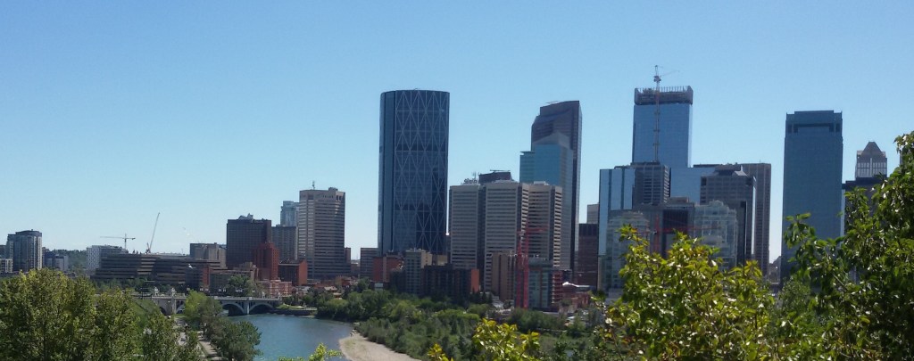
Enroute, we saw downtown Calgary across the Bow River
Downtown Calgary…view across the Bow River
The Bow River
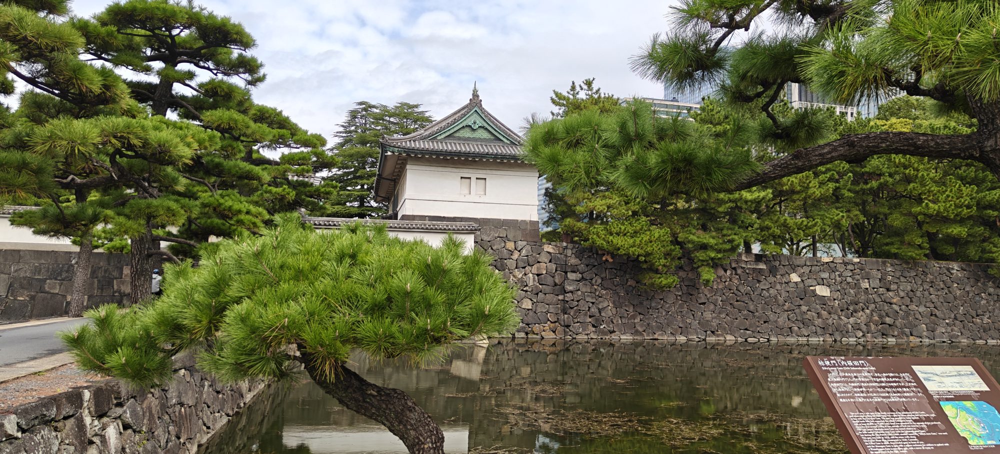
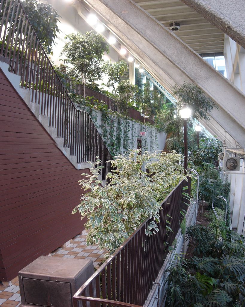
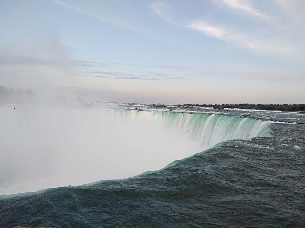
Next we headed to Peace Bridge…a unique looking bridge with a double helix structure across the Bow River. It has the nick name “finger trap bridge “for its similarity to the finger trap puzzle.
This bridge connects downtown Calgary with communities across the bow river. It was designed to accommodate the increasing numbers of commuters to and from work and has walking and cycling tracks. It is unique in that no beams or cables are included in the plan and is designed to support its own weight.
The openingshot in this blog is of the lit up Peace bridge.
The Peace Bridge
Peace Bridge….another view
We set up our picnic basket near the bridge and had a nice treat of Indian food.
Picnic by the Peace Bridge…some unforgettable memories….
Next we headed to Prince’s Island Park…a park built on an island in the Bow River. This park is an urban oasis and part of a pathway linking both sides of the river ….with a constructed wetland designed to treat storm water before it enters the Bow River!!!
This is a perfect example of River conservation…and how urban planners can effectively use the existing natural resources and make them sustainable over periods of time…at the same time; providing entertainment avenues to the locals and increasing the tourism potential. A lesson for us indeed!!!!!
Some pictures from Prince’s Island Park
Then we went to downtown Calgary and visited a mall where we had some goodies and coffee.
Devonian Garden is an indoor garden in downtown Calgary. This park is completely enclosed with glass and covers an area of 2.5 acres on the top floor of The Core Shopping Mall. It is an urban oasis and has play areas for children. It is also a popular venue for weddings. Some pictures…
Devonian gardens
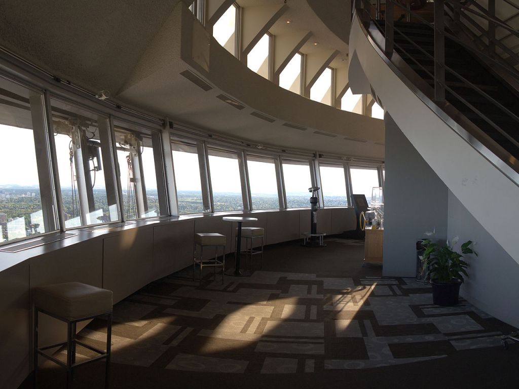
Calgary Tower
An iconic structure in Calgary, it was originally called Husky Tower.It is an observation tower in downtown Calgary built in 1967 to celebrate Canada’s centennial.
Calgary Tower and Observation deck
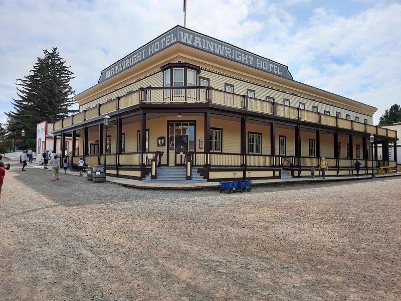
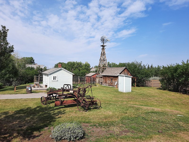
Another important tourist destination here is the Living History Museum or Heritage park historical village.Many of the buildings are historical and were transported to the park to be displayed. Most of the exhibits are genuine artifacts.The exhibits span Canadian history from the 19th and early 20th centuries
After an enjoyable day of sightseeing, we headed back home for some rest before we hit the best part of Alberta…The Canadian Rockies…
Quebec city sits on the St. Lawrence River and is in the predominantly French speakingQuebec province. Among its main distinguishing characteristics are its narrow cobblestone streets, stone buildings, fortifications, and rich French Canadian culture.
Brief history of Quebec and its french connection..
Canada is predominantly an English speaking country with Francophone communities throughout its provinces. French is the native language of 20 % of Canadians.Most native french speakers live in Quebec where it is the official language.
In the 16th century, Cartier ventured across the Atlantic Ocean in search of a route to Asia and landed at Newfoundland and mapped his route along the St Lawrence River. He tried to establish a French colony but was resisted by the aboriginals.
The name Canada originated from Kanata …the indigenous word for village. Cartier used this name for the French colony that developed along the St Lawrence River.
French Colony was established by the early 17th century in eastern Canada by Samuel Champlain and Quebec city was established in 1608. By 1642 a settlement called Ville Marie was established which subsequently became Montreal.
The 18th century saw French Canada fall to the British rule and consequently French lost its importance. Gradually Canada emerged as a federal state and it was divided into two provinces..Upper Canada(now Ontario) and Lower Canada(now Quebec). French was subsequently established as the official language in Quebec and many of the Eastern Maritime Provinces of Canada. Thus many of these places have French as the official language and that makes it a little difficult for non French speakers like us to visit and move around.
Come along to see the city….
Old Quebec city is a UNESCO heritage site and lies within fortified walls…the only city in North America to be so…
Being located in a hilly slope, the city is divided into upper town and lower town connected by funicular railway.
A typical Quebec street…the funicular railway seen in the backdrop..
We reached Quebec by noon and first visited the Quebec Tower ( Observatoire de la Capitale)from where you get a 360 degree view of the city. This is actually on the 31st floor of what looks like an office building!!!
From the tower, the old city can be clearly seen behind walls.
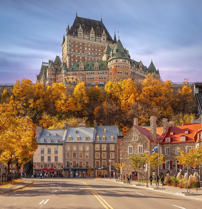
View from tower… St Lawrence River, Chateau Frontenac Hotel and walls of old city
After getting a view of the city from the tower, we went to the banks of the St. Lawrence River.
The Dufferin Terrace, a long wooden promenade located along the banks of the St. Lawrence River is one of the main attractions here. The Château Frontenac, a hotel that was initially built for the railways and is a luxury hotel today, is a landmark of Quebec. In the summer, musicians and street entertainers perform on this wooden promenade
The opening image of this blog features this hotel .
With its breathtaking view of the Château Frontenac, as well as of the St. Lawrence River and surrounding area, the Dufferin Terrace is the perfect spot to take beautiful pictures.
The Dufferin Terrace with The Chateau Fontenac Hotel in the background
A street singer and the canons along the river side on Dufferin terrace
From the Dufferin terrace area, we walked around the streets of Old Quebec. This place has an old world fairy tale charm about it. The narrow cobble stone streets with stone buildings gives it an ancient look. There are horse drawn carriages here which add to the old world look….and there are sightseeing tours on horse carriages
A family takes a joy ride on a horse drawn carriage..old world charm
A sightseeing bus….modern times
We walked along the cobble stone streets of old Quebec soaking in the old meets new feel….
There were lots of street musicians singing or playing various instruments…lost in their own little worlds….not affected by the passers by ….
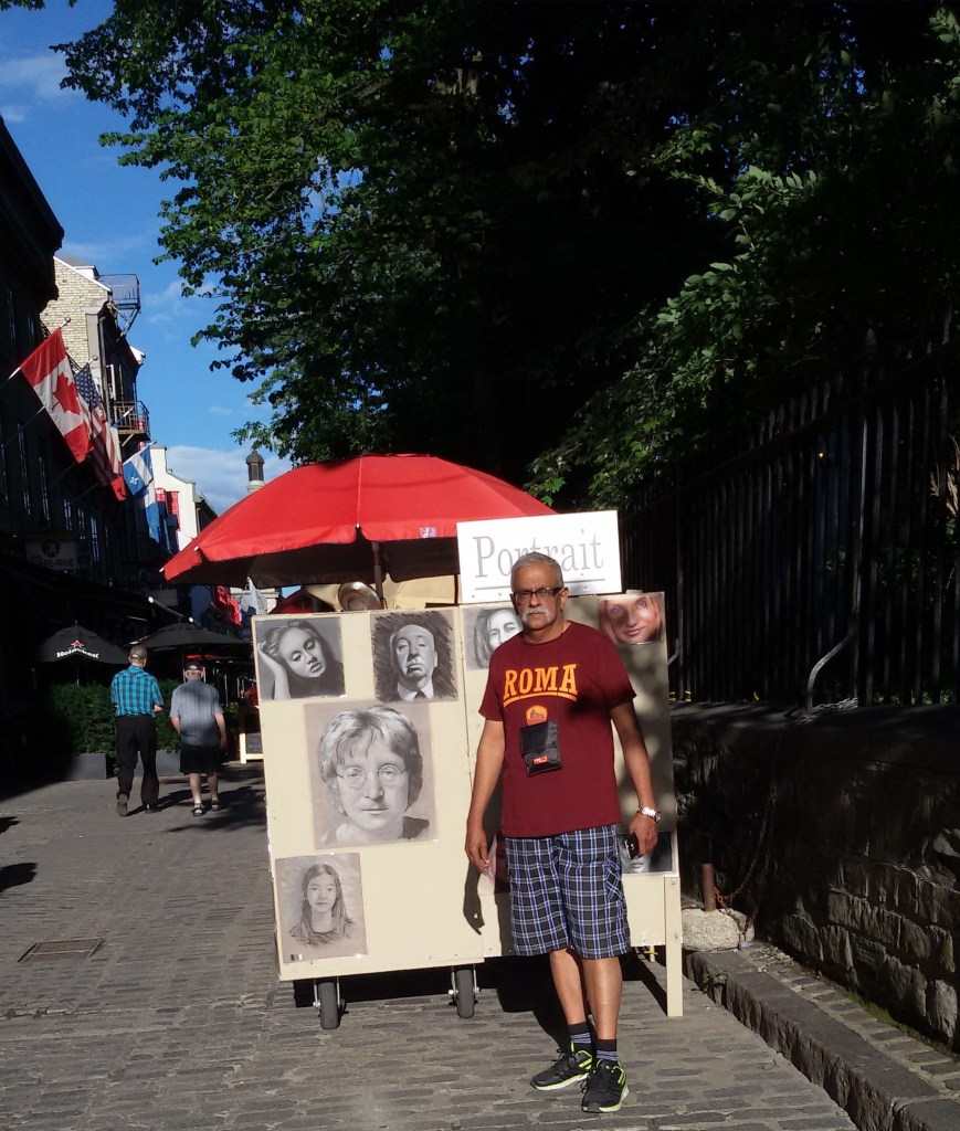
There were street artists….some doing general paintings and others making portraits of willing clients….
A street side artistic…portrait maker
All in all it was a heady mix of history, culture, fun, art and tourism!!!!
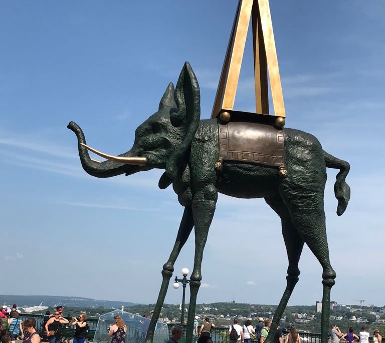
Talking of art…there were some nice sculptures by Salvador Dali at the Dufferin terrace… take a look
After a long day of sightseeing we retired to the hotel for the night.
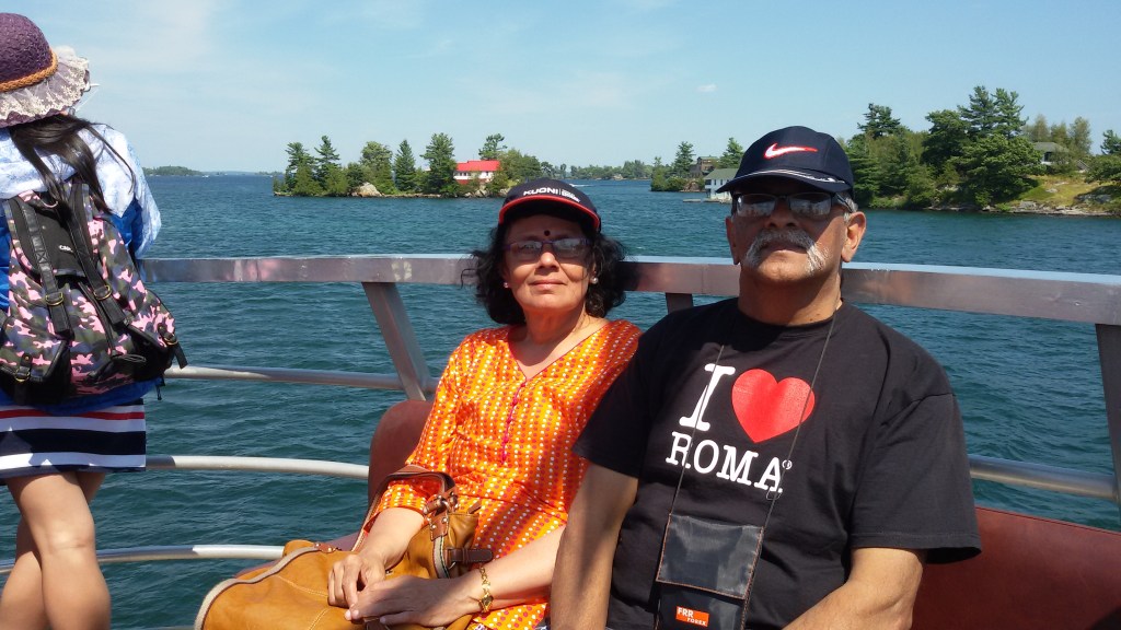
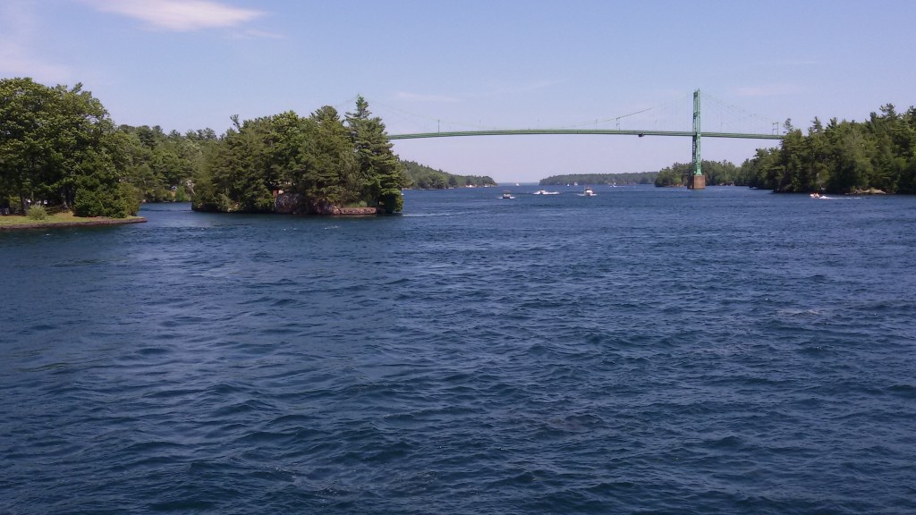
Next morning we had yet another interesting trip to do…the Thousand Islands Cruise…
This is a one hour cruise on the St Lawrence river to see this archipelago of islands.
The Thousand Islands are a group of more than 1,800 islands in the St. Lawrence River, straddling the border of the U.S. and Canada.The islands vary in size from over 100 sq kms to smaller ones occupied by a single residence or the uninhabited ones with just a few rocks. The criterion to be included in the island count is that it should have at least one square foot area and support at least two trees!!!
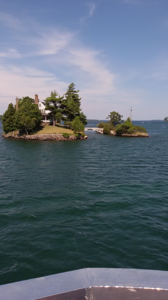
A fashionable retreat for the elite in the late 19th century, today the area is a hub for outdoor activities. It is home to elaborate island mansions such as the German-style Boldt Castle on Heart Island, and Singer Castle on Dark Island, with its Gothic windows and secret passageways.There are a variety of recreational activities available here for the tourists….fishing, diving, hiking, being some of them
Some of these islands are privately owned and have mansions belonging to the elite. There are some extremely small islands and many are connected by small overbridges. There are two islands connected by a bridge here, where one island belongs to US and another to Canada.
The Thousand islands International bridge connects Ontario province in Canada with New York state in US.
Some pictures from the thousand islands….
On board the cruise
The Thousand islands International bridge .
Two tiny islands with a single mansionconnected by a cute bridge
Boldt Castle
After the cruise we were picked up by our tour company and driven back to Toronto…after a 3 day roundup of some heritage, historic and cultural places in Canada…
Next week we move on to Calgary…in Alberta Province famous for its Rocky mountains…
We wanted to visit some of the important cities in Canada from Toronto. After some scouting around online, we narrowed down on a tour agency called Tours 4 fun. They were offering 3 day trips to these cities and so we booked with them. They cater predominantly to Chinese tourists . They did a good job overall.
We were picked up by the tour bus at Mississauga near the Chinese shops. Our first halt was at Kingston.
Kingston is a city in Ontario in Canada on the banks of lake Ontario at the mouth of the St Lawrence river. It is known as The Limestone City…due to its 19th century limestone architecture. It was a military post in the 16th century. It is called Kingston in honor of King George III. It was the first Capital of Canada . It prides itself in having a robust healthcare system and is home to a variety of educational institutions. At Kingston we saw the city hall,good lakeside homes like retirement communities, a marina and a locomotive exhibit.
The city hall is an imposing piece of neoclassical architecture with a prominent dome.It is the seat of local government in Kingston. It overlooks Lake Ontario which has a beautiful marina with lots of yachts anchored there.
The City Hall and Lake Ontario
An antique coach and a locomotive exhibit at Kingston
After spending about an hour in Kingston, we headed to Ottawa.
Ottawa city, the capital of Canada is located in Ontario on the banks of the Ottawa river.
We reached Ottawa by noon. After lunch at a restaurant , we proceeded to see the Canadian Parliament.
The Parliament is located on Pariament Hill on the banks of the Ottawa river in downtown Ottawa. In the foreground of the parliament building is the flame and water monument called Centennial Flame. The flame burns continuously and works with natural gas bubbling through water cascading underneath. The flame prevents the water from freezing in winter. It commemorates the hundredth anniversary of the Canadian Confederation.
The Canadian Parliament
The Centennial Flame
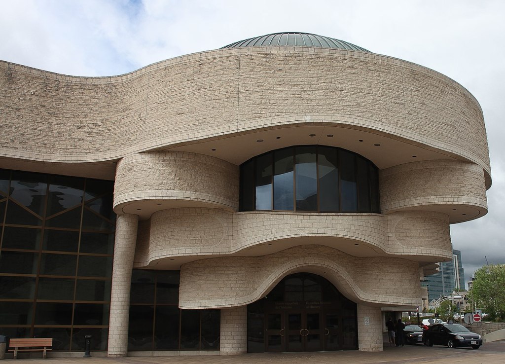
Next we visited the Museum of civilization also called Canadian Museum of History on the banks of the Ottawa River. It houses thousands of artifacts, archival documents, works of art and other ancient material relating to the indigenous people of Canada to the present time. Interactive shows related to Canadian History is another attraction at this huge complex.
Museum of Civilization
The Ottawa River seen from the museum
We next visited the Notre Dame Basilica…the largest and oldest church in Ottawa.
The Notre Dam Basilica
After the visit to the church, we proceeded to Montreal for an overnight stay.
Montreal is located in Quebec province and is predominantly French speaking.
We were put up at a hotel and next morning, we set off sightseeing Montreal.
Approaching Montreal….
We visited St Joseph’s Oratory. It is the biggest church in Canada built in ItalianRenaissance style and has a copper dome which is one of the biggest church domes in the world. It is a National Historic Site. It is located on the highest point in Montreal located on Mount Royal.The insides of the Basilica is decorated with intricately carved murals. On display at the Basilica is a wall covered with thousands of crutches from those who were purportedly healed by the divine healing powers of Brother Andre.
Some restoration work was in progress when we visited and that can be seen in the picture
St Joseph’s Oratory
Next we visited the Olympic Tower….now known as Montreal tower, this is part of the Olympic games complex built for the 1976 Olympics in Montreal.…..and is the tallest inclined structure in the world.
This tower is inclined more than the Leaning tower of Pisa and the cables that hold the retractable roof of the Olympic stadium is suspended from the tower.The opening shot of this blog shows this …..
There is an observatory in the tower that can be accessed by an inclined elevator from where one gets a view of the Olympic village.
Montreal Tower and view of Olympic village from Montreal Tower
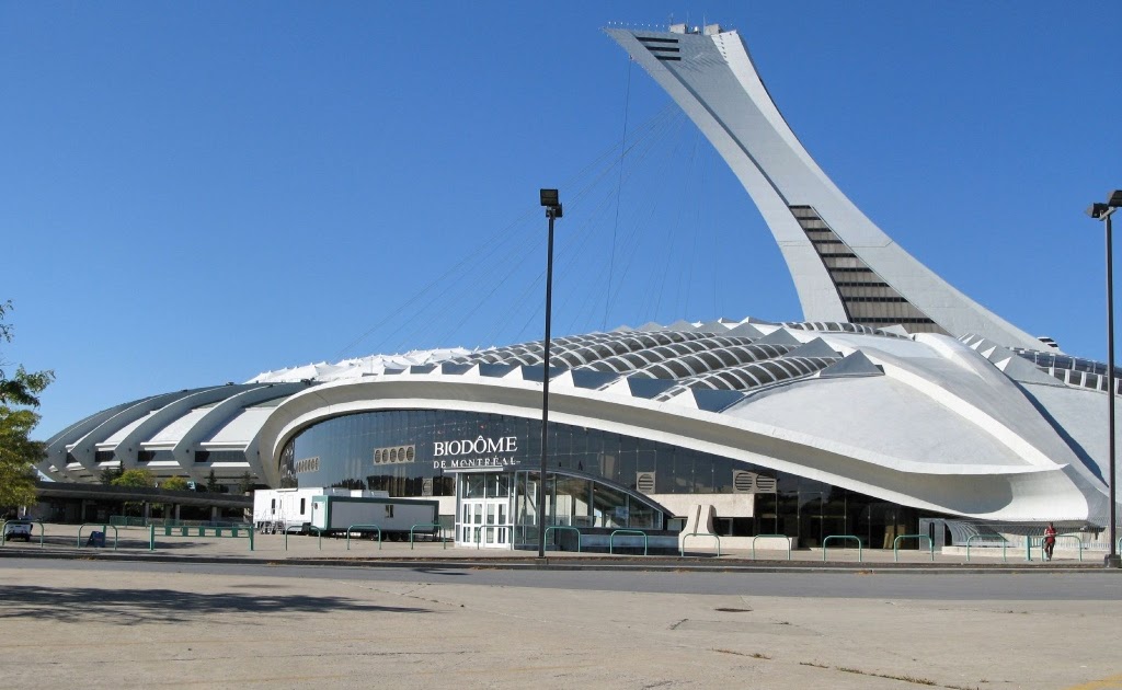
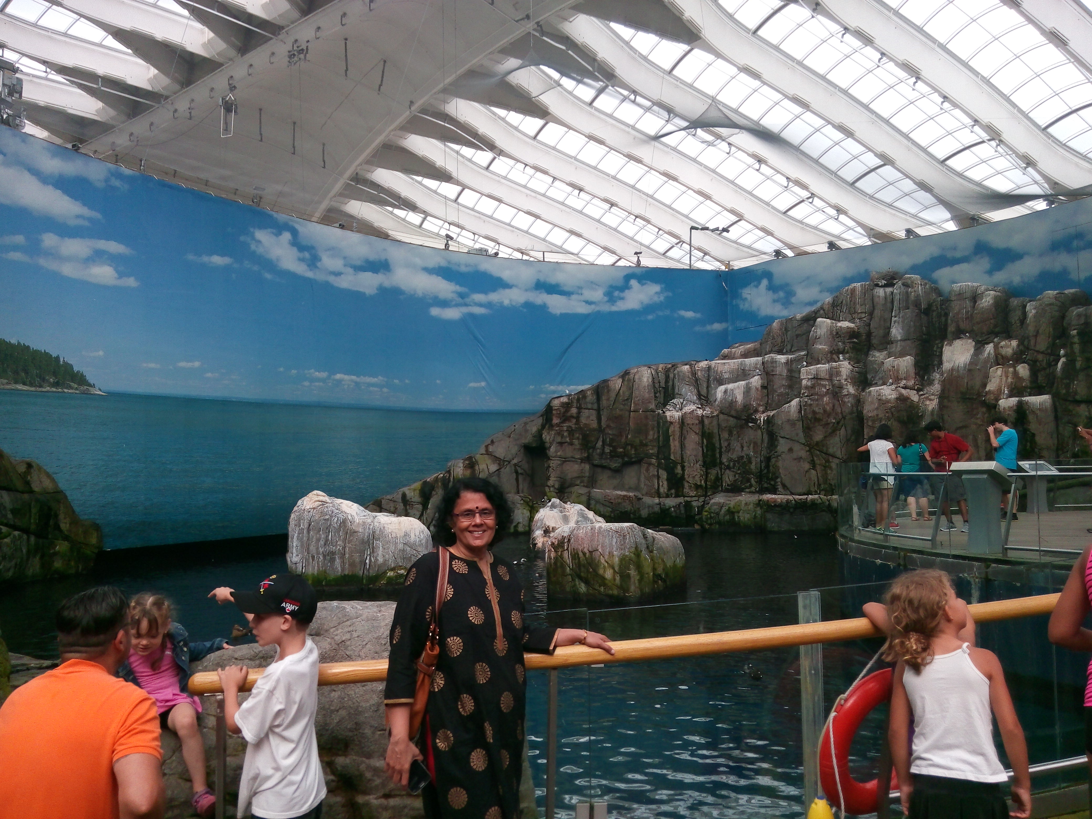
The Biodome which is located adjacent to the tower was our next destination.
This housed the velodrome for the 1976 Olympics and the track cycling and judo events were held here. After the Olympics, it was converted into the Biodomewhich showcases four miniature echo systems.These are filled with plants and animals found in these eco systems and visitors can walk through the different ecosystems and enjoy nature under a roof. Some of the featured ecosystems are…Tropical forest, Laurentian Maple forest, St Lawrence Marine,Labrador coast and sub antarctic islands.
So one can imagine….the range of plant and animal life residing there…from the parrots and monkeys of tropical forests to the fish of St Lawrence River to the penguins and puffins of subantarctic zone…Its a different world inside the Biodome…
The Biodome from outside and inside
Some inhabitants of the Biodome
After visiting the Biodome, we continued our journey across Canada to yet another iconic city...Quebec…
This week we do Toronto. Since we were at Toronto for a month, there were lots of things we did and this blog is a sum total of this. Unlike in my previous blogs, here I narrate various visits and my regular readers may notice that it is not a continuous flow.
First thing that struck me was… as you alight from your flight and enter through the gates into the terminal….you see a large board…You are Welcome in Canada…this is something which I found unique….this board would surely have reassured many a foreigner stepping on Canadian soil with trepidation and uncertainty.This would apply more to potential immigrants who would like to chart a future in Canada. Very Immigrant friendly country!!!
We landed there at night and woke up after a long sleep overcoming jet lag.As I opened the front door and looked out, I wondered if I had landed in Canada or Punjab? Every person I saw was an Indian and most of them Sikhs…that’s how much this city has embraced our people and vice versa. Indian seniors sitting on garden benches and chitchatting while soaking in some sunshine to beat the biting cold, is a common sight.Travelling by public transport, you often hear telephonic conversations in Hindi and Punjabi. So if any of you travel to Canada…particularly Toronto, have no worries of feeling alien….you will feel very much at home.
OK…now let me get into specifics….
First let me introduce you to our friends in Toronto who were so kind to host us and also take us along sight seeing.
Our friends at their beautiful house in Brampton, Toronto
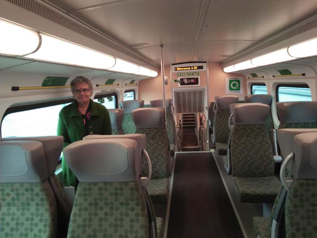
We did a lot of commuting in Toronto, partly by public transport and partly driven around by our friend. Here are some pictures of the local buses, trains etc…just to give a perspective…
The local city bus and bus stop
The double decker GO Train outer and inner view
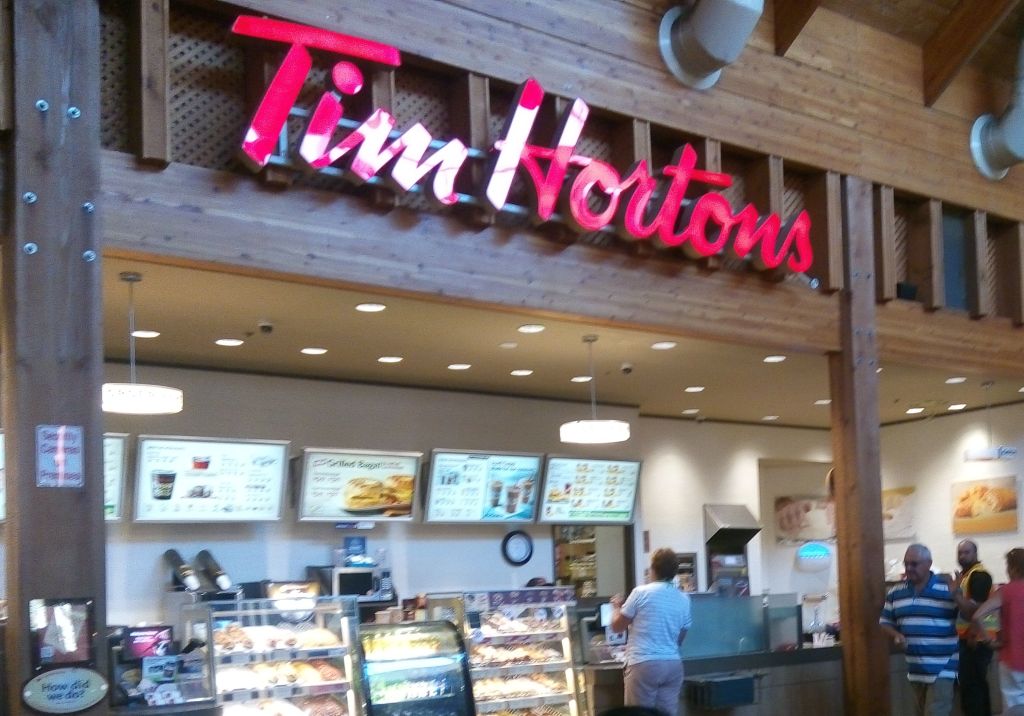
For us Tim Horton’s is synonymous with Canada….where ever we traveled, we enjoyed their coffee and snacks. This restaurant chain kept us pepped up with energy during our long trips many times…So I decided to include a picture of one of their outlets for all of you to see. We sort of got addicted to their awesome coffee and I particularly enjoyed the pumpkin spice flavor which is associated with fall…the season we were there….
A Tim Horton’s Outlet
Let me start with our visit to Downtown Toronto .
We were dropped at the Toronto airport by our friend. From the airport, we took the Union Pearson Express train to downtown Toronto.
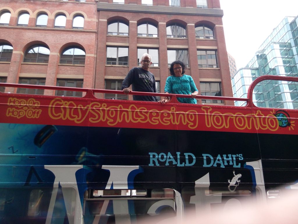
After getting down at Union Station, we explored the place on foot and decided to do a hop on hop off tour. Booked our tickets from the agent near the station and boarded the double decker bus with an open upper deck.
The Sightseeing bus
The bus wound its way through the streets of Toronto and we were in front of the
CN Tower… the iconic structure in Toronto.
We alighted there and wanted to go to the top of the tower to get a panoramic view, but unfortunately the queue was too long and we did not have time to wait for our turn . So we walked around, clicked some pictures.
The CN tower is a telecommunication tower and is the tallest free standing( not held by wires)towerin Canada. But it is the fifth tallest free standing structure in the world.
The C N stands for Canada’s National tower.
It has an observation deck with floor to wall glass windows and a glass floor. Apart from that there is an observation point in the sky pod from where you may be able to see even Niagara falls or New York State in US on a clear day. One can also take a walk on the famous Edge walk…(a 1.5 mt wide ledge around the outer edge of the pod) attached to a safety harness. Apart from this there is a revolving restaurant in the tower which offers 360 degree views of the city and the landscape around.
The C N Tower
The entrance to the tower
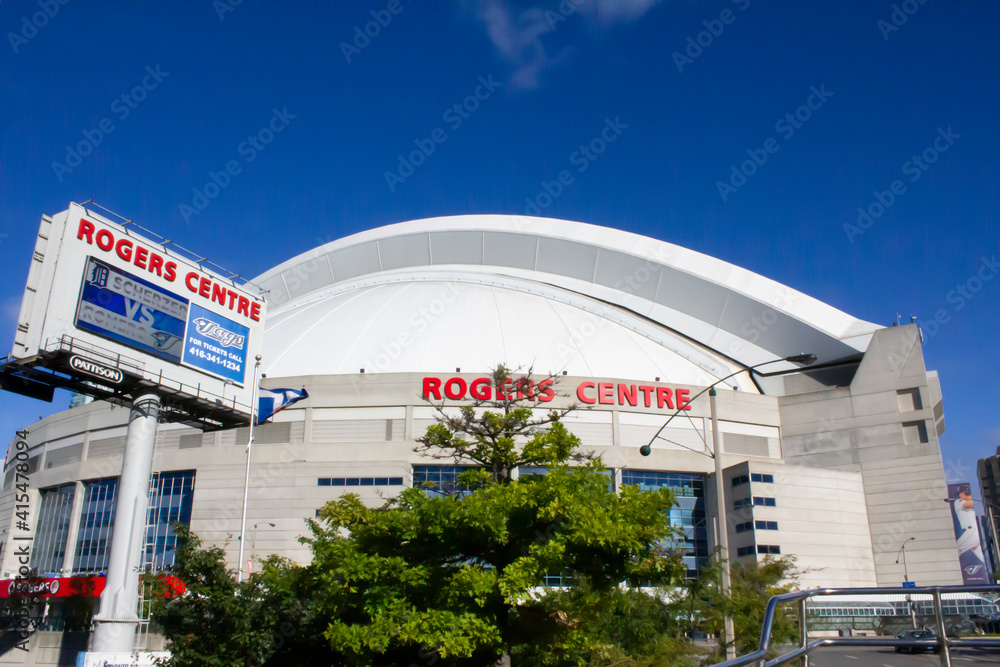
Next to CN tower is the Ripley’s Aquarium and the Roger’s center.
The Roger’s center is a domed sports arena. Its unique design allows for the roof to be retracted under favourable conditions. Roger’s center is the home of Toronto Blue Jays… the baseball team….and that day we did get to see fans trooping in to the center to watch a match….most of them in Blue garb. The cutest thing was a poodle also dressed in a bluejersey hopping along with its master to cheer the Blue Jays!!!
After we finished with these views we boarded the bus again and hopped off at Casa Loma. Casa Loma in Spanish means” Hill House” It is a building resembling a medieval castle set in a garden. Due to its unique architecture, it is a popular filming destination. It houses a museum. It is also a popular destination for wedding ceremonies for which it can be rented out.
Casa Loma
Next we visited Lawrence Market which houses a variety of vendors selling food, flowers etc. We took a break here for lunch.
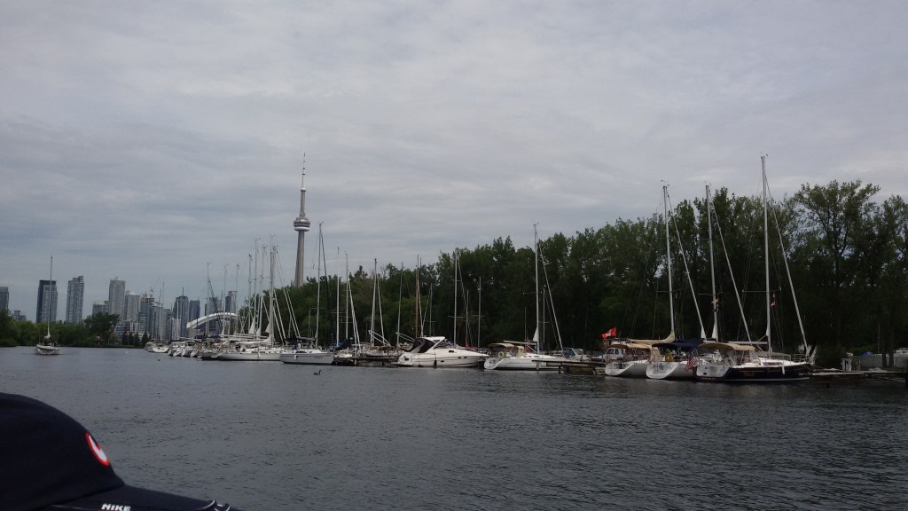
Post lunch, we took the cruise to the Toronto Islands.
These are a chain of 15 small islands in Lake Ontario south of mainland Toronto. These are just offshore from the city’s downtown area. It houses the Billy Bishop Toronto city airport, an amusement park, yacht clubs and a public marina. This is a car free community and access to the mainland is only via ferry. Bicycles can be carried on the ferry.
We took the ferry from the mainland and as we cruised along, got some great views of Toronto city.
View of Toronto city from the cruise
Yachts anchored at theToronto islands
After the cruise, we returned back to the station and took the train back home.
Riverwood conservancy was one of the places we visited
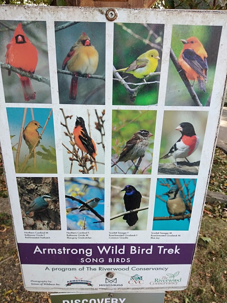
We took the local bus to Riverwood conservancy ; the 150 acre park..an urban oasis with accessible trails, creeks, wetlands and wildlife. The Credit River also flows by its borders. Children from the local schools often volunteer here for nature studies.Bird watching trails are also earmarked here.
It amazed me to see how such a serene and quiet place exists right in the middle of a buzzing metropolis! Also how the river water is so crystal clear and pristine….says a lot about the local people who refrain from maligning it!
The Credit River
Some views at Riverwood conservancy
Square one Mall is a high end shopping mall situated in downtown Mississauga. It is the second largest shopping center in Ontario. Needless to say, it houses many branded and high end shops and restaurants,Both the interior and exterior are beautifully designed.
At Square one Mall
Lakeshore Toronto
One morning ,we were dropped off at Lake shore by our friend and we spent a morning there. There are well landscaped gardens along the shores of Lake Ontario. Walking and cycling tracks draw the locals to this place. Being September, it was the start of fall and we did get a taste of fall colors on the maple trees.
Some pictures from our visit to Lakeshore
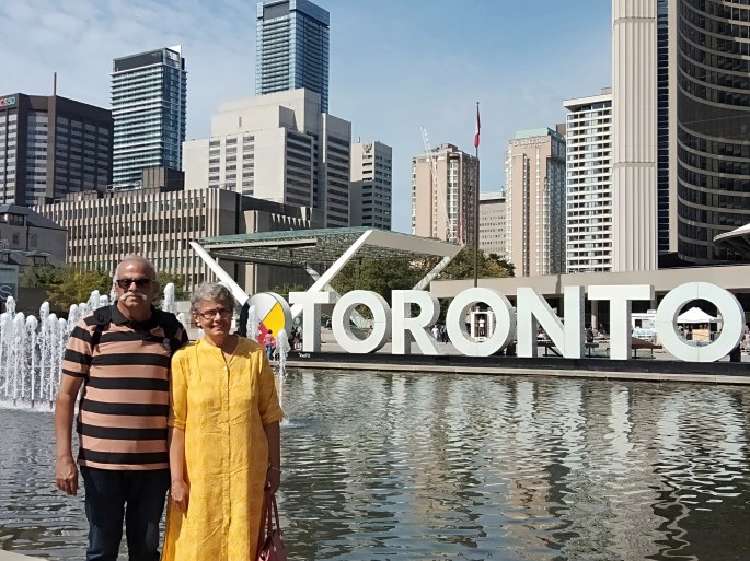
After a relaxing morning at Lake shore, we took a bus to downtown and visited Nathan Philips square; a plaza in front of the city hall . Here we saw the Toronto signage..one of the most photographed places in Toronto. It provides the backdrop to a reflecting pool which is used as a skating rink in winter. This square is the site of concerts, art displays, the farmer’s market, the winter festival of lights, and other public events. There are kiosks selling variety of food items and appeared to me like a picnic spot for the locals.
Nathan Philips Square
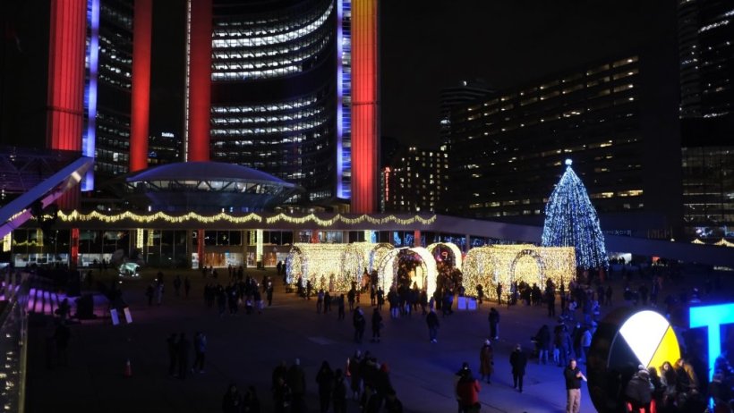
During Christmas time, this square is decorated and lit up. This is called the Cavalcade of lights.This officially marks the beginning of Christmas celebrations. A huge Christmas tree is also lit up. A stage is set up and many high profile music programs are held here. These celebrations last for almost 2 months.
Cavalcade of Lights
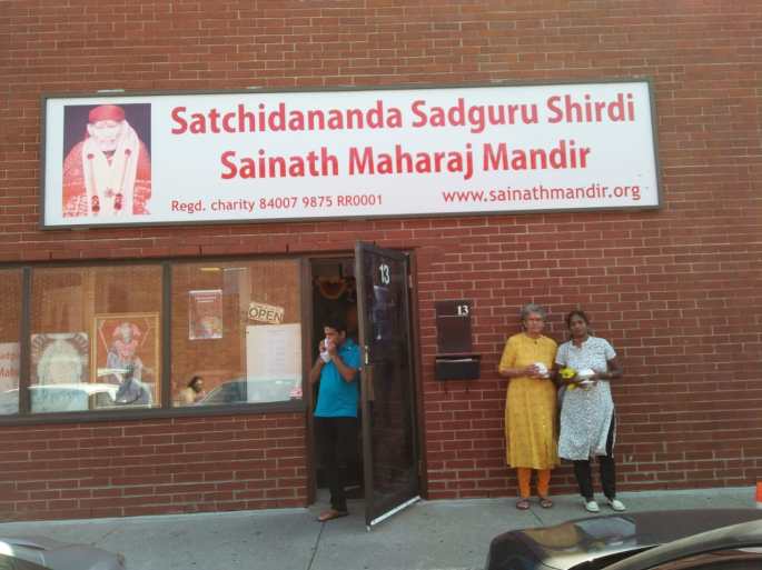
We also had the opportunity of visiting the Sai Baba temple in Mississauga. This temple looks unique from outside. In fact it is housed in a commercial complex and externally looks like an office. Once inside, it resembles any typical Indian Temple.
The entrance to the temple
There was another unique tourist destination we visited The Cheltenham Badlands.
Badlands is a geologic term for an area of soft rock devoid of vegetation and soil cover that has become molded into a rolling landscape of rounded hills and gullies
An area of approximately 0.5 km, it features essentially clay that is easily eroded by water. The Queenstone shale has brick red to maroon color. Formed as a result of tectonic activity hundreds of years ago, this region was used extensively for cattle grazing. The unscientific agricultural and grazing practices over the years added to the erosion by nature and led to this formation.There are trails here where you can explore the badlands. But entry on to this fragile shale is prohibited.
The Cheltenham Badlands
Since we stayed at Toronto for a considerable period of time, and moved around and interacted with some locals , we really got to experience day to day life here…would like to share some pictures…a sneak peek into the life of immigrant Indians in Canada…take a look
There was a reasonably big park with lot of recreational activities that we used to visit ….close to where we stayed….. Sandalwood park. Some pictures…
At Sandalwood park
We had a small picnic with some Indians one evening at the park. Also attended a birthday party hosted by an Indian family…take a look
A picnic and a birthday party
Well, I hope I have conveyed the essence of Toronto to all of you…..
From Toronto, we also visited Ottawa,the capital of Canada, and Montreal and Quebec which are some important cities in Canada. My next blogs will cover my experiences in these cities…
Most of you would agree that Niagara falls would be a nice place to start this series…it literally sits on the US-Canada border!!!
Having seen it….or rather experienced it twice; I can tell you, its simply amazing!!!
We visited Niagara falls from Toronto . (pictures in this blog are a mix from both the visits and some keen eye among my readers may notice it) .Since the view of the falls from the Canadian side is way better than from the US side, we decided to do it from Canada.
A brief on the falls before we get to the actual travel and attractions:
The Niagara falls is a name used for a group of three waterfalls at the border between US and Canada.The largest…the horseshoe falls is located in Ontario province in Canada while the American falls and Bridal Veil falls are on the American side of the border. These falls are formed on the Niagara river as it empties Lake Erie into Lake Ontario. Niagara falls was formed at the end of the ice age when the Great lakes carved its path through the Niagara escarpment on its way to the Atlantic ocean.
Some Statistics and Comparisons
There are about 500 waterfalls in the world taller than Niagara.
Angel falls in Venezuela with a height of 979 metres is the tallest waterfall in the world.
Victoria Falls on the Zambezi river in Africa is 108 metres high but is very broad….a width of 1708 m!!!!
The Iguazu falls in South America bordering Argentina and Brazil is a conglomerate of 275 waterfalls….becoming the world’s largest waterfall system
In spite of all this, Niagara is so popular. Have you wondered why?
Niagara has a height of only 51 metres. But the volume of water that flows is very high. 2832 tonnes of water flows over the falls per second. It is this peculiarity that makes it so popular
The water at Niagara is green in color due to the enormous amount of minerals being swept over due to its erosive nature.
Where does the water come from?…this will be the next question in everyone’s mind..
From the Great Lakes. The Great Lakes is the largest collection of freshwater in the world…18% of the fresh water.The water flows from streams and rivers that empty into the Great Lakes, from Lake Superior down through Niagara to Lake Ontario and then into the St. Lawrence River and finally Atlantic Ocean
Future Of Niagara?
The falls continuously erode. At a rate of 1 to 1.5 metres per year. Rock falls occur regularly at the edge of the falls. Flow control and diversion for hydroelectric power has managed to reduce the natural rate of recession. Climate change is also affecting Niagara. All things considered, scientists speculate that perhaps 2000 years from now, the American falls would dry up. The falls could be reduced to a series of rapids…
Well…that is far far away in time….for now, enjoy the falls as I take you along…
Coming to our trip....
We were in Brampton,Toronto and were hosted by a close friend who drove us up to Niagara falls city which is about 130 km. The drive was beautiful and we passed lake Ontario on the way. Had a short coffee break at a Tim Horton’s outlet at Grimsby.
Tim Horton’s is a chain of restaurants you find all over Canada.I must tell you, the coffee at Tim Horton’s is just too good.Highly recommended for future visitors!!
Reached Niagara by noon and checked into Embassy Suites located bang opposite the falls …..it offers lovely view of the falls.
Our hosts at Toronto….with the falls in the background
Rested for sometime and visited the falls in the evening.
As we walked up to the falls, there are a few nice view points along the roadside from where you get a panoramic view of the falls like the one in the picture below.
The Horseshoe falls at Niagara
As you reach closer to the falls…the sound of the water builds up the excitement and when you actually stand by the railings on the footpath and look at it; it’s a life time experience!
The sheer size of the falls and the volume of water that gushes by every moment is awe inspiring!!No amount of description will match the visual treat…so just putting some pictures for you to enjoy….
Some pictures depicting the sheer size and volume of water flowing by…..
A short video of the Horse shoe falls
Wanting to get an ariel view of the falls, we headed to Skylon Tower.
Skylon Tower is an observation tower in the Niagara falls city in Ontario (Canada) that overlooks both the American falls and the horseshoe Canadian falls and the Niagara River.
An aerial view of the horseshoe falls with the cruise boat sailing towards the falls
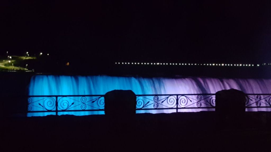
After that we returned to the falls in time for the illumination of the falls. How is this done?
Hundreds of LED lights are housed in three locations across the Niagara gorge. Together these lights create a breathtakingly beautiful view. This takes place daily at dusk.On special occasions they are lit up in specific colors too!
The illuminated falls is a great sight to behold…
Some pictures…
Illuminated falls
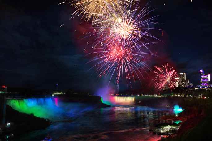
Niagara Fireworks
A fireworks display over the brink of the falls is held in summer and also during the winter festival and other special occasions
Fireworks over the falls
After a spectacular view of the illuminated falls, we returned to our hotel
Day 2
After breakfast, we again headed for the falls..this time to get closer…to get to the bottom of the falls. We then took the Hornblower cruise to the bottom of the falls. Each of us was provided with a red rain coat and we cruised towards the falls. As we came close to the falls, there was lot of spray and the raincoat protected us. However, taking pictures was almost impossible due to the movement of the boat and the spray..But the experience was exhilarating…to say the least..
If you do the same activity from the US side, you use the Maid of the Mist cruise and you are in blue coats!!
After that we walked up to see more of the American side of the falls…much smaller than the Canadian one..
The American Falls. The cruise boat heading to the bottom of the fallsis also seen
The buildings you see in this picture are in USA…the falls are located just at the border.
We also saw the Rainbow bridge the bridge across the Niagara river connecting the land borders of Ontario in Canada with New York in USA.
If you zoom and see…you will see the Canadian flag closer to you and the American farther away…There is a full fledged immigration station functioning here for people crossing over..
After that, we walked around Niagara falls city…
Though the falls is the highlight of this place,Niagara falls city has lots more on offer…. it is a full blown entertainment city too.There are plenty of Casinos, theme parks, game centres and various entertainment avenues here…including the Niagara wheel…a giant wheel which also offers great views as one ascends ….
A casino in Niagara falls city
During our walk at Niagara falls city
Besides this there are helicopter rides that take you over the falls. As we sat around the beautifully landscaped park across the falls, we saw this activity taking place too.
We spent our second evening at Niagara again enjoying the illuminated falls and returned to the hotel.
Next morning we took a bus from Niagara falls bus station to Brampton Terminal and then home…ending a wonderful visit to this wonder of nature…
Next week we meet at Toronto….
Till then…good bye
Don’t forget to subscribe to my blog below
For those of you who would like to see some awesome views of Victoria Falls…in comparison to Niagara, do visit
A day that we were excitedly looking forward to….the trip to Key West. Key West is the most popular of the archipelago of islands called Florida Keys
.
A brief summary about the Florida Keys:
“Key” is derived from the Spanish word cayo, meaning small island
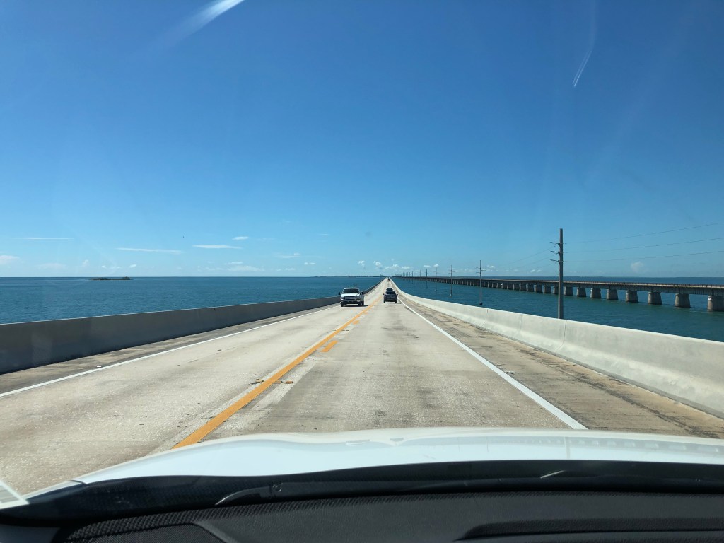
The Florida Keys are a string of tropical islands off the southern tip of Florida between the Atlantic ocean and the Gulf of Mexico. These islands are linked by the Florida Keys Overseas Highway which is rightly called The Highway that goes to Sea. The drive from Miami to Key West takes 4 hours and crosses over 42 bridges ; the longest bridge being 11 km long. The water surrounding this highway has shallow flat lands, mangroves and coral reefs. The drive to the Keys is indeed mesmerizing with a straight road ahead of you with water on either side for the major part.
The Highway that goes to Sea
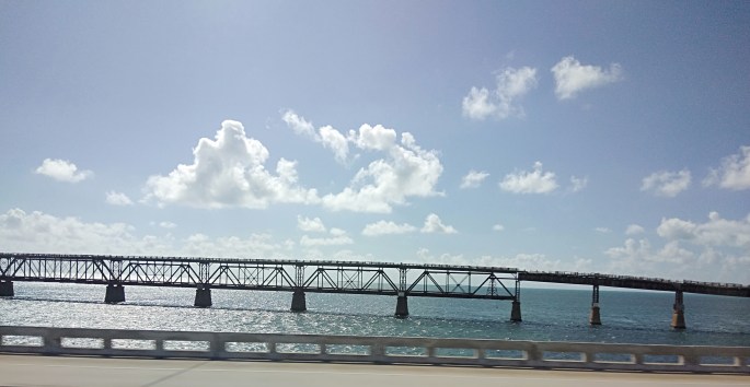
Initially, the Keys were accessible only by water. A railway link was subsequently developed but was disrupted due to repeated hurricanes. Following this, the rail road bridges were converted into automobile roadways.
The Old railroad bridge that was destroyed by the hurricane
The keys are divided into 5 main regions..Key Largo, Islamorada, Marathon, Big Pine and Lower keys and Key West.
Key Largo is the largest and it is home to living coral formations.The Coral Reef State Park located here is the first Underwater state park. Glass bottomed boats, snorkeling, scuba diving and other coral reef viewing activities are available here.
The keys are home to a variety of plant and animal life particularly a variety of deer and is a refuge for the great white heron. The Everglades National park encompasses many of the keys and is home to turtles, alligators and manatee.
Key West
Key West, the southern most Key is the most popular and is just 90 miles from the Cuban coast.
Our Trip
The Key West Express Bus picked us up from our hotel in Biscayne Boulevard (Miami) and soon we were on the way to the Keys. The drive to the keys is really beautiful with water on either side of the road and crossing multiple bridges. The landscape includes a mixture of shallow flat lands, mangroves and well developed tourist resorts on both sides. As we approach the main Keys, there are lots of restaurants, hotels and resorts along the road.
View from the highway of some of the resorts as we drove by
After 4 hours of this beautiful drive on the highway to sea, we were dropped off at Key West
Typical street scene in Key West with Spanish colonial villas
Once we were dropped off at Key West with time to explore on our own,we decided to take the conch train.
We took the train tour and our first destination was Duval Street which is the epicentre of Keywest. This thoroughfare is lined with bars, pubs, restaurants, shops, galleries and other attractions.The famous Key West butterfly and nature conservancy is also located here.
Walked around the street and savored the ambiance and had some good food .
The Train Tour
Some good food at Duval Street
After re boarding the train we hopped off at The Southernmost Point….
There is a red Buoy to mark the southern tip of Florida which is only 90 miles from Cuba
The Buoy at the southern tip of florida
Boarded the train again and hopped off at Mallory Square.
Mallory Square is a plaza located adjacent to the cruise ship port. This Square is particularly famous for its sunset views. Tourists gather here in large numbers to watch the sun go down. There are various activities here around sunset time….street performers, food carts, art exhibitors etc. Since we were leaving before sunset time, we missed the celebrations in Mallory square. Spending one night at Key West will definitely be worth it, if your schedule permits.
A short video of Mallory square with people enjoying the water sport activities
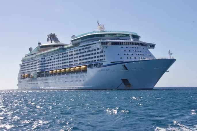
At Mallory Square with the cruise ship in the background
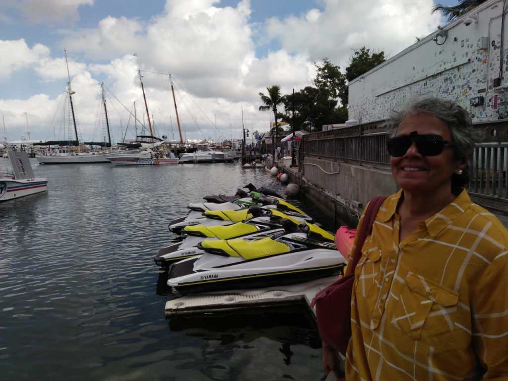
From Mallory square, we walked along the water front and reached a marina where lots of yachts were anchored. Also some high speed motor boats were seen anchored there.
Key west Marina with the high speed boats and a passenger catamaran
Tourists enjoying the evening at the marina at Key West
While discussing Key West, it will be inappropriate to not mention one of its main attractions… snorkeling. Home to the only living coral reef in America, it is a prime snorkeling site. Since we had experienced snorkeling at great barrier reef in Australia and we had dearth of time, we did not snorkel. For snorkeling, you are taken in a catamaran to the designated sites and guided to snorkel.
Another attraction at Key West is Hemingway House which is a museum dedicated to the famous english author Earnest Hemingway. We also saw this during our tour around key west.
The sun was slowly going down on yet another beautiful day and we headed to our bus for the return trip.
Meanwhile, tourists who were staying overnight at Key West were gathering around Mallory square for the sunset and other activities.
Spending one night in Key West is definitely worthwhile if your itinerary permits!
Boarding the bus, we had another beautiful drive on the Highway that goes to Sea…this time in the other direction. Enjoying the scenery, we bid farewell to Florida and USA.
Well as I said earlier; with this blog, I finish my blogs on USA. From next week, its going to be Canada….
I hope you all enjoyed your US trip with me…
Get set to cross the border to Canada.
See you all next week at a great destination…NIAGARA Falls!!
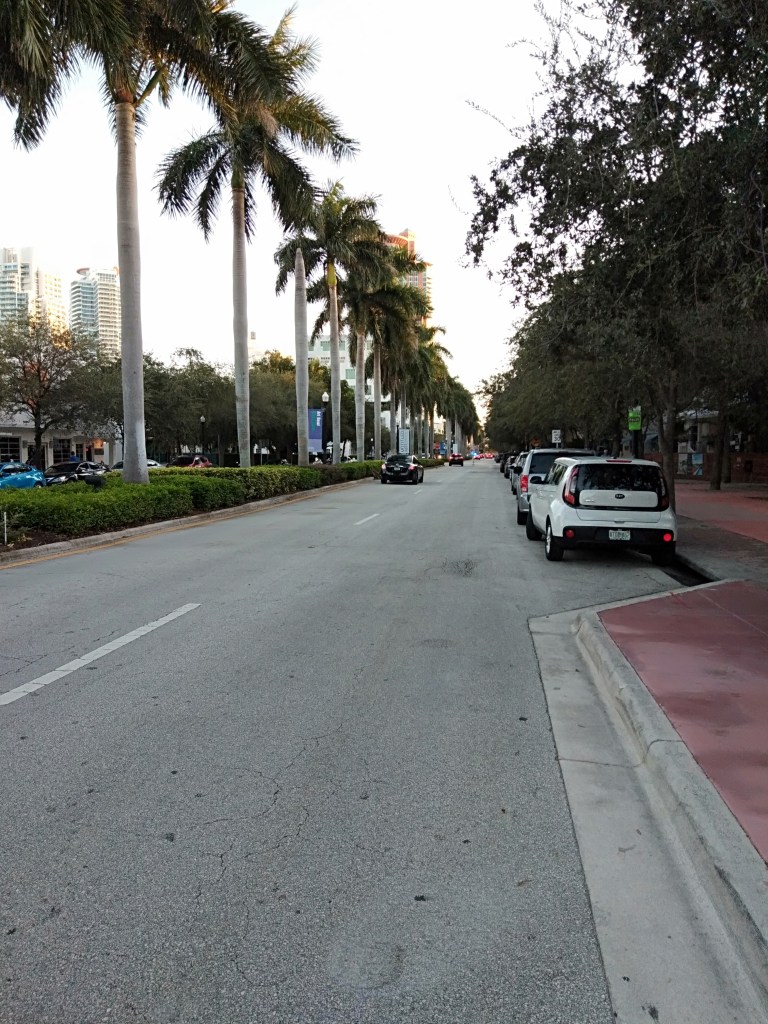
One of the most popular cities in the Sunshine State of Florida, Miami is famous for its white sand beaches and it’s typical Latin -American mixed culture and vibrant night life. It is also one of the starting ports of the Caribbean cruises. Cruise liners are a common sight in Miami. An important tourist destination by itself, it also attracts visitors to the Caribbean for their cruises. This doubles the tourist potential of this fun city.
Miami offers an array of local transport options ranging from metrotrains, metromover, tri rail, buses, taxis and luxury cabs. Its your pocket that decides what you want to use.
We flew in from SFO to Miami and reached by noon.
Took an airport shuttle bus to our hotel…Holiday Inn at Biscayne Boulevard. Walked around the Biscayne Boulevard area in the evening savoring the warm Miami air. Walking along Biscayne Boulevard, I noticed an illuminated Spanish style clock tower. That was Freedom Tower
The Freedom Tower
The Freedom Tower is a national historic landmark on Biscayne Boulevard.. It was originally a safe haven for Cuban refugees who arrived here seeking asylum. During the Cold War there was an influx of Cuban refugees in Florida due to its proximity to Cuba. This tower with Spanish architecture is now with Miami Dade College and serves as their main cultural center. This Cuban influx has left its mark on Miami . A lot of locals are of Cuban lineage and Little Havana, a neighborhood in the city has predominant Cuban shops and restaurants.
The Biscayne Boulevard overlooks the Biscayne Bay. As the sun goes down, Biscayne Boulevard lights up in all its glory. The waterfront market called Bayside Market is dotted with restaurants serving international cuisine. Sea food courts are the highlight of course! There are shops that cater to all pockets …from exclusive branded goods to small wayside vendors. There are dinner cruises that start from here in the night . The reflection of the lit up cruise vessels is really beautiful.
Bayside Marketplace
The illuminated shops and restaurants with reflections on Biscayne bay
One of the many cruises that depart from the Biscayne Bay
Next morning, we set out to explore more of Biscayne Boulevard and surrounding areas on our own. Walked along the seafront and was pleasantly surprised to see some dolphins playing around in the Bay. There are lot of shopping options in and around Biscayne Boulevard and so we did some shopping . We also saw the FTX Arena ( formerly American Airlines Arena) which is a sports and entertainment arena located here.There are many residential and commercial high rises overlooking the Biscayne bay. And I do not have to tell you that those must be some of the most valued real estate in the world!
Biscayne Boulevard at daytime
Wanted to visit Fort Lauderdale and North Palm Beach. So we took the Tri rail from Airport station.
As the train left Airport station, we were surprised to see the sides of the tracks. Lot of metal junk dumped all over .Old dilapidated buildings with graffiti painted on them. Dirt and filth around. It was a far cry from what we had expected. More like any third world country!
Some parts of Miami have high crime rates and moving around on lonely streets after dark is not advisable. This kind of fear is palpable in this city as one goes around.
The Trirail which took us to North Palm Beach
The train to North Palm beach passes through various stations and at places, the tracks are close to the seafront. We wanted to explore Fort Lauderdale which is known to offer great holiday experiences, but it started raining and without raingear, it was impossible to alight here. So we continued our journey. We saw Fort Lauderdale airport from the train itself. This is the other airport close to Miami.
Fort Lauderdale is known to have nice beaches and boating canals and is the Yachting Capital of the world. It is refered to as the Venice of America and we wanted to visit it .The rain really spoiled our trip that day. We missed the canals and the beachfront. Fort Lauderdale is also renown for the International Boat Show that it hosts. This Boat show is a showcase of luxury yachts, water sport equipments and related activities.It also offers water transportation education.
We continued our journey by train and reached Palm Beach
After alighting at Palm beach, we took a cab and drove to the beach. We also saw the famous Mar a Lago…the residence of President Trump. Photography restrictions prevented me from taking a shot of the imposing mansion!!
The Palm Beach…across this is Mar a Lago…
Next day we took the Metro mover and explored downtown Miami. Visited little Havana….the famous Cuban neighbourhood in Miami. This area is like a slice of Cuba….with Cuban Coffee shops, Cuban Cigar shops etc.
Late afternoon, we visited the world famous Miami Beach.
Miami Beach is actually an island city separated from mainland Miami by the Biscayne Bay. Bridges connect it to the mainland. It comprises of the South Beach area and the Art Deco District. The main Beach is in the South beach. The Art deco district houses some ancient art deco architecture.
The roads are palm fringed and have a lot of skyscrapers overlooking the ocean
A typical Miami street scene with palm fringed beaches and skyscrapers
We went to the water front at South beach and then relaxed on the sands . Plenty of families relaxing under colourful umbrellas, lot of sunbathers and other fun activities kept us enthralled.
Miami beach front
Lifeguard station
The most popular area in Miami Beach is the Ocean Drive…a road along the beach. Plenty of restaurants, bars, pubs line this road and as the sun sets, the preparations for the night begin. The bright neon lights come on, the tables are laid out under umbrellas and tourists start trooping in.
Restaurants and bars getting ready for the night
The Art Deco District with ancient architectural buildings
After enjoying the sights of Miami Beach,we returned to our hotel looking forward to our trip to the KEYS …
See you all next week at my final destination in USA…Key West…
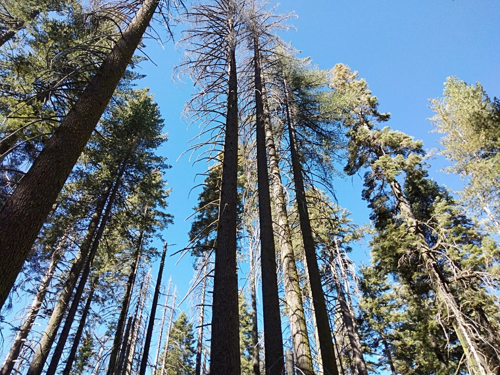
Yosemite National Park located in California’s Sierra Nevada Mountains and spread over more than 1200 sq miles , is known for its the granite cliffs, waterfalls, clear streams, sequoia groves , meadows , lakes , glaciers and valleys and has unmatched biological diversity.Tunnel view is a popular view point here from where you get an overall view of the popular granite cliffs and some of the waterfalls. It was first protected in 1864.
About 10 million years ago, the Sierra Nevada mountains were uplifted and tilted due to tectonic activity; resulting in steep valleys and canyons. Snow and ice accumulated in the higher altitude alpine ranges forming glaciers. The downward movement of ice masses cut and sculpted the terrain as we see it today.
Yosemite is the name of an indigenous tribe that originally inhabited this area and were driven out as a part of the California gold rush in the early 19th century.
The Yosemite Valley represents less than 1% of the park area but this is where most visitors arrive today.
Granite Cliffs
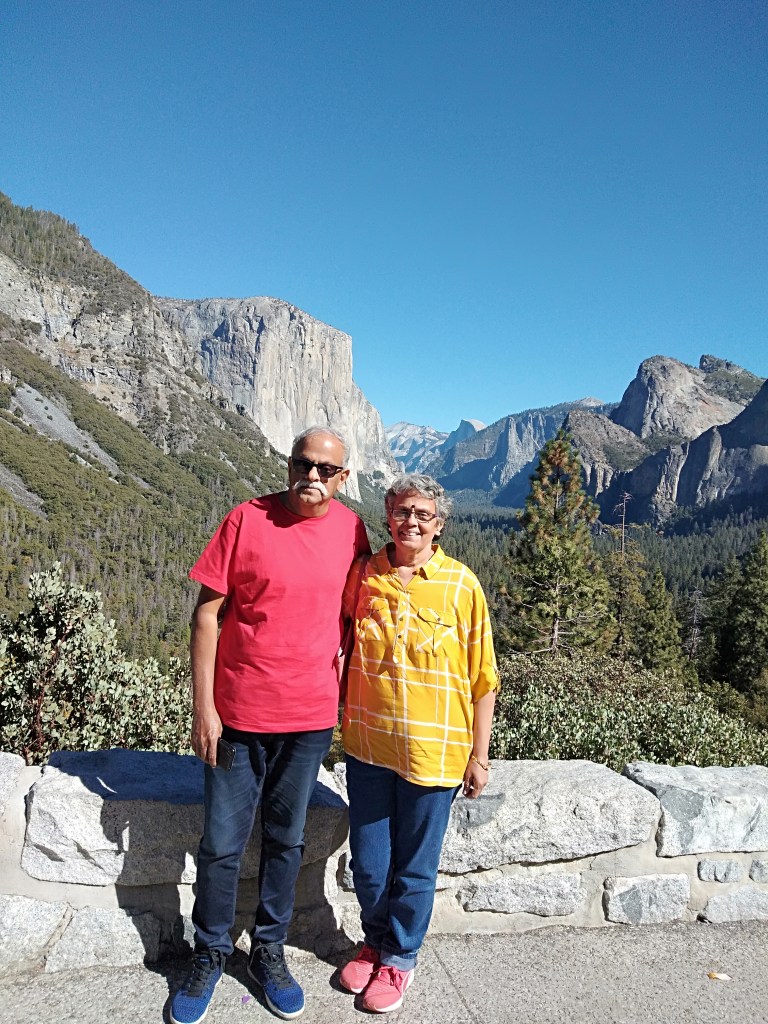
El Capitan(the captain) and Half Dome are the most popular cliffs and are sought after rock climbing destinations. Permits for hike are distributed by lottery.The introductory image in this article is that of sunlight falling on the Half Dome
Giant Sequoias
The Tuolumne, mariposa and Merced groves have giant Sequoia trees. The Tuolumne and Merced river systems flow through the park. Hydrological processes like glacialisation and flooding have been responsible for creating the various landforms in the park.
Waterfalls
Yosemite is also well known for its innumerable waterfalls, the most famous among them being the Bridal veil falls seen from Tunnel view. The best time to view these are between April and June. Many of them are dry during the dry season.
Fire fall is another phenomenon peculiar of Yosemite. Occuring at sun set in mid to late February, the sun rays hit the Horsetail falls causing it to look like molten lava
Apart from this, Yosemite is home to a variety of wildlife species which changes according to the plant species and the altitude of the area. Noted among them are the black bear, coyote, raccoon, marmots, deer etc
Wild fires occur seasonally and clear the park of dead vegetation making way for new growth. The Giant Sequoias need fire to reproduce. It clears away the competing firs and cedars and exposes bare mineral soil for the tiny seeds to take root. These fires do help some of the other trees as the fire clears the way for sunlight to trickle into the forest floor.
Lodging Facilities like the Yosemite lodge and various other options are available inside the park and in neighboring communities.
Wilderness Permits are required for all overnight visits.
Suffice to say that this is not a place you can rush through in a day. You need to camp and spend time exploring the place. It is a naturalists delight and the more you explore…the more you discover….
Our Tour
We had booked with Extronomical tours for this trip and we were dropped off at city Hotel at 5.30 am ;from where a cab picked us up and drove us to Livermore. Driving to Livermore was an eye opener about San Francisco traffic….there was heavy traffic at that early hour. We were dropped off at a Starbucks outlet at Livermore where there were other people waiting to join the tour. After a half hour wait, the tour bus pulled up and we all excitedly boarded the tour bus
Our first halt was at The Tuolumne Grove….The grove of giant sequoias.
The main attraction here is the Giant Tunnel tree, but a steep trek is required to reach it. The tour guide dissuaded us from taking the trek as there was limited halt time here. So, we walked around the grove and admired the giant sequoias.
The missing of the Tunnel tree was a disappointment …but we did get some nice pictures at the grove.
The single dirty toilet here with long a queue was also a sore thumb…..
The Tuolumne Grove
Giant Sequoias
The Sequoia grove is at one end of Yosemite and so after we left the grove, we were driving through thickly forested areas and winding roads with amazing scenery.
So, the drive was really captivating and we reached the Tunnel View point where we could see The Half Dome and El Capitan. These are granite cliffs sculpted by the vagaries of nature and are popular rock climbing destinations .
Tunnel View
The El Capitan (blue) and Half Dome( green) and Bridal Veil Falls(red) opposite the El Capitan
At Tunnel View with the cliffs in the backdrop
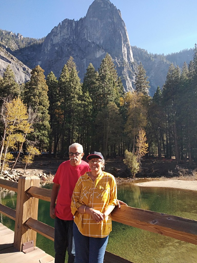
We were then taken to the picnic area where we had around two hours to spend. We had lunch and walked around the area and also took some pictures. The Merced River was flowing like a small stream…the effect of drought over the years.
The Merced River with the reflection of the cliffs
The wooden bridge across the Merced
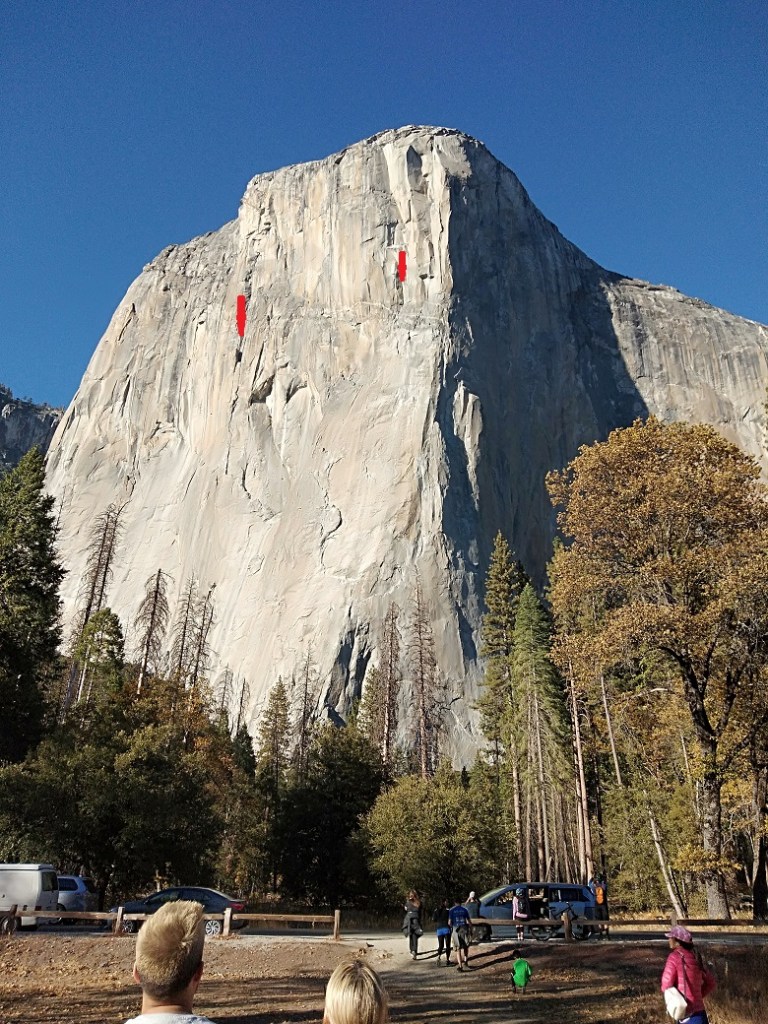
After the break, we were picked up by the guide and we reached close to El Capitan from where we could see Rock climbers as tiny specks on the cliffs….that was something really unique!!! These climbers even halt overnight on these vertical cliffs…..literally the heights of adventure……
The El Capitan with rock climbers (marked with red arrows)
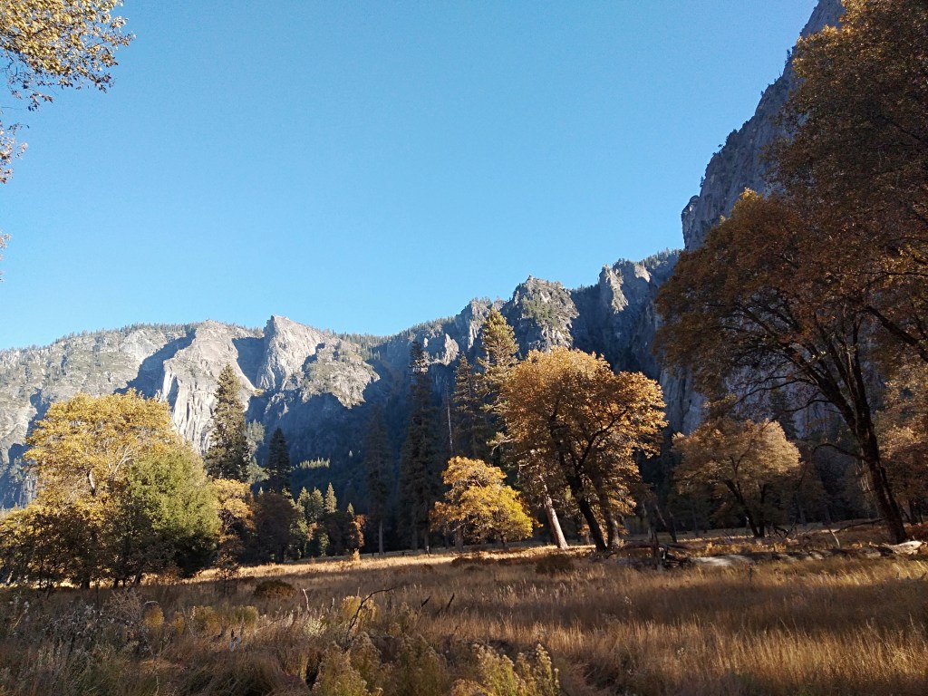
A general view of the park with the Merced River.
There is yet another exciting event that occurs in Yosemite….the firewall.The horsetail falls here gets illuminated by the sun rays in a particular angle during a few days in the month of February.This gives an illusion of fire falling along the rocks…hence fire fall.
(The above picture is courtesy Pexels…It would be unjust to miss this phenomenon in a description of Yosemite and hence chose to put a non personal picture .)
Let me show you some pictures we took as we walked around. Take a look…
Some general pictures from Yosemite
I leave this description with a note that Yosemite is not for you to cover in a day. Whether you are looking to hike the cliffs, or simply enjoy the stillness of nature or even ski the slopes, you will not be disappointed.You need to spend a few days camping there to extract the cream of Yosemite
Meanwhile, please do not forget to subscribe below
See you all next week at the Sunshine state of Florida….at Miami
Till then take care….
In case you missed my last blog on the Big Basin Redwoods, here’s the link
Continuing my series from San Francisco, this week I take you to an amazing place..
The Big Basin Redwoods
Brief history and overview
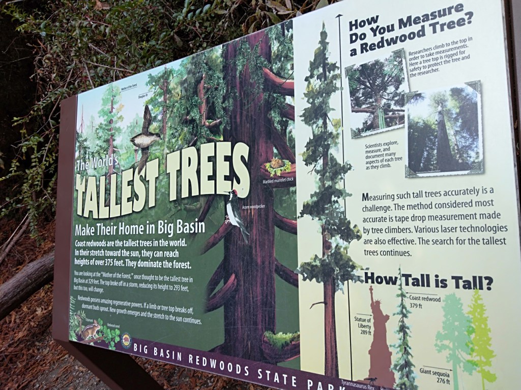
One of California’s oldest state parks, The Redwoods Park is home to ancient coast redwoods that are among the tallest and oldest trees on earth.
Covering more than18000 acres and ranging from sea level to heights of more than 2000 ft elevation, this place is truly awe -inspiring!!! Some of the trees are more than 300 ft tall and 50 ft in circumference and are estimated to be 1000 to 2500 years old.
The coast redwoods ( Sequoia Sempervirens ) are native to the US and are found only along the Pacific coast from Oregon to California….No wonder the Redwood is California’s state tree! Sempervirens means “ever living”
There is evidence that this place was inhabited much before the Spanish explored the area in 1700s. The European explorations followed by the gold rush resulted in wide spread logging and deforestation. A group called the Sempervirens club was formed to halt this destruction and finally in 1901, a state park was created
Apart from redwood, this place is home to Douglas-fir, Red alder ,oak and myrtle apart from lot of native shrubs. Foxes, coyotes, bob cats and a variety of birds inhabit this park.
There are plenty of facilities for recreational activities like hiking and camping .
Peculiarities of REDWOOD TREES
Bark: It can be upto a foot thick and protects the growing part of the tree
Roots: Are remarkably shallow for such tall trees but they grow sideways and fuse with neighboring roots forming a network which gives more stability
Leaves:Can catch water from fog and hence helps tide over drought
Dormant Buds: Continue to grow after a part of the trunk or branch falls off
Red Pigment: Tanin, the red pigment is a potent insect repellent
This explains the relative strength, resilience and longevity of these trees…no wonder they are “everliving”
Our Trip
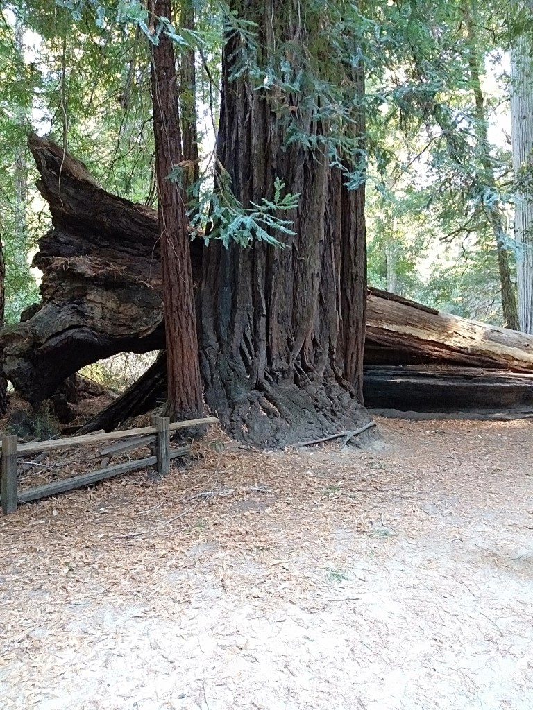
Located at Santa Cruz county, we drove down to Big Basin Redwoods State park. A huge tunnel tree at the entrance welcomed us to the park.
Let me take you through the park with my pictures so that you can see these trees yourself…better than any explanation I give…take a look….
The huge tunnel tree at the entrance…a giant by any standards!
One of the many walking trails in the park
A fallen redwood tree
Sunlight trying to filter in through the canopy
Mother of the Forest Tree( zoom to see details)
This is one of the oldest and tallest trees in the Big Basin
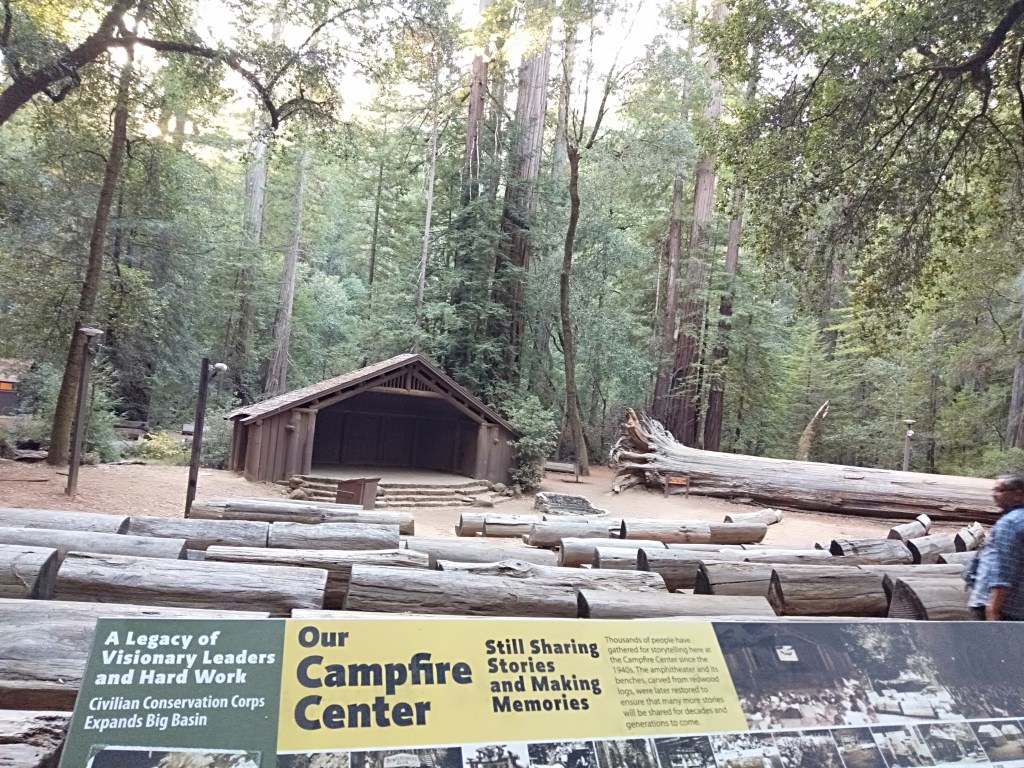
The Campfire area with seats made of fallen redwoods
The Campfire area looks very attractive…with seats carved out of fallen redwood trees.a covered stage and a huge fire ring.
Measuring tree height….a display board explains
I visited this park in 2019….however, after that there was a major fire here .
(CZU fire) Forest fire in 2020
Unfortunately this park is now closed to visitors temporarily. A fire swept through the visitor centre of this park in August 2020 destroying most of the visitor centre, some parts of the camp ground and a few redwoods. Majority of the ancient trees however survived this fire . Hopefully the park should reopen soon after the renovation activities.
Let us hope, that happens fast….
There is another amazing sight in this park,….a fallen tree…its roots displayed like a sculpture…take a look
Standing against a natural sculpture…the roots of a fallen redwood tree….see the beauty even in its fall…….
When I saw the beauty even in the roots of a fallen tree, I thought….
These trees would say:
Here I stand strong and tall
Withstanding it all
Giving hope to one and
Even after we fall….
See you all next week in yet another amazing place…Yosemite National park…till then goodbye
This week we continue our visit to San Francisco city.
We did a city tour of San Francisco with the Big Bus…
We drove past some of the iconic buildings and other landmarks in San Francisco. Detailing a few of them for you,
Transamerica Pyramid, the second tallest skyscraper in SanFrancisco, an icon in the San Francisco skyline. It houses offices and is not open to the public.
The Transamerica Pyramid
The City hall, the seat of government for the city and county of San Francisco. Built after the older city hall was destroyed in the earthquake and fire of 1906, this structure was built to showcase the rebirth of the city in time for the world’s fair of 1915.
The City Hall
The Lotta Crabtree Fountain..commissioned by actress Lotta Crabtree. Located at a busy intersection in downtown San Francisco, this served as a meeting place in the aftermath of the earthquake and fire.
Lotta Crabtree Fountain
The Painted Ladies
These are old Victorian houses and buildings repainted in 3 or more colours that enhance their architectural details
The Painted Ladies
The Cable Cars
This is an iconic structure of the city and is the world’s last manually operated cable car system , a tramway where the cars are pulled along by cables embedded in the street. It is part of the Urban transportation system but is mainly used by tourists today. It has the distinction of being the only transportation system to be called a National Historic Landmark.
The Cable car and a typical street scene in downtown San Francisco
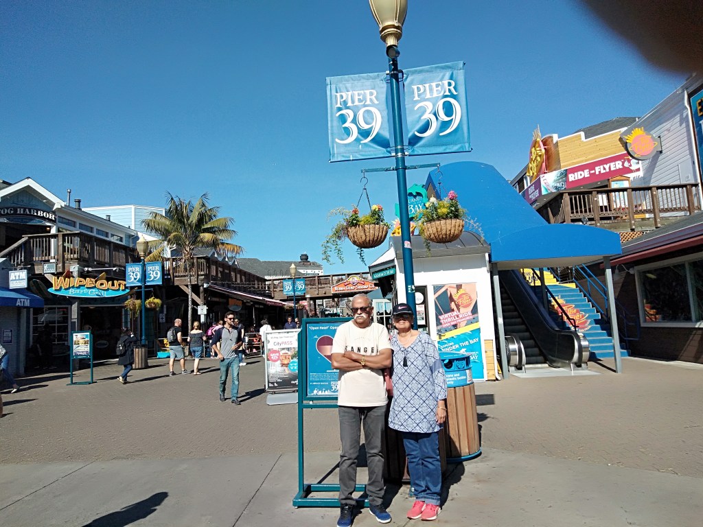
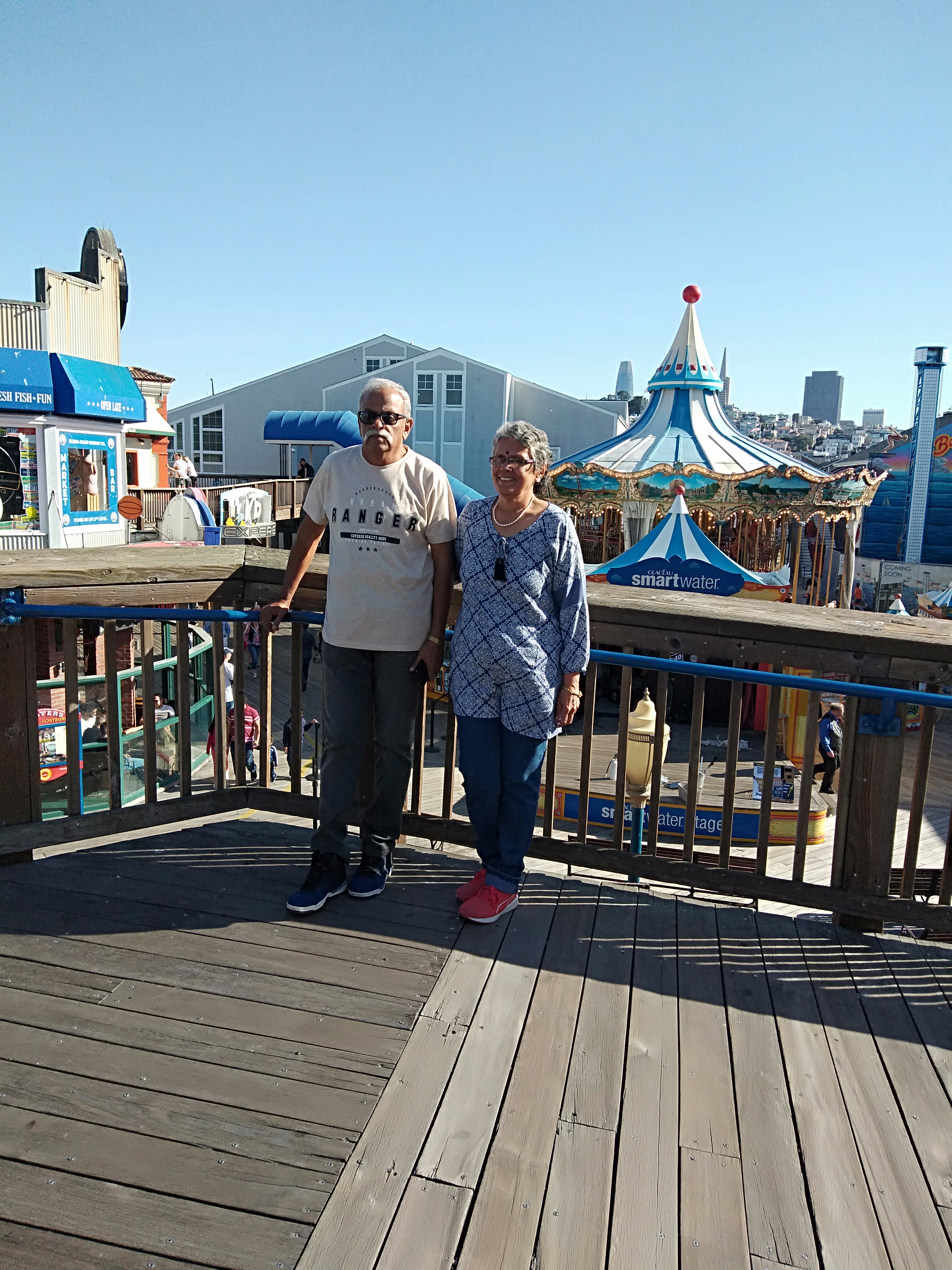
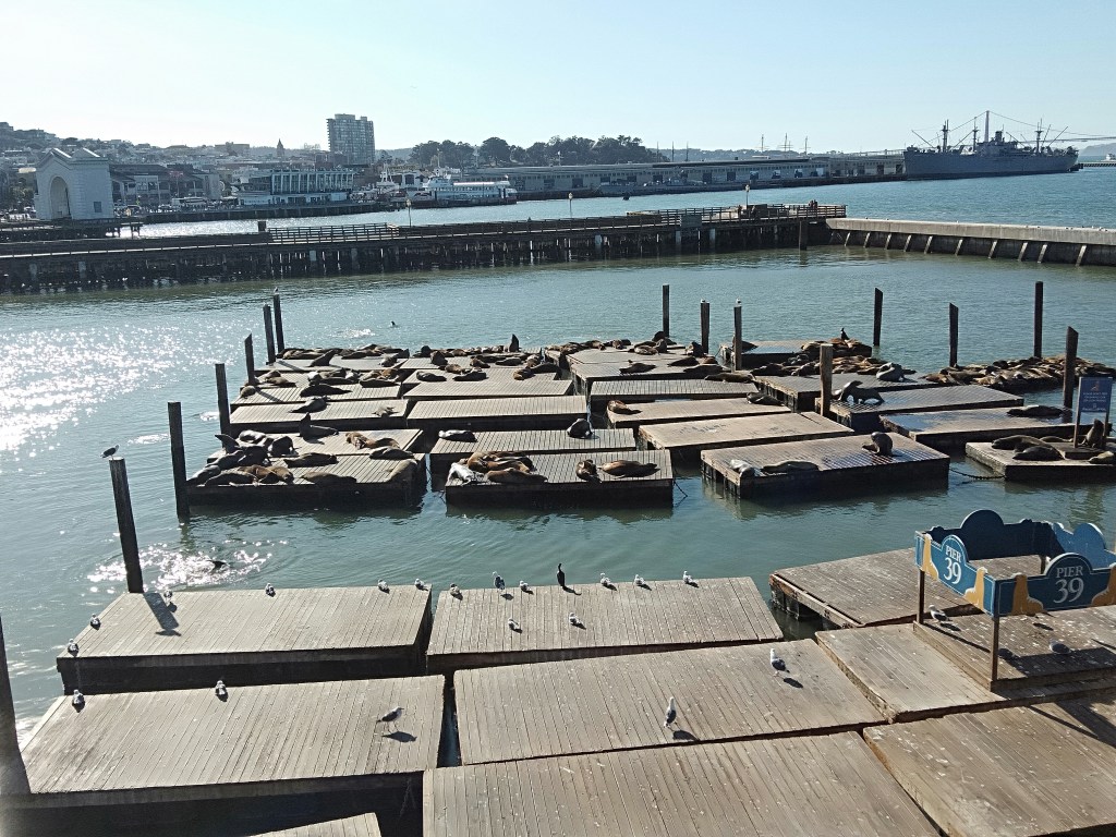
Next we visited Pier 39 also called Fisherman’s Wharf.…a fun place ; an outdoor shopping mall by the bay filled with dozens of shops and restaurants of all types. Set with wooden planks, there are two levels of shops . Most of the restaurants are family run and serve sea food. Clam Chowder in Sour Dough Bread ( clam soup in a bowl made from sourdough bread) was really a unique dish I found here. That seemed to be the most popular dish around.
Most of the restaurants offer great views of the bay. An added attraction here are the sealions that visit the back docks. One can watch them lying lazily around and creating a cacophony….
Some pictures from Fisherman’s Wharf
Sea Lions basking in the sun….at Pier 39
The Homeless….the unglamorous part
I must also mention here that apart from all the glamour of San Francisco, there’s a very sad side too. As we drove around town, we found lot of homeless people sitting amid dirt and grime on the footpaths, smoking and generally looking drugged. Makes one feel highly unsafe. We were also witness to needles and syringes lying by the road…probably left by a drug peddler.
Most of the flyovers and bridges in San Francisco have hutments below them; small dwellings covered in coloured plastic sheets . The hapless homeless make themselves these shelters to escape the vagaries of nature
Again at Embarcadero, we did see people scavenging the dustbins for food. The roadside benches near Embarcadero have people sleeping on them in broad daylight.
Suffice it to say that inspite of all the high and powerful outer image, there’s a dirty underbelly to this place.
Sweeter side
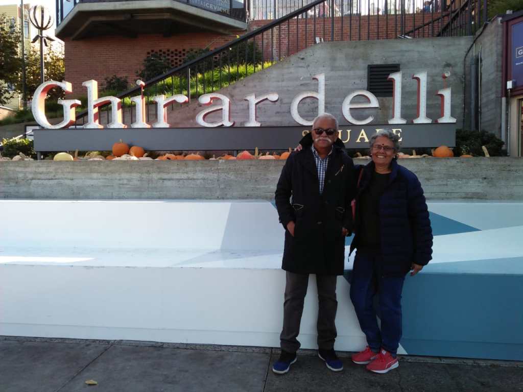
We then visited Ghirardelli Square….I guess I don’t have to elaborate on what that is!!!
Tasted and bought some yummy chocolates and Ice cream. There was a quaint old lady walking around with a basket and distributing free chocolates to every one . She resembled a character from an old fairy tale…
Nice quadrangle with shops selling a variety of desserts.One can spend hours here shopping for chocolates and other goodies or simply enjoying the views downing some coffee or icecream!
Don’t miss that enthu smile on my face in anticipation of the treat ahead…
That was really a sweet ending to our San Francisco city tour…
Next week we visit the famous Redwood forests of California….
Meanwhile do subscribe and follow my blog below
In case you missed my last blog, click on San Francisco 1