Bhutan’s Divine Madman

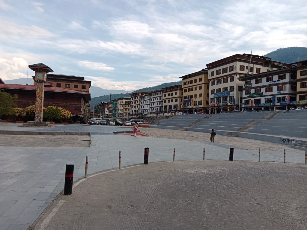
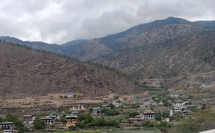
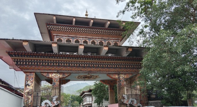
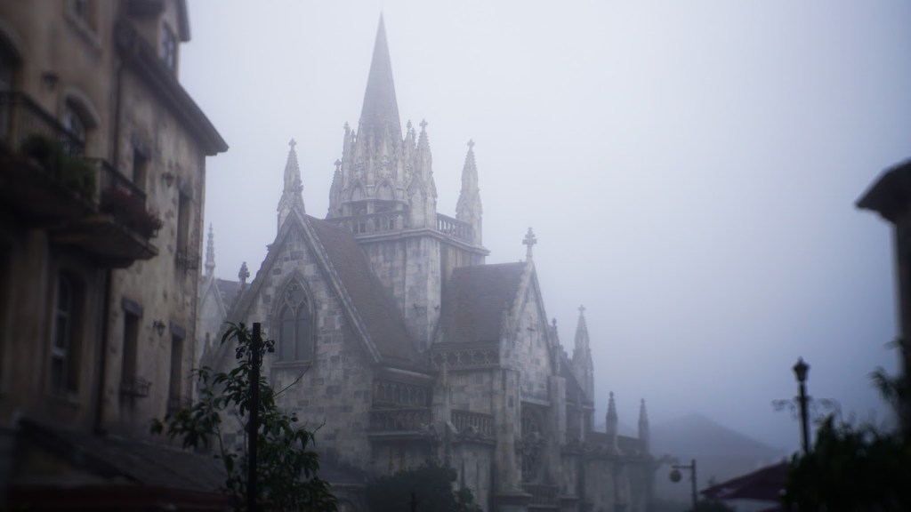
Moving away from Thimpu, our next destination was Punakha. This beautiful and quaint town did really jolt us with its unique and strange practices. Before I get to the practices, let me brief you about the man behind it…Drukpa Kunley ( popularly known as the Divine Madman) the revered saint of the Bhutanese.

Some of the pictures posted below may appear kinky and unconventional . But to explain Punakha ‘s tryst with the phallus and fertility, it is unavoidable…..
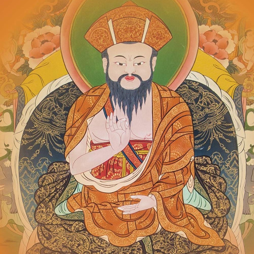
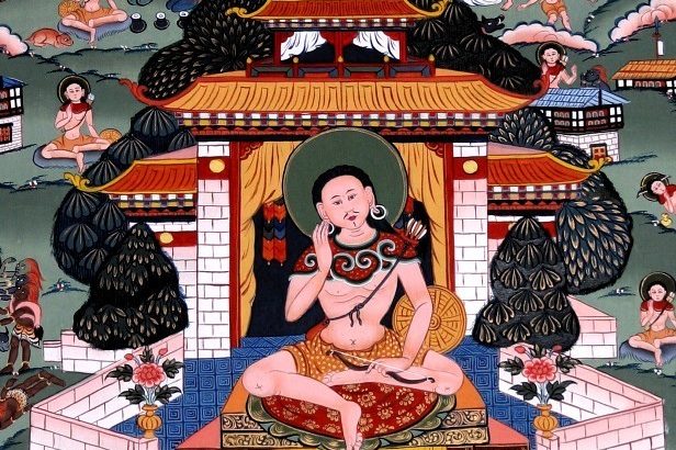
The Divine Madman

The Tibetan monk Lama Drukpa Kunley is known here as the divine madman. And this is not without reason. He had rather unconventional and unorthodox ways of teaching Buddhism , often relayed with sexual connotations. He questioned the preconceived ideas of society particularly its hypocrisies. The monastic community was his chief target. His use of the Phallus to subdue demons and enlighten humans was rather bizarre and his phallus was considered so powerful that it was dubbed the “Thunderbolt of Flaming Wisdom.”

“Wine and women are my meditation”….he declared and wrote blasphemous poetry which shocked the regular clergy. He proclaimed that celibacy was not a necessity to the path of enlightenment. He got himself lot of followers particularly women and earned the nickname “Saint of 5000 Women”.

The phallus is considered a symbol of fertility and good luck and even today, his influence looms large in the form of giant phalluses painted on walls of houses. He is perhaps the only saint in the world exclusively identified with the phallus.

These pictures and models of giant phalluses seen everywhere will seem a little strange to the first time visitor as it did to us.

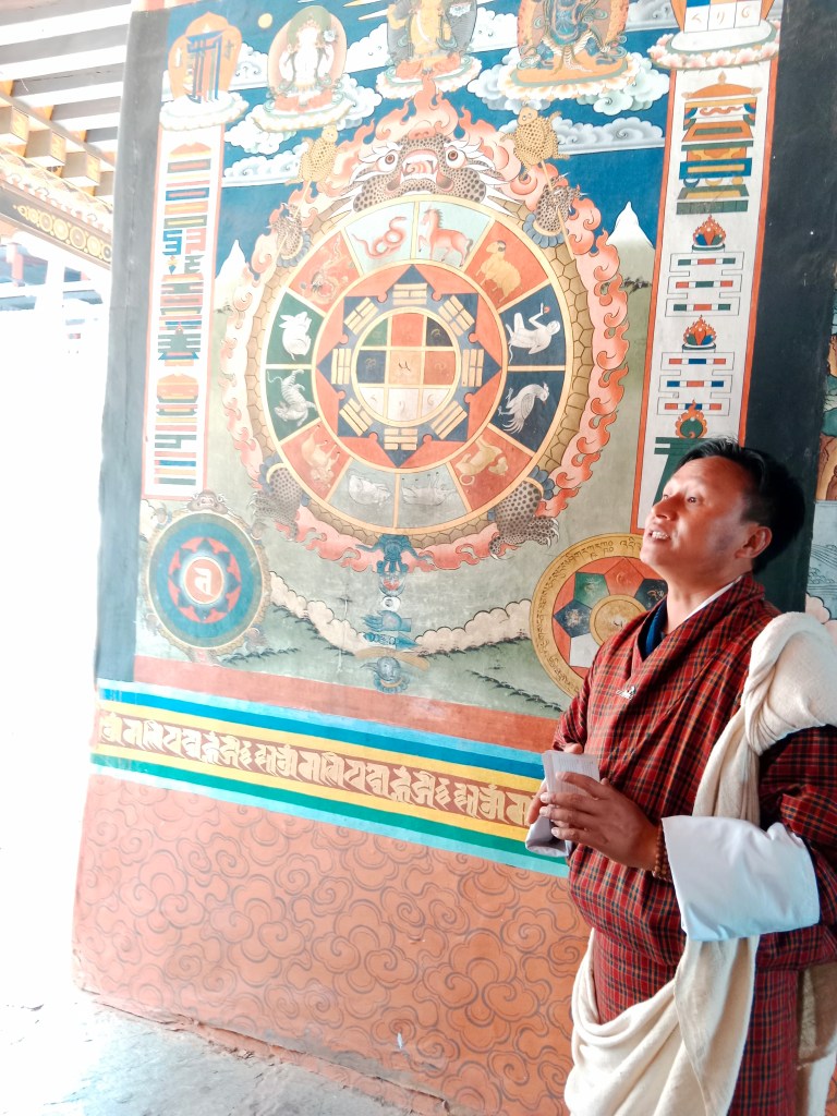
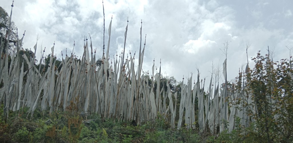
Pictures of animals and chortens painted on the walls are a common site everywhere in Bhutan. But when you reach Punakha, the story is different …..

In such a conventional Buddhist country, this practice seems unbelievable indeed!

Have a look at this strange practice….

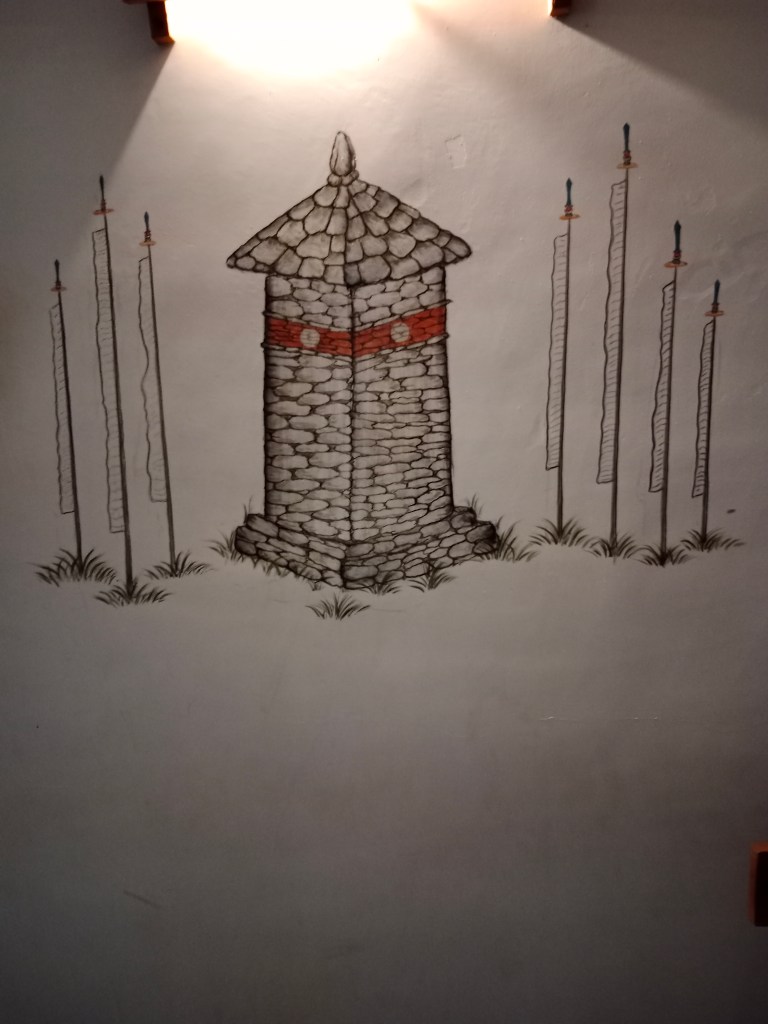
Pictures on walls found elsewhere in Bhutan

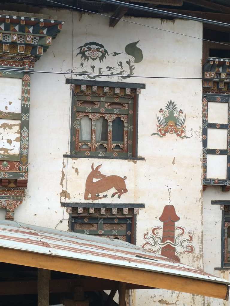
Phallus paintings so typical of Punakha

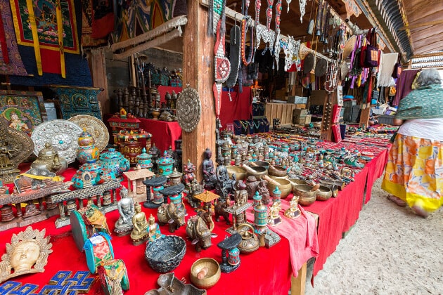
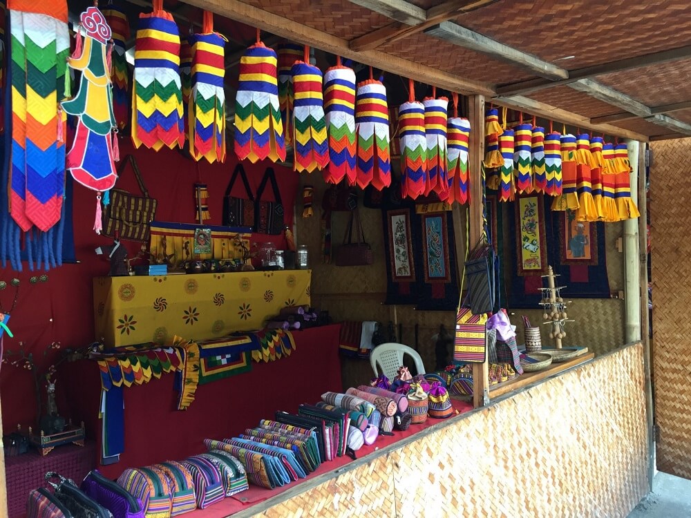
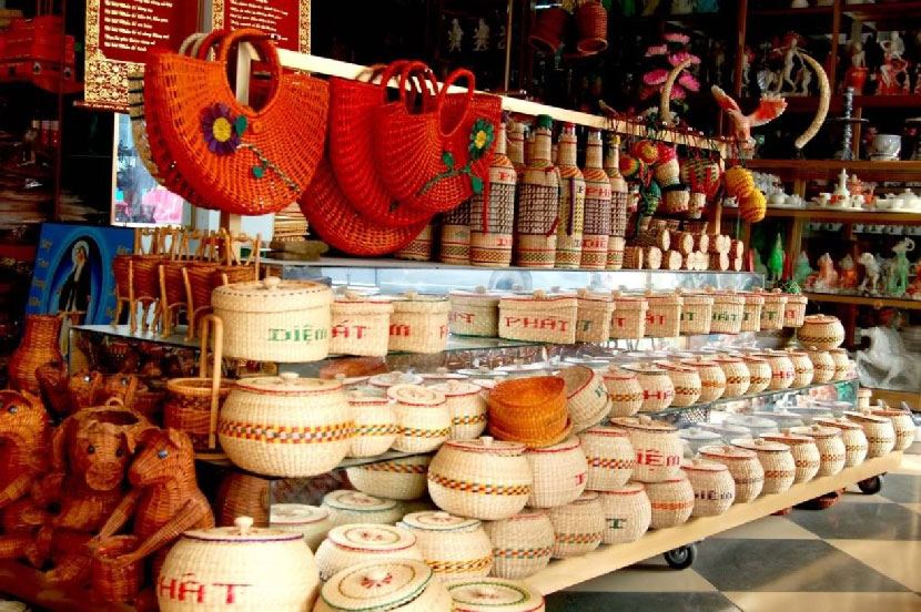
Not only these pictures, you will find phallus models everywhere, from the roof tops to entrances and they form an important gift item and souvenir from here. Phallic art is so inherent to the people of the region and not considered quirky here. In fact, these souvenirs are believed to bring good luck.

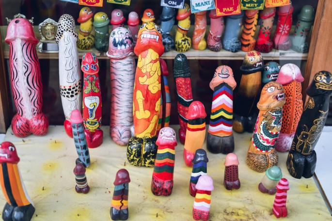
Phallic art souvenirs displayed in shops around Punakha.

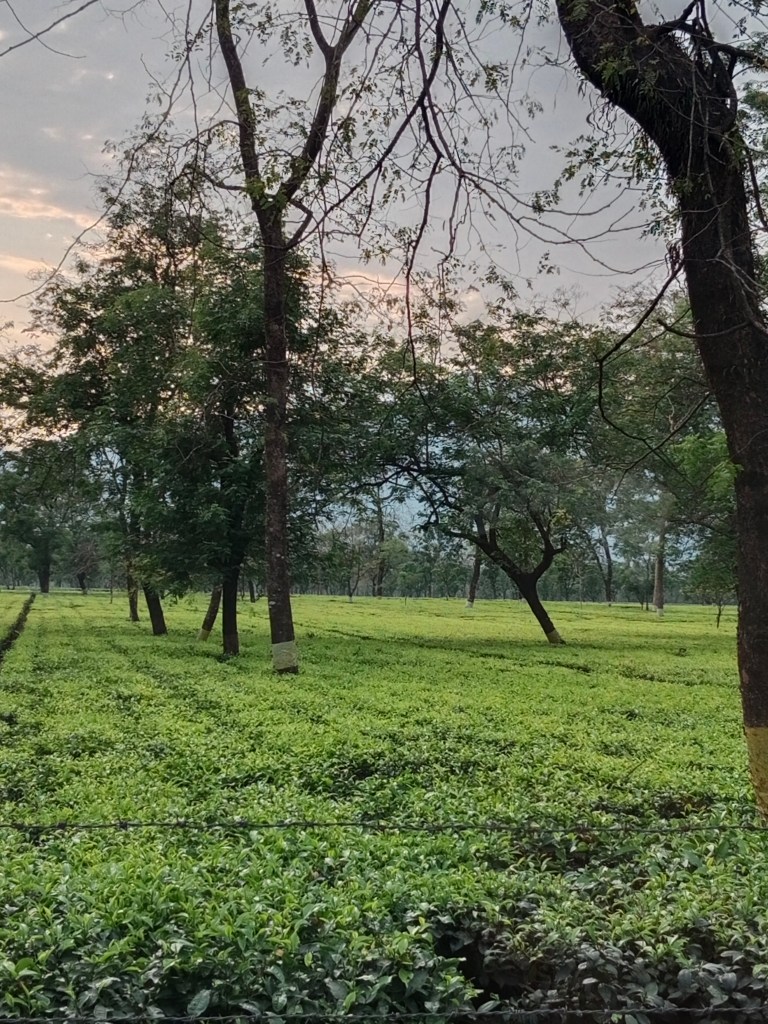
Punakha is inseparably associated with the word ” Fertility”. On one side ,it is a rather fertile valley with lot of farming around and on the other, it is has associations with human fertility too….

The famous fertility temple known as Chime Lhakhang is located here and infertile couples visit this temple and are believed to have been blessed with off spring…
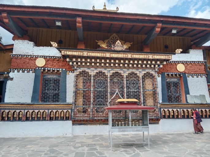
Chime Lhakhang

This fertility temple is located on a small hillock at Punakha. A small climb will take us to this unique temple.

This temple was built in memory of The Divine Madman and the locals believe that there was a demon who created trouble for the locals and converted himself into a dog to avoid the wrath of the Divine Madman. But he subdued the dog with his phallus and buried it at the site of the black chorten seen at the entrance to the temple.

This temple is visited by devotees from all over the world who seek fertility blessings . After seeking the blessings and offering prayers, the lady is expected to circum ambulate the temple with the phallus model. The temple in fact has an album of pictures with couples who are believed to have benefited from the divine intervention.

The temple itself is not as grandiose as many of the temples in Bhutan and appears rather simple. Some pictures….

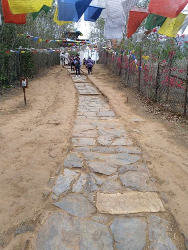
The short path up the hillock and the board explaining the legend of the temple

The unusual black chorten at the entrance associated with the dog demon

A huge prayer wheel at the entrance and many small wheels around the temple
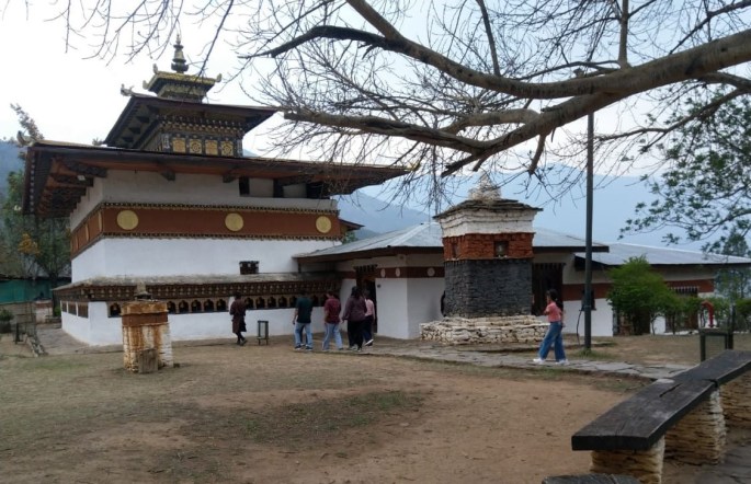
The main temple

A large peepal tree adorns the courtyard with small seats for devotees to rest.

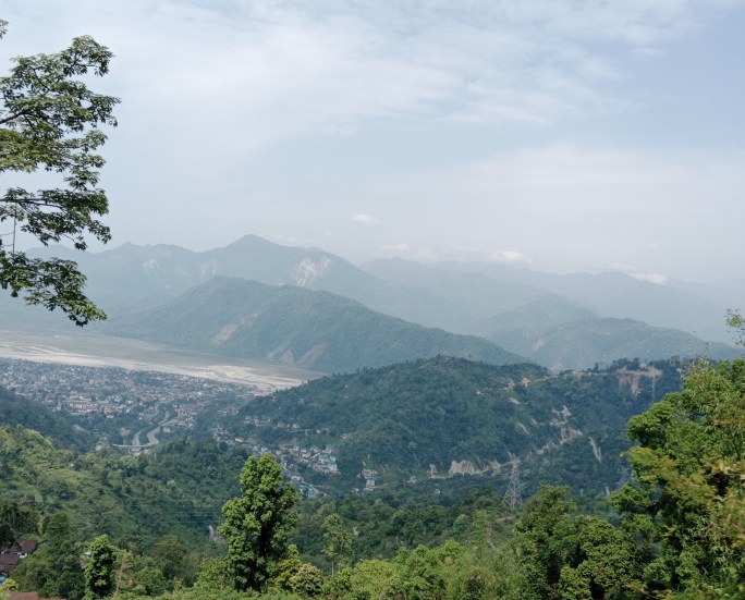
Resting in the courtyard and view of Punakha from the hillock

Photography is prohibited within the temple and images of the deity cannot be shown. There is a statue of Guru Padmasambhava with a reclining statue of Drukpa Kunley beside it.

A 10 inch phallus model made of wood and ivory is kept here near the altar and we were all blessed by the priest with a tap on the head with it.

After some pictures in the courtyard, we proceeded back to the bus to continue our tour of Punakha. See you next week with more pictures and stories from Punakha. Till then, do continue to give your feedback and comments.

Dochu the Himalayan Pass

Dochu La is colloquially Dochu pass ( La means pass in Dzongkha language). It is a pass in the snow covered Himalayas that lies in Bhutan on the road from Thimpu to Punakha.

The most iconic image of this pass is the 108 Chortens or Stupas built here. We made a stop here on our drive from Thimpu to Punakha . Come along; let me take you through some interesting facts and images of this Eastern Himalayan pass…

The pass is located at an altitude of 10300 feet above sea level on the Thimpu Punakha highway. Due to this altitude, the temperature here hovers around 10 to 12 degrees Celsius. On a clear day, one can get a full 360 degree view of the snow clad Himalayan peaks from here. But very often the place tends to get foggy and hazy hampering the view. Coniferous trees on the hill slopes adds to the natural beauty of the place. Coloured flags that are important to the Buddhists also dot the area. The area has plenty of Rhododenron trees and when they bloom in March, they provide a colourful spectacle.

The whole atmosphere here is calm and peaceful with pines covered with mist and fog and occasional patches where one can see beyond the fog. Have a look…

The views of the Himalayas from Dochula Pass

The board that helps identify the peaks on a sunny day

The most striking structure here is the 108 Druk Wangyal Chortens.

The Chortens

Chortens are important monuments or shrines in Bhutanese culture and are also called Stupas. Typically, they are tombs of saints. At Dochula Pass there are 108 such Chortens built in memory of the soldiers who lost their life fighting Assamese insurgents from India in 2003. After the Bhutanese were successful in defeating the insurgents, the Queen mother ordered the building of these Chortens .

A panoramic view of the chortens at Dochula pass.

Here the Chortens have been built in three layers around a main Chorten. The first layer has 45 chortens, second has 36 and the topmost has 27; all built around the main structure. A glance at the Chortens does not reveal the strict religious processes that have gone into building them. They have been built in accordance with astrological beliefs.

The 108 chortens built in 3 layers

A flight of stairs takes us to the top where the main chorten is located

At the main Chorten

A nice paved walking track takes us around the chortens

Each chorten has a “Sokshing” which is a square wooden pole carved from juniper trees, has been painted bright red and is installed on an auspicious day to the accompaniment of sacred hymns.

In addition to the Chortens, there is a temple here called the Druk Wangyal Lhakhang.

Druk Wangyal Lhakhang

Built in memory of the fourth king of Bhutan, is an important place of worship for the locals. It was completed in time for the commemoration of hundred years of of monarchy in Bhutan. The walls of this temple are adorned with traditional paintings relating to Bhutanese history. The courtyard of the temple is the venue of the famous Bhutanese festival in December performed by the Bhutan Army.

The Druk Wangyal Lhakhang

The beautifully decorated walls of the Lhakhang

Royal Botanical Park

Adjacent to the Chortens is a park that is home to many varieties of Rhododendron. In late February and early March, the Rhododendrons bloom and add colour to the place.

The direction board at the Park

Cafe

There is a cosy café near the Dochula pass and with it’s glass windows provides beautiful views of the Himalayas.

The café entrance

Our group enjoying coffee and hot chocolate at the cafe

Remnants of Rhododendron blooms

We visited Dochula pass two times and the second time it was much more foggy and misty than the first time…

The mist at the pass on our second visit

After the halt at Dochula we proceeded on our way to Punakha. Punakha is yet another interesting place in Bhutan, closely associated with the strange legends of “The Divine Madman”.

See you next week at Punakha. Till then do give your comments and feedback.

Thimpu

Let me start this blog with a big thankyou to each and every one of you who have accompanied me on this journey to this milestone….my 100th blog…

Celebrating a milestone…..

Starting with Thimpu……

A new day dawned on Thimpu and the visuals from our hotel window were very beautiful….Enjoying a cup of tea sitting by the window, we clicked this picture…

Day dawns on Thimpu

Excited and looking forward to a great day ahead, we had breakfast and met up with our group in the hotel lobby.

Outside our Hotel Osel with typical Bhutanese decor at the entrance

Soon we were on our way to do the sightseeing around Thimpu city.

Our first halt was at Memorial Chorten.

Memorial Chorten

Built in honour of the third king of Bhutan, this Stupa is a prominent landmark in Thimpu with its golden spires and bells. Most Buddhist Stupas contain human remains but this Stupa stands out in that it does not contain any human remains and only has a photo of the third king in ceremonial dress adorning the hall. It had been the wish of the king to build a stupa “like the mind of Buddha” but he passed away before achieving it and so it was built by his mother in his memory in 1974.

As one enters the complex, there are large prayer wheels and a shrine with copper lamps being lit by devotees.

The prayer wheel and the copper lamps at Memorial Chorten complex

As one walks past , the central walkway leads to the main Stupa or Chorten built in Tibetan style. The large white exterior has a golden spire on top and a smaller golden spires on the porches in all directions.

Main Stupa

The intricate decorations and the Buddha statue on the second floor seen from outside

The chorten is decorated with richly carved annexes facing the four directions and contains mandalas, statues and a shrine dedicated to the third king. A staircase from the ground floor leads to two floors each with four shrines. There are multiple statues of wrathful looking protective deities.

Locals come here to offer prayers and everyone has to remove their footwear and caps . Photography is prohibited inside the Stupa.

From Memorial Chorten, we proceeded to another of Thimpu’s landmarks…

Buddha Dordenma

This gigantic statue of Sakhyamuni Buddha on a hill is iconic of Thimpu and can be seen from far away . It is one of the largest sitting Buddha statues in the world at 169 feet height. It was completed in 2015 and took nine years for completion. It is made of bronze and gilded with gold . The statue faces the East and is believed to bring peace and prosperity to the people.

The statue was built with private funding from the Buddhist community in China, Singapore, Thailand and many such countries. It had been prophesied in one of the sacred texts that a statue of Buddha or the Unifier will be built in this place which was the site of the palace of the 13th Desi of Bhutan.

The gigantic statue seen from below the hillock

It was built to commemorate the 60th anniversary of the fourth king of Bhutan.

The decorative gate and the statues in the courtyard of the Buddha Dordenma complex.

A panoramic view of the Complex

As one enters the complex below where the statue is located, there is a huge hall with multiple golden coloured pillars. All along the walls are replicas of the giant Buddha of various sizes and in golden colour. There are 125000 such Buddha statues which are replicas of the giant statue inside glass showcases along the walls .

The walls have beautiful murals of Buddha, Zabdrung Rinpoche and Padmasambhava…the three most revered images in Bhutan. A crystal pillar and various offerings given by devotees is spread before the altar.

The main statue.

One of the many statues and a Stupa in the courtyard

The snow clad Himalayan peaks as seen from the courtyard

Our group at the Buddha Dordenma Complex

Our next destination was the Royal Takin Preserve.

Royal Takin Preserve

This is a wildlife reserve created to preserve the Takin which is the national animal of Bhutan. Takin is a rare and unique animal and is supposed to be a mosaic of the goat and the antelope.

The reserve is meant for the animals to roam around freely in natural surroundings unlike in the confined areas of a zoo. It is located in a forested area spanning more than 8 acres and has wild boar, sambar, barking deer, musk deer and other animals besides the Takin.

There is an interesting legend on how the Takin was created but it’s correctness is doubtful. A Tibetan monk known popularly as “The Divine Madman”( about whom we will discuss in further episodes) with tantric powers is supposed to have created the Takin by fixing the head of a goat to the body of a cow.

A short hike up a garden path leads to the animal viewing area. Some pictures…

The entrance to the Preserve with models of the Takin

The preserve forest and the trek to the animal viewing area

Animals relax in natural surroundings

The Takin

Bhutan Post Office and Museum

By now we were all famished and so we had lunch at a restaurant at Thimpu and proceeded to the Bhutan Post Office and Museum.

This place functions as a post office and has a museum depicting old stamps and postal articles. A documentary on old postal services is also played out here.

This post office is unique as it allows us to create a stamp with our desired image and use it as a functioning postage stamp for a fee.

Various gift articles and souvenirs are for sale here as are the famous Bhutanese Thanghkha paintings.

Some pictures…

Souvenirs and masks at the postal museum

Typical Bhutanese Thanghkha Paintings

Changangkha Lhakhang

An ancient temple built in the 12th century, located on a ridge in the city, offers great views of Thimpu city from above.

A short trek up to the ridge brings us to the temple courtyard where there are several prayer wheels. Inside the temple is a statue of Avalokiteswara with 11 heads, 1000 hands and eyes. The eyes are located on the palms of the hand. Avalokiteshwara is a lord of compassion and he/she has 11 heads as he has to think of the welfare of all his disciples and thousand hands to help all the people around….so goes the legend. It was built by a Tibetan monk who came to spread Buddhism in the Himalayas.

This temple is frequented by parents with small children who seek the blessings of the lord for health and happiness of the child. Childless couples also visit the temple to be blessed with a child. Children are brought here for naming by the monk too.

The Changangkha Lhakhang Temple

The flags and views of Thimpu city

Clock tower

A central square with a clock tower forms the main shopping area in Thimpu. The square is surrounded by buildings with a variety of shops. Flower boughs create a nice ambience here. The sides have seating arrangement like in a stadium as important events are often held in the central square

The central Square and Clock Tower(note how clean it is)

After some shopping here, we had tea and Momos at a restaurant near the central square.

The Flower boughs and the momos

Handmade Paper Factory

Another interesting place we visited at Thimpu was the handmade paper factory. The process of paper making was demonstrated to us. The bark of the tree is processed and made into a pulp. This is further converted into blocks and paper of required size and thickness is cut out and dried. The paper is of good quality and paintings on this paper are on sale too.

The tree from which paper is made and processing of the bark

Blocks of paper and paper cut into required size

Finished product and a painting on display

Well, that rounds up our visit to Thimpu. Our next destination was Punakha. See you next week at Punakha.

Till then, like, comment, subscribe and give me your feedback…

The Dzongs of Bhutan

When we talk about Bhutan, the first picture that comes to our mind is the strong association with Buddhist culture. Structures that have unique architecture and are associated with Buddhist culture are the Dzongs that we see here.

Dzongs

“Dzong” in Bhutanese means a fortress. So all of them are fortresses that serve multiple purposes. The two main functions are Administrative and Religious. Though the dzongs were present in Bhutan since the 12th century, they belonged to different schools of Buddhism established by various Tibetan monks. It was Zhabdrung Rinpoche who used these Dzongs as a unifying force to bring various schools together thus unifying Bhutan.

Zhabdrung Rinpoche (Bearded Lama)

Zhabdrung Rinpoche (Popularly called the Unifier of Bhutan) was born Ngawang Namgyal and was a Tibetan monk. Bhutanese consider him as the most important personality in the history of Bhutan. He formed the Dzongs which helped in bringing neighbouring rulers together and this helped in unifying them into a consolidated Bhutan. He introduced the dual system of administration which is followed even today with the Je Kenpo controlling the religious activities and Desi (elected leader) controlling political activities.

A mural painting of Zhabdrung Rinpoche

Dzong Architecture

As a general rule, dzongs have rectangular buildings around a stone paved courtyard. At the centre of the courtyard is a prominent tower or UTSE which houses the shrines of guardian deities and Buddhist masters . Most such temples have statues of Gautham Buddha, Avalokiteshwara and Zhabdrung Rinpoche .Administrative offices and monk’s accommodation also form part of the Dzong complex.

They usually have huge exterior walls which are painted white with red ochre stripes near the top of the walls dotted by gold circles. Windows are usually absent in the lower part of the walls.

Flared roofs atop the interior temples which are mostly painted with red and have a gold lining is another unique feature. There are massive doors for entry and exit and are usually made of wood.

Brightly coloured typical Bhutanese motifs decorate the inner temple and courtyard walls. Paintings depicting Bhutanese beliefs and folklore adorn the walls of the Dzongs.

Location

It is believed that the locations were chosen based on the prophecies of ancient saints and auspicious events that took place.

Strategic location of the Dzongs is one of the main factors that led to the unification of the country. Most are located on hilltops or ridges giving a panoramic view that helped prevent attacks from enemies. Many of them are located close to rivers or surrounded by them again giving strategic advantage against the enemies.

Purpose

Dzongs serve as religious, military, administrative and social centres for the respective district and are the venue for the annual religious festival.

A large number of national treasures including the remains of Zhabdrung Rinpoche are inherited and housed in these Dzongs.

Continuous changes in structure and adaptation to modern requirements have made these Dzongs the centre of religious and administrative activities. They have adapted to the change in the government system from monarchy to constitutional democracy and as such occupy a significant status in the country.

Most Dzongs today house the offices of the respective district authority and a number of temples and residences of monks.

My Experiences

We visited two main Dzongs ….one each in Thimpu and Punakha…the summer and winter capitals of Bhutan. We also saw the Dzong in Paro.

Some pictures from these two Dzongs and special experiences there….

Tashichho Dzong (Thimpu Dzong)

The seat of Bhutan’s government since 1968, this Dzong was built by the third King of Bhutan. A series of fires and an earthquake destroyed the original Dzong which has been in existence since 1216.

The name Tashichho Dzong means “Fortress of the Glorious Religion“. It houses the throne room and offices of the king, the cabinet secretariat, and other ministries besides the thirty odd temples and shrines.

A panoramic view of the Thimpu Dzong

A closeup view of the Thimpu Dzong

The gate leading to the King’s Palace and a flagstaff in the Dzong complex

Ceremonial flag lowering

Every evening, there is a flag lowering ceremony held at Thimpu Dzong. Fortunately we were witness to it. A group of smartly dressed soldiers accompanied by a monk take part in the ritual again emphasising the dual system of governance.

After the flag is lowered , it is carried by the soldiers inside the Dzong.

Watch a short video of this ritual below…

A video of the ceremonial flag lowering at Thimpu Dzong

Our group at the spacious central courtyard of the Dzong

The prayer wheels and the central tower

Typical Bhutanese designs adorn the walls

Thimpu Dzong was one of our first destination at Thimpu. After the scenic drive from Phuentsholing, we visited this dzong. This was our first visit to a Dzong.

The other Dzong which we visited was in Punakha.

Punakha Dzong

Known in Bhutanese as “Palace of great happiness or bliss”, this dzong is the second largest dzong in Bhutan and has one of the most majestic interiors. It houses the remains of Zhabdrung Rinpoche.It was the administrative centre of the Bhutan Government till 1955 when the capital was moved to Thimpu, though Punakha still is the winter capital.

This Dzong was the site of coronation of the first King of Bhutan.

It is located between the Po Chu and Mo Chu rivers which join to form the Puna Tsang Chu which ultimately joins the Brahmaputra river. Due to the presence of the two rivers, this dzong is vulnerable to flash flooding.

The Punakha Dzong with wooden bridge across the Mo chu river

The beautiful jacaranda trees adding to the beauty of the Punakha Dzong

A wooden covered bridge across the river Mo Chu was built in the 17th century and connects the dzong to the main road.

Crossing the Mo Chu river on the wooden bridge, we were on the side of the Dzong

On the bridge leading to the Dzong ( in the backdrop)

Soon we were in front of a flight of stairs…

A flight of stairs leads to the interior of the Dzong.

You will notice in the picture that towards the top of the stairway there are three divisions in the stairs. The extreme left is for visitors, the extreme right is for monks and the central part for the monarchy.

Once we climbed the stairs we entered a small passage that led to the central courtyard.

This passage had traditional Bhutanese folklore paintings, the Zodiac signs and the name of Zhabdrung Rinpoche painted on the walls.

The paintings of zodiac signs, folklore and name of Zhabdrung Rinpoche and Sanchay explaining

The huge central courtyard with the sacred banyan tree

Our guide led us from the first courtyard further into another courtyard where there were two very beautifully decorated temples. Tourists can enter only one of these temples.

The inner courtyard with the two decorated temples

The decorations at the temple entrances and a golden gate within the courtyard

Our guide took us around the Dzong and explained the significance of many of the sights.

One peculiar thing we found in all the temples and shrines was that there were seven bowls of water offered to the deities. Traditional Bhutanese legend has it the when Buddha was born, he was no ordinary child and he took seven steps as soon as he was born and lotuses bloomed on those steps. Hence the importance of the number seven and the water bowl offerings

Since temples and shrines do not allow photography, these cannot be shown…

A third Dzong which we saw was the Paro Dzong.

Paro Dzong

Known locally as Ringpung Dzong meaning “Fortress on a Heap of Jewels” is located on a steep hillside overlooking the Paro Valley .It has an impressive collection of heritage buildings inside and hence got it’s name. It has a complex of courtyards with temples, shrines and towers with intricate Bhutanese carvings. Unlike other dzongs, this one has huge windows with delicate art work and decor.

Its courtyards serve as the venue for Cultural performances too…

A wooden bridge across the Paro Chhu leads to the Dzong.

The National Museum of Bhutan sits further up on the hillside. The Dzong and Museum are illuminated at night providing spectacular views.

The Paro Dzong with the wooden bridge across the Paro Chhu.

The illuminated Paro Dzong and the National Museum behind it

Well, this is just a round up of the Dzongs I visited in Bhutan and all I learnt about these fortresses. There is a lot more to these including the history and various changes that have taken place in modern times. That will get too exhaustive and hence, I stop with this brief overview.

Next week we do a city tour of Thimpu. Till then, keep your comments and feedback coming in.

Scenic drive to Thimpu

A beautiful morning dawned in Phuentsholing and we were all set to move to Thimpu which was our next destination in Bhutan. We were to continue our drive further in the Duars region of the Himalayas and it had to be beautiful.

After a sumptuous breakfast at our hotel, we set off on this drive on a bright and sunny day. Soon we left Phuentsholing town and its outskirts and were truly in the lap of the lower Himalayas.

Hills on one side and ravines on the other, with rivers at the bottom of the ravines….a very simplistic description of the surroundings . But a few pictures will give you a clearer picture of the scenery…

Leaving Phuentsholing behind…

The winding roads and the Monastery roofs add to the beauty

Stupas of this type line the roadside every now and then

The varied shades of green on the hillside and a waterfall far away

Soon we stopped at a View Point. The views were beautiful and there were the typical coloured flags hung over there. Sanchay, our Bhutanese guide explained the significance of the flags and its importance in Bhutanese culture.

Beautiful view from the view point with a monastery we had passed by on top of another hill

Stupa at the Viewpoint

Our group at the viewpoint and Sanchay explains…

Bhutanese Flags and their significance…

Talking of flags, the bus in which we were travelling had this colourful flag hung in front…so typically Bhutanese…

The flags with the famous Bhutanese chant…..

Coloured flags : Colours of the flags represent the five elements which create and destroy us. The colours are…blue (sky), White (clouds), Red (fire), Green(water) and yellow (earth) .There are prayers written on these flags and are tied by common people to ward off evil and bring good fortune.

White flags : These are tied by relatives of a dead person in his honour and they too contain prayers which will give salvation to the soul. 108 white flags are generally put up for one person. We found several such groups of flags on the hillside everywhere as we drive along.

Coloured flags and white flags dot the hillsides everywhere

We continued our drive and soon took a wash room halt near a group of shops. Some pictures of local life in Bhutan…

A fruit shop on the way. The white cubes seen hanging is a variety of hard Bhutanese cheese

A wayside shack of a shop with a little shopkeeper, local greens and brinjals…

Continuing our drive, we were in for more natural beauty….

A river flows along the ravine

Every now and then there were places of landslides which are very common in this region.

Evidence of landslides

A small waterfall

Soon it was lunch time and we halted for lunch at the Dam View Restaurant. Some pictures from near the restaurant..

The valley and the dam

We enjoyed the scenery from the restaurant overlooking the valley and the dam . Our first encounter with KEWA DATCHI also took place here. It is a very popular Bhutanese dish which has a cheesy gravy with potatoes similar to our vegetable stew.

The restaurant and Kewa Datchi ( traditional Bhutanese gravy)

When we are talking about the dam, there is something interesting I learnt about Bhutan. Bhutan produces surplus hydroelectric power and India is one of the countries that imports the power from them. I felt it was commendable for such a small kingdom to do this!!!

At many places during our drives through Bhutan, there were check posts where Sanchay would get down and present all our papers ….probably crossing over to a different district..I assumed !

Continuing our drive to Thimpu, we encountered some rocky areas of the hill slopes with the roads being particularly narrow at places. At places the rocks seemed to have faces chiselled on them…or was it just my imagination running wild ?…you can decide by looking at the pictures below…

Rocky cliffs and chiselled rocky hillslopes

A stream was flowing by peacefully…

A stream flows along

Sanchay then announced that he is going to give us a surprise….a waterfall where we could wet our feet…

The waterfall and some of us near it….the water was ice cold

Enjoy the feel of the icy cold waters in this video

After the icy encounter, for which we thanked Sanchay, we continued the journey to Thimpu and soon, we could see signs of a city approaching…

As we approached Thimpu

As in any other place, gradually the number of buildings along the roadside increased and soon we were at Thimpu . We thought we would drive directly to our hotel but Sanchay had other plans for us. He wanted to take us to Thimpu Dzong , which is a government office and a monastery rolled into one . So we drove straight there and visited the Dzong where we also witnessed the traditional flag lowering ceremony that happens every evening there.

After the visit to the Dzong we drove to our hotel in Thimpu and relaxed for the night.

The Thimpu Dzong which we visited needs elaborate description and will be covered in my next episode on the dzongs of Bhutan. See you next week in the dzongs…a unique place , typical of Bhutan. Till then, do subscribe, comment and give your feedback.

The Gateway To Bhutan

Phuentsholing….that quaint little town in Bhutan is the gateway to this Himalayan Kingdom.

Let me start with a brief overview of my Bhutan trip…

I did this tour of Bhutan with a group of amazing Seenagers ( Senior citizens with a teenager’s heart!) organised by a travel and adventure company from Bangalore called 50 plus Voyagers. We were twenty three of us and apart from a a couple of us,( who knew each other before) were total strangers when we all met up. In a matter of few hours, all of us gelled with each other and anyone would think we had been friends for years….

That friends, is the magic of age…each one of us knew that we were in it for fun and wanted to make the most of what life had to offer in its twilight years….

Accompanying us on this tour was our Teenage guide Vanshika and two Bhutanese guides, Sanchay and Tenzing

Have a look at my co travellers before we embark on this Himalayan journey…

My co travellers on the Bhutan tour…at the immigration office at Phuentsholing

Our Tour Manager Vanshika

Our Bhutanese guides Sanchay and Tenzing

Earlier that day, we arrived Bagdogra by flight from where we were received by our tour manager Vanshika. We started our drive to Bhutan from Bagdogra airport by car. Siliguri is the closest city to Bagdogra and we drove past Siliguri..

A lunch at a hotel in Siliguri helped in quenching our hunger and getting to know each other more…

Soon we left the crowded streets of Siliguri and headed to Jalpaiguri where the greenery of the tea estates left us in awe. The peculiarity of these tea estates is that they are on flat ground. Elsewhere, tea estates are located on hill slopes but here it was different….

A little bit on the Duars region of the Himalayas

These are basically plains on the foothills of the eastern Himalayan ranges mainly in North East India and West Bengal.

Duar means door and forms the gateway to Bhutan and NE India. With the backdrop of the Himalayas, this region is a paradise for nature lovers. The Teesta river, several wildlife sanctuaries, tea gardens, several small rivulets and waterfalls add beauty to this region.

Some pictures from our drive through the tea estates of West Bengal…

The tea gardens

We also crossed some bridges and the long road to Bhutan welcomed us with the views of the mountains ahead…

The rivers and the long road to Bhutan with the mountains ahead….

Just as we were enjoying this ride, it was tea time and we enjoyed some saffron tea and biscuits at a tea shop…

Enjoying tea and biscuits…

Continuing the drive, we enjoyed the scenery and the company. After five hours of the drive from Bagdogra, we were close to the Bhutan border and we could see Phuentsholing town at a distance.

Phuentsholing at a distance….on the slopes

The last Indian town was Jaigaon and as we approached Phuentsholing, our guide collected our passports and other documents to get the visa and other permits for travel in Bhutan.

Once we reached the border, there was an ornate gate here to demarcate the border. In addition there is a wall also to one side.

The ornate gate at Phuentsholing and the wall demarcating the Indo-Bhutan border.

After alighting from our vehicles we walked to the immigration counter at Phuentsholing. Our guide accompanied us and we walked through the typically Bhutanese style immigration office.

The immigration office with typical Bhutanese decor

We had to wait there for sometime as our papers were getting ready and we used that time for some quick pictures .

Once our papers were through, we walked in to Bhutan and I must tell you, it was such a contrast.

A few feet this side of the ornate gate and the streets were clean, there was no honking, vehicles were stopping to let pedestrians pass and the whole atmosphere was so calm and peaceful. It was simply unbelievable!!!

The Indian side here was particularly crowded and dirty ( though I must add that it does not represent a major part of India) and that added to the contrasting image in our minds.

The clean streets of Phuentsholing and our hotel

Soon we reached our hotel Bhutan Ga Me Ga ( meaning happiness in Bhutanese). With a nice welcome drink, we all reached our respective rooms after a long drive and relaxed for sometime.

We decided to explore Phuentsholing and here are some pictures from our outing….

A typical shopping area with shops displaying boards in green and white colour

Bhutanese Handicraft shops

There was a monastery close to our hotel that was beautifully lit up at night.

The lit up monastery

Returning to our hotel in time for dinner, we rested for the night looking forward to our drive to Thimpu the next day.

From the next episode, we are going to travel inside Bhutan and it will be good to know some important details of this country to understand the various places we visit and their significance.

Bhutan is located in the Eastern Himalayas between China in the North and India in the South. Its actual name is “Druk Yol “or Land of the Thunder Dragon. It is a constitutional monarchy with the King as the head of state and the prime minister as head of government. Buddhism is the state religion and its political history is intricately connected with its religious history. Religious leaders known as the Chief Abott are given as much importance as the political leaders.

Dzongs are fortresses where there are both political and religious activities taking place. This again points out the importance given to religious activities and leaders. We visited several Dzongs in Bhutan which we shall cover as we go along. Zhabdrung Rinpoche occupies a very important role in Bhutan and his statues are seen in all monasteries and Dzongs

The national language is Dzongkha (meaning language spoken in the fortress)

Getting back to Phuentsholing…..

We stayed at Phuentsholing overnight during our return journey too.

At that time, we visited a Buddhist Temple called Karbandhi Gompa.

Karbandhi Gompa

Located at a height of 400metres , the beautiful garden surrounding this temple offers views of Phuentsholing town and the Indo Bhutan border.

The temple itself has beautiful paintings of Buddha and statues of Buddha , Guru Rinpoche and Zhabdrung Ngawang Namgyal ( Zhabdrung Rinpoche or Unifier of Bhutan)

We attended a typical Buddhist prayer session accompanied with music using local instruments. Unfortunately photography is not allowed at the temple.

Karbandhi Gompa and the steps leading to the temple

The views of Phuentsholing town and the IndoBhutan border were also great…

Phuentsholing town and the Indo Bhutan border from above

Our group at the Indo Bhutan border viewpoint

We checked into our hotel and got busy as most of us did our last minute shopping for trinkets, handicrafts, clothes and Bhutanese Wine which was good and was available at reasonable rates.

Well, that’s all from Phuentsholing. Next week we do a picturesque road trip to Thimpu. Till then do subscribe, comment and give your feedback…

Cu Chi Tunnels

This is the concluding episode of the series on Vietnam. But, like they say…last but not the least….these tunnels are symbolic of the tenacity and resourcefulness of the Vietnamese people. It is a standing example of how even a small country like Vietnam could stand up to a super power like the USA simply by people power!!!

History of Cu Chi Tunnels

Situated 70 kms from Ho Chi Minh city, this tunnel complex is a hidden maze which provides visitors a peep into Vietnamese history.

How the tunnels were built….

These tunnels were dug by the Communist guerrilla troops known as Viet Cong (VC) soldiers to combat the better equipped American and South Vietnamese soldiers. Thousands of miles of under ground tunnels were dug by these soldiers to house troops, transport supplies, lay booby traps and mount surprise attacks on the US and South Vietnamese troops. Many of these tunnels were dug by hand , a short distance at a time.

The process of digging these tunnels started in 1940s during their independence struggle from the French colonialists. Gradually US increased it’s presence in Vietnam supporting the non communist regime of South Vietnam. The VC soldiers parallelly expanded these tunnels and their use was at it’s peak during the Vietnam War.

Why the tunnels were built in that location….

The soil at this place was very hard and would not collapse , it was almost like concrete. Besides, they wanted to live intermingled with the locals making it difficult to trace them . The tunnel system extended to the Cambodian border and when the US attacked, they would move closer to the Cambodian side where the US could not bomb. Located at a higher level then Saigon river there was no danger of flooding .

The tunnels extend into three levels..

First level was 3mts deep . Bunkers at 1st level were meant for fighting . The Kitchen and hospital were at this level

Second level at a depth of 6 mts was meant for resting.

Third level was 10mts deep and these were used as bomb shelters.

A display at the tunnel complex explaining the various levels of the tunnels

Air holes connecting the various levels were built. There was no electricity. Lamps were used in 1 , 2 levels. But at 3rd level there was no oxygen to burn lamps. Only the VCs knew the entrances to the lower levels and the US soldiers were confused.

Life in the tunnels…

Needless to say, life in the tunnels was very difficult . Local youngsters and VCs lived inside. Families lived outside. More than 12,000 people lived inside the tunnels. Air, food and water were scarce and the tunnels were infested with ants, centipedes, snakes, scorpions and rodents. It was hot and humid inside the tunnels .

Food was cooked in the early mornings because the smoke from the kitchen bunker would mix with the fog and the tunnels could not be detected. During the daytime, the guerrillas rested within the tunnels and came out at night for food, supplies and other essential activities. Sometimes, they were unable to come out for days together.

The tunnel dimensions were also very small and the heavily built US soldiers would not fit in.

From their side, VC soldiers used guerrilla tactics and laid traps of various types to defeat the US .

The different types of traps were….Sticking trap, Clipping armpit trap, window trap, folding chair trap, fish trap, see saw trap and traps hung from trees were also use to trap the enemies.

It is believed that more than 45,000 Vietnamese men and women were killed defending the tunnels over the course of the war.

War Memorial Park

The tunnels are preserved today as part of a War Memorial park and visitors can crawl through some of the safer parts and experience what the VCs underwent at least to some extent. The tunnels have been widened at many places to facilitate tourists from entering but still it is very narrow and one gets claustrophobic inside.

Some pictures from our visit to the Cu Chi Tunnels….

The reception area where arms and ammunition are displayed

The long passage that leads to the actual tunnels

Once we reach the actual tunnel area, it resembles a mini forest with a walkway in between tall trees.

The walkway at the tunnel complex

Our guide explaining the features of various areas in the tunnel complex

One of the first areas we reach is a camouflaged hatch with a cover (more like a man hole) into which one person can just enter and come out vertically. There is no place to turn and the hatch is covered with a lid like a manhole cover and covered with dried leaves of the forest. Unless someone points out the place, we will not know that a hatch exits there. It is so cleverly camouflaged by the fallen leaves!!

The hatch and the lid camouflaged with leaves

After a short walk we reached the fighting bunker where we are allowed to enter and there is an exit after every 20mts to come out. A local guide accompanied us into this bunker.

The entrance to the fighting bunker and the local guide.

After some hesitation, around 7 of us decided to enter the bunker. I was part of this brave group and entered the bunker. A few steps inside and I realised it was not my cup of tea. I hastily retreated and climbed up to safety.

This is me coming out of the bunker after giving up the attempt!!!

Sure enough , the remaining six were out in a few minutes after taking the first 20mts exit. It was too claustrophobic and humid inside. Just imagine what the VCs went through!!!

Walking along , we came across the Kitchen bunker ….

The kitchen bunker and the smoke vents

Our guide gave us a small challenge to identify the air holes….this is how they look….

The VCs were targeted by the US soldiers by pumping water into the tunnels through the air vents and suffocating them.

The air holes looked like some openings in ant hills

As we walked along we came across some models of soldiers and artillery displayed. Some pictures…

Models of Soldiers and a tank on display

Then came the various kinds of traps laid for the enemies….

Most of the traps had metal hooks and spikes which would pierce the body of the enemy when they step on the camouflaged traps. Thus they would trap them and kill them or torture them. The details of these traps are very gory indeed!

Traps of various kinds

Shooting range

As we walked around, we heard the sounds of gun fire. We were told that at the firing range tourists can buy ammunition and try their hands at firing.

The shooting range

I had mixed feelings after this visit. The stories of violence and gore were quite a put off. But on the other side, it was also a tale of resilience and valour.

With mixed feelings we proceeded for lunch and the surprise we got at lunch helped us recover from the sad thoughts after the tunnel visit. We had ordered for rice; sticky rice as they call it and were surprised by this rather unique hollow ball of rice that was served….

The sticky rice ball…

It was quite tasty and once the ball is pierced, it crumbles and resembles a dosa or pancake. We enjoyed this Vietnamese speciality and was ready to bid goodbye to Vietnam.

With goodbyes and promises to keep in touch, we all proceeded to the airport and from there on to our respective destinations.

The next country I am going to take you to is the Himalayan Kingdom of Bhutan. See you next week at Bhutan. Till then, keep your feedback and comments pouring in.

Mekong River Delta

The Mekong River is more than 4900 km long and is the third longest river in Asia. Known in local Vietnamese as Nine Dragon River ; it flows through China, Myanmar, Laos, Thailand, Cambodia and Vietnam .

The Mekong Delta is the region in South West Vietnam where the Mekong river empties into the sea through a network of tributaries.

The Mekong delta region lies close to Ho Chi Minh city or Saigon. Popularly known as the Rice bowl of Vietnam, this area has a number of inhabited islands. Four of the popular islands are named after animals that are considered special by the Vietnamese…Unicorn, Phoenix, Dragon and Tortoise. The inhabitants are predominantly Vietnamese with a significant population of Cambodians too.

This region is highly productive in agriculture and aquaculture. Rice is the predominant agricultural produce while fish and fish products are also a great contributor. Palm sugar, coconut products, exotic fruit preserves and other fruit products and beekeeping and honey production contribute in a large way to the economy of the region.This region is dubbed a biological treasure trove with its variety of plants, fish, reptiles and mammals. The low lying coastal geography makes this region vulnerable to coastal erosion and salt water intrusion.

Life in this region revolves round the river and most villages are accessible by rivers and canals rather than roads. Floating markets where sack loads of exotic fruits like pomelos, durian and pineapples are traded is a common sight here.

Sewage treatment is very rudimentary in these areas and widespread contamination of the river and the canals is very obvious as one takes the boat ride on the canals. Dams built at various points on the river affects the dynamics of water flow and has brought drought to many parts of the delta damaging the eco system.

Our Trip

As is obvious, the Mekong River and it’s delta are too huge to cover in a short tour. But a tour of few of the islands in the delta gives one an overall picture of the region and its people. That’s what we did on this day long trip from Ho Chi Minh city.

Leaving the morning peak hour chaotic traffic of Ho Chi Minh city behind us; we drove to the Mekong Delta. It took us almost two hours to reach the Mekong Delta with traffic in the city and some other issues on the highway.

The chaotic traffic at Ho Chi Minh city

Soon we reached the jetty and started the cruise on the Mekong river.

Cruising the Mekong is an exhilarating experience. The sheer width of the river and the force of the water flow gives it an aura of invincibility!

Cruising the Mekong River

The Mighty Mekong and boats anchored along the banks

Fruit Farm

Our first halt was at the Unicorn island where we visited a local fruit farm and were treated to some local fruits with salt and chilli as a dip for the fruits. The Pomelos were awesome with the dip!

The Fruit Farm and the platter of exotic fruits that was offered to us

Some pictures of the exotic fruit varieties seen here…

Mangosteen and Pomelo

Rambutan and durian

Bee Farm

The Villagers also engage in Bee keeping and extract honey and sell it. Some pictures from the Bee farm..

Bee keeping and an artificial hive with bees

There were locally prepared snacks and honey that was available for sale.

Honey fried bananas and ginger candy with pure Vietnamese honey

In addition to all this, we were treated to a traditional Vietnamese music performance by the local girls.

A traditional music performance

Click on the video to see and hear the music performance

An auto took us on a trip around the Unicorn island. We had some free time to walk around and explore the island and do some shopping too. We were also treated to some local ice apples ( our palmyra fruit) which was very refreshing in the humid weather.

After that, we boarded the boat again and headed for the Phoenix island. There the boat halted close to a restaurant and we proceeded for lunch.

The restaurant on Phoenix island

Traditional Vietnamese fare for lunch

Canal Boat Ride

A boat ride along the palm fringed canals is a great way to enjoy the ambience.

After lunch, we took small wooden boats and were taken around the canals here. The boat could take four passengers and was rowed by two ladies, one in front and one behind.

Similar to the boat rides in the backwaters of Kerala, but the canals were very narrow and the water was murky and often had a foul smell too. Along the canals were seen a particular type of palm which was so typical of this area.

The palm fringed canals

The traditional wooden boats and a ride on one such boat

Have a feel of the ride by clicking on the video

The boat landed us at a small jetty. From there we visited a coconut candy unit. Here candies were being made from coconut and we were all given some to taste. Some of us did purchase the candies.

Mechanised coconut candy making

Lot of local handicraft were up for sale…

Attractive local handicrafts

By now it was evening and we had to bid goodbye to the Mekong and its people. We boarded our boat and started our trip back to the city.

A theme park and a posh resort on the banks of the Mekong

As we headed back, my thoughts were with the locals and how they utilised their resources to their best. The islands and the Mekong river may not have gorgeous scenery and the murky waters and commercial boats can be a put off at times.

The essence of this trip was accepting the realities and short comings of a place in an attempt to explore the culture of the people . The people themselves had a lesson to teach us…one of living up to the challenges and making the most of what we have.

There was one glaring lesson in marketing that was obvious to me. However small or insignificant an article may seem, best marketing practices can get it global acceptance.

Take the humble coconut as an example; the way it is marketed, presented and delivered to the tourists, is commendable indeed!! A picture as an illustration of what I said…

The humble tender coconut marketed and delivered in five star style!!!( at breakfast )

With lots of memories and experiences we ended the day with dinner at a local restaurant. Our tour next day was to the Cu Chi tunnels; a remnant of the Vietnam war.

See you next week at the Cu Chi tunnels. Till then, keep your comments and feedback flowing in like the Mekong….

Ba Na Hills

The word Ba Na Hills is synonymous with a certain picture. What is that?…..Well, the Golden Bridge. The famous curved pedestrian bridge that appears to be held up over the world far below by two giant stone hands. That is where we were headed that beautiful morning from Da Nang.

Ba Na Hills

Basically, a hill station in the outskirts of Da Nang city, Ba Na hills was developed by French colonists and used as a leisure resort by them . Located 1500 metres above sea level, it is much cooler up there in the hills.

Sun World, the famous entertainment company has developed a theme park at the Ba Na Hills something on the lines of Disneyworld but amalgamated with Buddhist spirituality with pagodas and a Buddha statue and a Japanese garden.

Our Trip

A half hour drive from Da Nang and we were on Ba Na Hills. It was clear that we would encounter some rain but we were hoping that the sky would clear out soon. But since our plans had been pre fixed we could not change our visit date. This is one of the reasons why a day’s break in between is required while planning such trips. We do follow this when we do our own planning. But in group tours we have no choice!!

Some views as we approached the hills.

An obviously less than ideal day for a visit to Ba Na with the clouds and wind

The view of the multiple lines of cable cars going up

We arrived at Sun World .

Time Gate

The entrance to Sun World is called Time Gate and is designed with a Sun and Moon clock. This gate is symbolic of leaving reality behind and entering the world of Fantasy as one crosses the threshold.

The Time Gate with Sun and Moon clock

Once inside, we were greeted to a lovely village of statues, bridges and other features meant to replicate old town Hoi An.

Some pictures at Sun World lower level.

The bridges and other structures resembling Hoi An

The beautifully decorated interiors

After taking an escalator we reached the top from where we got a good view of the whole park.

The view from above

The rain played spoil sport with us on Ba Na Hills. Though it was difficult with the rain pouring down, we made the most of it as you will see in the pictures below. With purple rain coats purchased at the counter, we decided to counter the rain and danced and frolicked in the rain as if to throw a challenge at it!!!

We reached the cable car station holding the record for the longest nonstop cable car ride at 19,000 feet.

The cable car station from where we boarded the cable car.

The view from the cable car to the depth below would have been fantastic but with the rain beating down heavily, we were left with imaginary visuals!!!

We could just about see the huge waterfall as we passed by…

The waterfall….note the rain beating down on the cable car windows

Getting down from the cable car we reached Fantasy Park .

Fantasy Park is a huge indoor entertainment arena which features thrilling rides, arcade games and 4D cinemas. Though this part of it is more for kids, we decided to stay indoors to escape the rain and enjoy some of the games and rides.

The interiors of fantasy park with games and entertainment as in a theme park

Games where we participated, some with 4D experiences

After indulging ourselves in some of the games at Fantasy park, we stepped out see the French Village

As the name suggests, this part is modelled on the lines of an old French village and has traditional French architecture and shops. There are many shops and restaurants here but due to the rain most were shut. Some pictures

French Village

From there we visited the Debay Wine cellar.

A cosy Wine Cellar built by the French is a storage space for wine with wooden casks of various sizes and shapes. Some narrow tunnels led us underground into the storage spaces.

The Debay Wine Cellar

Out of the Wine cellar, we were again in open terrain with models of antique cars and other properties decorating the place.

The Decorations and all of us enjoying the rain

As we stood there, the cable cars whizzed past us….

The cable cars whizzing past….

And now to say…..last but not the least, we were at the Golden Bridge.

The Golden Bridge

The Golden Bridge perches on a prime location at Ba Na hills just outside Da Nang city in Central Vietnam. At a height of 1500 metres above sea level, it is a marvel with its golden hued frames and a curved shape. It was built as recently as 2018. The two gigantic hands that appear to hold the bridge up are symbolic of God holding up his gift from the ground. Its impressive design and location has made it a photographer’s delight!!

Some pictures from the Golden bridge….

The Golden Bridge

The coveted photo on the Golden Bridge drenched in rain

By this time we were all totally or partially drenched and with a stiff breeze, it was really cold. So we all escaped to the cosy indoor part of the park and tried to dry ourselves as much as possible.

Soon our guide arrived and escorted us to the exit and on to our bus as we were to drive to the airport to take the flight to Ho Chi Minh city that evening.

Our guide Mr Chi sees us off at the airport

Soon we flew off to Ho Chi Minh city, our last destination in Vietnam. See you next week with more travel tales from there. Till then, do keep your feedback and comments flowing in….

Old Town Hoi An

Old Town Hoi An is an example of a well preserved SouthEast Asian trading port dating back to the 15th to 19th centuries. It is a UNESCO World heritage site. Its buildings and street plan reflect indigenous and foreign influences that have been combined to produce this unique heritage site. It reflects an amalgamation of local with Chinese, Japanese and even European influences.

Narrow pedestrian streets lined by tightly packed unbroken rows of houses is the hall mark of Hoi An. The houses are tiled and have a timber frame with brick and wooden walls. A ferry quay, an open market, religious buildings and pagodas complete the town apart from the row of dwellings. One peculiarity of these buildings is that the front faces the road for easy customer access and the back faces the ferry quay enabling easy loading and unloading during the trading period. The streets are also in grid pattern and one can easily lose one’s way as the streets look so identical!

The entire area is a state property and this has helped preserve its original look. No modern buildings are allowed here although regular maintenance and restoration work is undertaken.

Our Trip

Hoi An is situated near Danang city and we did a day trip to Hoi An from Danang.

A visit to Ancient Town Hoi An involves lot of walking. If one has to experience the street and its people, one has to walk along the streets, bargain with the locals, taste their food and visit their religious monuments. This is exactly what we did.

Since most streets cannot accommodate buses, we engaged buggies to visit some of the shops.

The typical buggies

The buggy took us to the central area of the old town.

A board welcomed us to this old town with its old world charm….

The board and the cycle rickshaw

Typical streets in Hoi An and of course the colourful lanterns are not to be missed!!

The Hoi An Riverside

Most of the roads lead to the riverside which is part of the old trading port of Hoi An . This part is lined by cafes , bistros, bars, and restaurants and offers various local delicacies. Pavement vendors throng the place in the evening .

This part gets lit up with lanterns in the evenings making it a beautiful sight.

The Riverside

The beautifully lit riverfront at dusk

Walking along the streets of Hoi An , I managed to capture a shot of a typical Vietnamese fruit seller . But I must confess, the look on her face made me feel sad. Though she became the subject of a colourful photograph for me, the harsh realities of her daily life reflect on her face….

A typical Vietnamese fruitseller

Accompanied by our guide, we walked along the crisscross streets of Hoi An.

One of the main attractions we visited was the Japanese Bridge.

The Japanese Bridge

It is believed that this was built by the Japanese to reach the Chinese quarter across the river. It is covered with a roof and is made of wood. The bridge is one of the iconic images of Hoi An.

The Japanese Bridge

Phuc Kien Temple

This temple serves both as a place of worship and as an assembly hall or meeting place for the Chinese. It was built by people from Fujian in China who had settled down at Hoi An.

The grand portico of the temple stands out with its pink colour. Once we enter, there is a yard with statues, bonsai and fountains. Another section of the temple has a huge table like a conference hall.

The heady smell of incense hits one as one enters the temple. It was only much later that I realised that the red spirals seen hanging from the ceiling are actually incense sticks. These sticks had tags with names of family members who had made the offerings.

Some pictures…

The pink exteriors of Phuc Kien Temple

The shrine

The incense spirals

The Old House of Tan Ky

Aged over a couple of centuries, this house is one of the preserved ancient houses at Hoi An. It has a mix of Chinese and Japanese architecture.

The house is packed with wooden antiques and one lady guide escorted us around the house and highlighted the features of the house. At many places, the walls have a line along its walls, showing the water level at the time of flooding of Hoi An.

Some pictures…

The board displayed outside the Tan Ky house

Guide explaining the inside features of the heritage house

The Chinese alphabets made of bird images at the heritage house

Ba Mu Temple

A traditional Vietnamese temple, the architecture was really beautiful. Some pictures…

The Ba Mu Temple

Massage Parlours

Massage parlours dot the streets of Hoi An.

After a tiring day walking along the streets of Hoi An in the humid climate, some of us decided to go in for a relaxing massage at one of the innumerable massage parlours here.

A foot massage in progress

Hoi An Memories show

After the round up of this ancient town, we were booked for a show called Hoi An Memories. It portrays the story of Hoi An over the years. Very colourful and musical, it was a visual treat indeed.

If we could understand the language of the songs, the stories would have been more clear, that’s what I felt. But the presentation, visual impacts, the properties used and the upkeep of the complex was good. Unfortunately, rain played spoil sport halfway through and we had to move into to safer seats. That added to the adventure…Some pictures..

The illuminated open air theatre complex

The entrance and the inside of the complex

The climax scene of the show

Half drenched, we all got into our bus and reached the hotel in anticipation of our tour to the Ba Na Hills the next day. What we did at Ba Na Hills will form the subject of my next blog. I can only tell you, it turned out to be another adventurous trip!!

Till then do keep your comments, likes, feedback flowing in.

See you next week at Ba Na….